Property Record
4500 S Ellis Rd, Sioux Falls, SD 57106
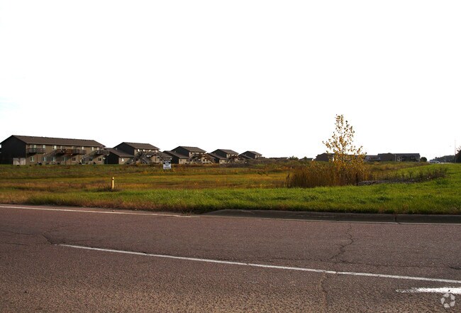

Property Detail
4500 S Ellis Rd
11903
SW14 (EX E730 S2060 & EX W670 E1400 S1315 & EX H1, H3 AND EX SOUTHERN VISTAS ADDN) 34-101-50 SIOUX FALLS CITY UNPLATTED
Commercialacreage
MINNEHAHA
RR;RURAL R
South Dakota
B and X Area of moderate flood hazard, usually the area between the limits of the 100-year and 500-year floods.
6.16 AC
2024
Sioux Falls
2024
Other Market Areas
001111
Sioux Falls, SD-MN
NEARBY LISTINGS FOR SALE OR LEASE
DEMOGRAPHICS near 4500 S Ellis Rd
1 mile
3 mile
5 mile
2025 Total Population
6,366
49,401
100,903
2030 Population
6,737
52,697
108,461
Pop Growth 2025-2030
+ 5.83%
+ 6.67%
+ 7.49%
Average Age
34
37
37
2025 Total Households
2,305
19,603
40,821
HH Growth 2025-2030
+ 6.12%
+ 7.07%
+ 7.72%
Median Household Inc
$100,524
$82,601
$77,552
Avg Household Size
2.70
2.50
2.40
2025 Avg HH Vehicles
2.00
2.00
2.00
Median Home Value
$297,021
$303,489
$305,594
Median Year Built
2005
2002
2000
Nearby Places
Map Layers
Map Styles
 Street
 Aerial
Layers
 Traffic
 Biking
Places
Listings with unknown addresses are not visible on the map
- Restaurants
- Banks
- Shops
- Fitness
- Groceries
PUBLIC TRANSPORTATION
AIRPORT
Joe Foss Field
Drive
Walk
Distance
Joe Foss Field
30 min
11.5 mi
Freight Ports
Port Milwaukee
Drive
Walk
Distance
Port Milwaukee
557 min
511.2 mi
SALE & LEASE HISTORY
LISTING DATE
SALE/LEASE

Sep 24, 2016
For Sale
Nearby Properties
Address
Land Use
TOTAL SIZE
Lot Size
Zoning
Address
Land Use
TOTAL SIZE
Lot Size
Zoning
8.89 AC
MUNICIPALI
Address
Land Use
TOTAL SIZE
Lot Size
Zoning
639,393 SF
53.46 AC
FP;FP
Address
Land Use
TOTAL SIZE
Lot Size
Zoning
8.80 AC
MUNICIPALI
Address
Land Use
TOTAL SIZE
Lot Size
Zoning
32,169 SF
9.91 AC
Address
Land Use
TOTAL SIZE
Lot Size
Zoning
55,998 SF
5.42 AC
FP;FP
Address
Land Use
TOTAL SIZE
Lot Size
Zoning
8.51 AC
MUNICIPALI
Address
Land Use
TOTAL SIZE
Lot Size
Zoning
15.40 AC
MUNICIPALI
Address
Land Use
TOTAL SIZE
Lot Size
Zoning
15.89 AC
Address
Land Use
TOTAL SIZE
Lot Size
Zoning
8.57 AC
MUNICIPALI
Address
Land Use
TOTAL SIZE
Lot Size
Zoning
11.13 AC
MUNICIPALI
Address
Land Use
TOTAL SIZE
Lot Size
Zoning
8.65 AC
MUNICIPALI
Address
Land Use
TOTAL SIZE
Lot Size
Zoning
100,053 SF
8.50 AC
FP;FP
Address
Land Use
TOTAL SIZE
Lot Size
Zoning
9.56 AC
MUNICIPALI
Address
Land Use
TOTAL SIZE
Lot Size
Zoning
16.45 AC
MUNICIPALI
Address
Land Use
TOTAL SIZE
Lot Size
Zoning
7.07 AC
MUNICIPALI
Address
Land Use
TOTAL SIZE
Lot Size
Zoning
1.66 AC
FP;FP
Address
Land Use
TOTAL SIZE
Lot Size
Zoning
23,832 SF
216 AC
Address
Land Use
TOTAL SIZE
Lot Size
Zoning
Address
Land Use
TOTAL SIZE
Lot Size
Zoning
26,601 SF
5.31 AC
Address
Land Use
TOTAL SIZE
Lot Size
Zoning
72,601 SF
15.33 AC
Address
Land Use
TOTAL SIZE
Lot Size
Zoning
9.27 AC
MUNICIPALI
Address
Land Use
TOTAL SIZE
Lot Size
Zoning
8,768 SF
5.48 AC
Address
Land Use
TOTAL SIZE
Lot Size
Zoning
5,649 SF
9.13 AC
Address
Land Use
TOTAL SIZE
Lot Size
Zoning
9.16 AC
MUNICIPALI
Address
Land Use
TOTAL SIZE
Lot Size
Zoning
185,662 SF
18.09 AC
Address
Land Use
TOTAL SIZE
Lot Size
Zoning
5.27 AC
MUNICIPALI
Address
Land Use
TOTAL SIZE
Lot Size
Zoning
72,820 SF
12.43 AC
Address
Land Use
TOTAL SIZE
Lot Size
Zoning
214,855 SF
14.65 AC
FP;FP
Address
Land Use
TOTAL SIZE
Lot Size
Zoning
4.36 AC
MUNICIPALI
Address
Land Use
TOTAL SIZE
Lot Size
Zoning
1,796 SF
7.57 AC
The World's #1 Commercial Real Estate Marketplace
Connect with us
© 2026 CoStar Group
The information above has been obtained from sources believed reliable. While we do not doubt its accuracy we have not verified it and make no guarantee, warranty or representation about it. It is your responsibility to independently confirm its accuracy and completeness. Any projections, opinions, assumptions, or estimates used are for example only and do not represent the current or future performance of the property. The value of this transaction to you depends on tax and other factors which should be evaluated by your tax, financial, and legal advisors. You and your advisors should conduct a careful, independent investigation of the property to determine to your satisfaction the suitability of the property for your needs.