Property Record
4501 Douglas Ave, Kansas City, KS 66106


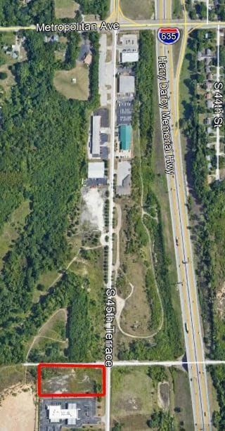
This Property Is For Sale
NEARBY LISTINGS FOR SALE OR LEASE
Property Detail
4501 Douglas Ave
Kansas City, MO-KS
Melrose Business Park Ph Ii
280303
MELROSE BUSINESS PARK PH II, S30, T11, R25, ACRES 2.17, L7 LS S 397FT
Industrialgeneral
Wyandotte
X
Kansas
20209C0160E
7
2025
2.13 AC
2025
Kansas City KS
043700
Kansas City
DEMOGRAPHICS near 4501 Douglas Ave
1 Mile
3 Mile
5 Mile
2024 Total Population
8,189
49,380
184,749
2029 Population
7,881
49,181
185,488
Pop Growth 2024-2029
(3.76%)
(0.40%)
+ 0.40%
Average Age
36
37
38
2024 Total Households
2,848
19,755
75,603
HH Growth 2024-2029
(3.86%)
+ 0.01%
+ 0.76%
Median Household Inc
$57,307
$58,808
$61,628
Avg Household Size
2.80
2.40
2.30
2024 Avg HH Vehicles
2.00
2.00
2.00
Median Home Value
$149,832
$170,828
$199,637
Median Year Built
1954
1963
1958
Nearby Places
Map Layers
Map Styles
 Street
 Aerial
- Restaurants
- Banks
- Shops
- Fitness
- Groceries
PUBLIC TRANSPORTATION
AIRPORT
Kansas City International
DRIVE
WALK
Distance
Kansas City International
26 min
23.1 mi
Nearby Properties
Address
Land Use
TOTAL SIZE
Lot Size
Zoning
Address
Land Use
TOTAL SIZE
Lot Size
Zoning
347,991 SF
51.92 AC
1KMC
Address
Land Use
TOTAL SIZE
Lot Size
Zoning
249,363 SF
58.59 AC
Address
Land Use
TOTAL SIZE
Lot Size
Zoning
100,090 SF
48.47 AC
KR1
Address
Land Use
TOTAL SIZE
Lot Size
Zoning
93,418 SF
12.07 AC
R-1
Address
Land Use
TOTAL SIZE
Lot Size
Zoning
21,635 SF
10.75 AC
KRP5
Address
Land Use
TOTAL SIZE
Lot Size
Zoning
24,920 SF
7.84 AC
KRP5
Address
Land Use
TOTAL SIZE
Lot Size
Zoning
383,232 SF
15.93 AC
LU1
Address
Land Use
TOTAL SIZE
Lot Size
Zoning
74,212 SF
8.01 AC
R-1
Address
Land Use
TOTAL SIZE
Lot Size
Zoning
13,210 SF
7.80 AC
KRP5
Address
Land Use
TOTAL SIZE
Lot Size
Zoning
311,454 SF
40.91 AC
PUD-G
Address
Land Use
TOTAL SIZE
Lot Size
Zoning
111,880 SF
36.74 AC
KR1
Address
Land Use
TOTAL SIZE
Lot Size
Zoning
62,452 SF
14.89 AC
KR1
Address
Land Use
TOTAL SIZE
Lot Size
Zoning
80,474 SF
11.30 AC
R-1
Address
Land Use
TOTAL SIZE
Lot Size
Zoning
56,700 SF
18.97 AC
KR1
Address
Land Use
TOTAL SIZE
Lot Size
Zoning
122,134 SF
3.67 AC
KRP5
Address
Land Use
TOTAL SIZE
Lot Size
Zoning
41,676 SF
18.45 AC
R-1
Address
Land Use
TOTAL SIZE
Lot Size
Zoning
1,032,141 SF
45.80 AC
LU1
Address
Land Use
TOTAL SIZE
Lot Size
Zoning
34,649 SF
20.26 AC
R-1
Address
Land Use
TOTAL SIZE
Lot Size
Zoning
48,031 SF
9.67 AC
KR1B
Address
Land Use
TOTAL SIZE
Lot Size
Zoning
43,073 SF
2.15 AC
Address
Land Use
TOTAL SIZE
Lot Size
Zoning
56,406 SF
16.39 AC
KR2
Address
Land Use
TOTAL SIZE
Lot Size
Zoning
53,352 SF
13.79 AC
KR1
Address
Land Use
TOTAL SIZE
Lot Size
Zoning
512,620 SF
23.85 AC
KM3
Address
Land Use
TOTAL SIZE
Lot Size
Zoning
47,640 SF
34.87 AC
Address
Land Use
TOTAL SIZE
Lot Size
Zoning
66,665 SF
30.36 AC
R3
Address
Land Use
TOTAL SIZE
Lot Size
Zoning
44,962 SF
0.81 AC
PARK
Address
Land Use
TOTAL SIZE
Lot Size
Zoning
13,925 SF
107.85 AC
KR1
Address
Land Use
TOTAL SIZE
Lot Size
Zoning
309,988 SF
19.68 AC
CP-O
Address
Land Use
TOTAL SIZE
Lot Size
Zoning
2,438 SF
4.88 AC
KRP5
Address
Land Use
TOTAL SIZE
Lot Size
Zoning
14,120 SF
2.95 AC
The World's #1 Commercial Real Estate Marketplace
Connect with us
© 2025 CoStar Group
The information above has been obtained from sources believed reliable. While we do not doubt its accuracy we have not verified it and make no guarantee, warranty or representation about it. It is your responsibility to independently confirm its accuracy and completeness. Any projections, opinions, assumptions, or estimates used are for example only and do not represent the current or future performance of the property. The value of this transaction to you depends on tax and other factors which should be evaluated by your tax, financial, and legal advisors. You and your advisors should conduct a careful, independent investigation of the property to determine to your satisfaction the suitability of the property for your needs.