Property Record
4501 E Riverside Dr, Austin, TX 78741
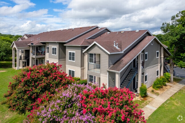


Property Detail
4501 E Riverside Dr
Austin-Round Rock-San Marcos, TX
LOT 1-3 & .32 ACR OF LOT 4 BLK A CHEVY CHASE SOUTH PHS 6 RESUB OF LOT 1
445755
TRAVIS
Multifamilydwelling
Texas
AE The base floodplain where base flood elevations are provided. AE Zones are now used on new format FIRMs instead of A1-A30 Zones.
1-4
2025
20.03 AC
2025
East Riverside-Oltorf
002314
Austin
243,796 SF
NEARBY LISTINGS FOR SALE OR LEASE
DEMOGRAPHICS near 4501 E Riverside Dr
1 mile
3 mile
5 mile
2024 Total Population
32,931
141,322
334,162
2029 Population
34,633
149,878
352,595
Pop Growth 2024-2029
+ 5.17%
+ 6.05%
+ 5.52%
Average Age
32
36
35
2024 Total Households
16,854
65,998
150,258
HH Growth 2024-2029
+ 5.83%
+ 6.78%
+ 6.34%
Median Household Inc
$62,502
$88,627
$85,663
Avg Household Size
1.90
2.00
2.00
2024 Avg HH Vehicles
1.00
1.00
2.00
Median Home Value
$442,751
$650,471
$674,770
Median Year Built
1995
2003
1999
Nearby Places
Map Layers
Map Styles
 Street
 Aerial
Transit
 Traffic
 Biking
Places
Listings with unknown addresses are not visible on the map
- Restaurants
- Banks
- Shops
- Fitness
- Groceries
PUBLIC TRANSPORTATION
COMMUTER RAIL
Austin (Texas Eagle - Amtrak)
Drive
Walk
Distance
Austin (Texas Eagle - Amtrak)
11 min
4.1 mi
AIRPORT
Austin-Bergstrom International
Drive
Walk
Distance
Austin-Bergstrom International
19 min
8.2 mi
Freight Ports
Calhoun Port
Drive
Walk
Distance
Calhoun Port
185 min
151.7 mi
Nearby Properties
Address
Land Use
TOTAL SIZE
Lot Size
Zoning
Address
Land Use
TOTAL SIZE
Lot Size
Zoning
9,768 SF
386.80 AC
Address
Land Use
TOTAL SIZE
Lot Size
Zoning
20,550 SF
14.15 AC
Address
Land Use
TOTAL SIZE
Lot Size
Zoning
1,156,135 SF
1.74 AC
Address
Land Use
TOTAL SIZE
Lot Size
Zoning
1,003,475 SF
1.84 AC
Address
Land Use
TOTAL SIZE
Lot Size
Zoning
786,600 SF
1.27 AC
Address
Land Use
TOTAL SIZE
Lot Size
Zoning
9,034 SF
28.69 AC
Address
Land Use
TOTAL SIZE
Lot Size
Zoning
709,300 SF
0.94 AC
Address
Land Use
TOTAL SIZE
Lot Size
Zoning
498,684 SF
61.86 AC
Address
Land Use
TOTAL SIZE
Lot Size
Zoning
47.20 AC
Address
Land Use
TOTAL SIZE
Lot Size
Zoning
1,400,000 SF
3.07 AC
Address
Land Use
TOTAL SIZE
Lot Size
Zoning
999,200 SF
25 AC
Address
Land Use
TOTAL SIZE
Lot Size
Zoning
513,567 SF
1.78 AC
Address
Land Use
TOTAL SIZE
Lot Size
Zoning
500,511 SF
0.82 AC
Address
Land Use
TOTAL SIZE
Lot Size
Zoning
609,613 SF
1.31 AC
Address
Land Use
TOTAL SIZE
Lot Size
Zoning
24.06 AC
Address
Land Use
TOTAL SIZE
Lot Size
Zoning
826,478 SF
1.75 AC
Address
Land Use
TOTAL SIZE
Lot Size
Zoning
341,096 SF
0.31 AC
Address
Land Use
TOTAL SIZE
Lot Size
Zoning
546,000 SF
1.27 AC
Address
Land Use
TOTAL SIZE
Lot Size
Zoning
533,917 SF
0.81 AC
Address
Land Use
TOTAL SIZE
Lot Size
Zoning
597,500 SF
0.99 AC
Address
Land Use
TOTAL SIZE
Lot Size
Zoning
400,000 SF
0.27 AC
Address
Land Use
TOTAL SIZE
Lot Size
Zoning
6.12 AC
Address
Land Use
TOTAL SIZE
Lot Size
Zoning
832,892 SF
30.12 AC
Address
Land Use
TOTAL SIZE
Lot Size
Zoning
483,917 SF
1.60 AC
Address
Land Use
TOTAL SIZE
Lot Size
Zoning
27.45 AC
Address
Land Use
TOTAL SIZE
Lot Size
Zoning
627,984 SF
0.81 AC
Address
Land Use
TOTAL SIZE
Lot Size
Zoning
219,543 SF
0.22 AC
Address
Land Use
TOTAL SIZE
Lot Size
Zoning
357,080 SF
0.41 AC
Address
Land Use
TOTAL SIZE
Lot Size
Zoning
364,532 SF
0.41 AC
Address
Land Use
TOTAL SIZE
Lot Size
Zoning
530,102 SF
1.10 AC
The World's #1 Commercial Real Estate Marketplace
Connect with us
© 2026 CoStar Group
The information above has been obtained from sources believed reliable. While we do not doubt its accuracy we have not verified it and make no guarantee, warranty or representation about it. It is your responsibility to independently confirm its accuracy and completeness. Any projections, opinions, assumptions, or estimates used are for example only and do not represent the current or future performance of the property. The value of this transaction to you depends on tax and other factors which should be evaluated by your tax, financial, and legal advisors. You and your advisors should conduct a careful, independent investigation of the property to determine to your satisfaction the suitability of the property for your needs.