Property Record
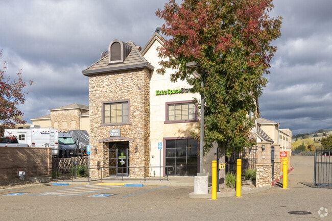
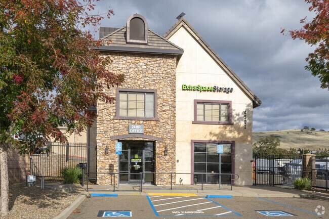
4501 Latrobe Rd, Shingle Springs, CA 95682

Property Detail
4501 Latrobe Rd
Sacramento-Roseville-Folsom, CA
PM 51/42/1
118-020-012-000
EL DORADO
Publicstorage
California
B and X Area of moderate flood hazard, usually the area between the limits of the 100-year and 500-year floods.
6.70 AC
2024
El Dorado
2025
Sacramento
030812
NEARBY LISTINGS FOR SALE OR LEASE
-
-
View all Shingle Springs listings for sale on LoopNet.com
DEMOGRAPHICS near 4501 Latrobe Rd
1 mile
3 mile
5 mile
2025 Total Population
5,677
40,148
107,943
2030 Population
5,785
42,020
110,821
Pop Growth 2025-2030
+ 1.90%
+ 4.66%
+ 2.67%
Average Age
44
41
41
2025 Total Households
2,250
13,923
38,115
HH Growth 2025-2030
+ 1.87%
+ 4.35%
+ 2.49%
Median Household Inc
$128,202
$164,903
$156,141
Avg Household Size
2.50
2.90
2.80
2025 Avg HH Vehicles
2.00
2.00
2.00
Median Home Value
$815,749
$829,079
$815,841
Median Year Built
2008
2007
2002
Nearby Places
Map Layers
Map Styles
 Street
 Aerial
Transit
 Traffic
 Biking
Places
Listings with unknown addresses are not visible on the map
- Restaurants
- Banks
- Shops
- Fitness
- Groceries
PUBLIC TRANSPORTATION
AIRPORT
Sacramento International
Drive
Walk
Distance
Sacramento International
50 min
39.1 mi
Freight Ports
Port of Stockton
Drive
Walk
Distance
Port of Stockton
86 min
72.7 mi
Nearby Properties
Address
Land Use
TOTAL SIZE
Lot Size
Zoning
Address
Land Use
TOTAL SIZE
Lot Size
Zoning
Address
Land Use
TOTAL SIZE
Lot Size
Zoning
23.23 AC
SP-R-M (SP
Address
Land Use
TOTAL SIZE
Lot Size
Zoning
8.54 AC
SP-MHD (PD
Address
Land Use
TOTAL SIZE
Lot Size
Zoning
553,153 SF
33.17 AC
Address
Land Use
TOTAL SIZE
Lot Size
Zoning
6.29 AC
SP-C-2 (SP
Address
Land Use
TOTAL SIZE
Lot Size
Zoning
203,397 SF
11.58 AC
SP-R-4 (SP
Address
Land Use
TOTAL SIZE
Lot Size
Zoning
114,835 SF
19.73 AC
SP-C-2 (SP
Address
Land Use
TOTAL SIZE
Lot Size
Zoning
354,406 SF
23.94 AC
VVSP
Address
Land Use
TOTAL SIZE
Lot Size
Zoning
6.07 AC
SP-OS2 (SP
Address
Land Use
TOTAL SIZE
Lot Size
Zoning
Address
Land Use
TOTAL SIZE
Lot Size
Zoning
148,663 SF
18.60 AC
SP-C-2 (SP
Address
Land Use
TOTAL SIZE
Lot Size
Zoning
127,600 SF
8.24 AC
CG
Address
Land Use
TOTAL SIZE
Lot Size
Zoning
Address
Land Use
TOTAL SIZE
Lot Size
Zoning
85,799 SF
4.67 AC
Address
Land Use
TOTAL SIZE
Lot Size
Zoning
150,808 SF
14.91 AC
R2
Address
Land Use
TOTAL SIZE
Lot Size
Zoning
50.99 AC
SP-GC (PD)
Address
Land Use
TOTAL SIZE
Lot Size
Zoning
76,737 SF
3.33 AC
C-3 (PD)
Address
Land Use
TOTAL SIZE
Lot Size
Zoning
524,157 SF
12.03 AC
VVSP
Address
Land Use
TOTAL SIZE
Lot Size
Zoning
130,715 SF
14.50 AC
C-3 (PD)
Address
Land Use
TOTAL SIZE
Lot Size
Zoning
70,787 SF
3.11 AC
C-3 (PD)
Address
Land Use
TOTAL SIZE
Lot Size
Zoning
40,559 SF
4.20 AC
CG
Address
Land Use
TOTAL SIZE
Lot Size
Zoning
15,227 SF
9.57 AC
CG
Address
Land Use
TOTAL SIZE
Lot Size
Zoning
8,064 SF
4.68 AC
R2
Address
Land Use
TOTAL SIZE
Lot Size
Zoning
90,924 SF
3.21 AC
SP-C-2 (SP
Address
Land Use
TOTAL SIZE
Lot Size
Zoning
2,876 SF
20 AC
RE10
Address
Land Use
TOTAL SIZE
Lot Size
Zoning
65,151 SF
6.11 AC
R2
Address
Land Use
TOTAL SIZE
Lot Size
Zoning
Address
Land Use
TOTAL SIZE
Lot Size
Zoning
Address
Land Use
TOTAL SIZE
Lot Size
Zoning
90,410 SF
3.06 AC
C-3 (PD)
The World's #1 Commercial Real Estate Marketplace
Connect with us
© 2026 CoStar Group
The information above has been obtained from sources believed reliable. While we do not doubt its accuracy we have not verified it and make no guarantee, warranty or representation about it. It is your responsibility to independently confirm its accuracy and completeness. Any projections, opinions, assumptions, or estimates used are for example only and do not represent the current or future performance of the property. The value of this transaction to you depends on tax and other factors which should be evaluated by your tax, financial, and legal advisors. You and your advisors should conduct a careful, independent investigation of the property to determine to your satisfaction the suitability of the property for your needs.