Property Record
4501 Main St, Oakley, CA 94561


Property Detail
4501 Main St
Oakland-Fremont-Berkeley, CA
SUBDIVISION 6356
035-263-082-6
CONTRA COSTA
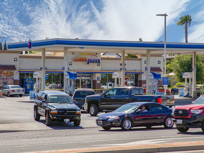
Servicestation
California
B and X Area of moderate flood hazard, usually the area between the limits of the 100-year and 500-year floods.
a
2025
1.39 AC
2025
Antioch/Pittsburg
302007
East Bay/Oakland
4,632 SF
NEARBY LISTINGS FOR SALE OR LEASE
DEMOGRAPHICS near 4501 Main St
1 mile
3 mile
5 mile
2025 Total Population
14,323
61,095
148,549
2030 Population
14,672
62,182
150,993
Pop Growth 2025-2030
+ 2.44%
+ 1.78%
+ 1.65%
Average Age
37
38
39
2025 Total Households
4,102
18,146
45,304
HH Growth 2025-2030
+ 2.36%
+ 1.79%
+ 1.61%
Median Household Inc
$134,685
$134,009
$129,212
Avg Household Size
3.40
3.30
3.20
2025 Avg HH Vehicles
3.00
3.00
3.00
Median Home Value
$712,706
$742,746
$743,136
Median Year Built
1999
1999
1997
Nearby Places
Map Layers
Map Styles
 Street
 Aerial
Layers
 Traffic
 Biking
Places
Listings with unknown addresses are not visible on the map
- Restaurants
- Banks
- Shops
- Fitness
- Groceries
PUBLIC TRANSPORTATION
AIRPORT
Stockton Metro
Drive
Walk
Distance
Stockton Metro
52 min
34.9 mi
Freight Ports
Port of Stockton
Drive
Walk
Distance
Port of Stockton
48 min
32.4 mi
SALE & LEASE HISTORY
LISTING DATE
SALE/LEASE

Nov 26, 2018
For Sale
Aug 16, 2018
For Sale
Apr 19, 2023
For Sale
The World's #1 Commercial Real Estate Marketplace
Connect with us
© 2026 CoStar Group
The information above has been obtained from sources believed reliable. While we do not doubt its accuracy we have not verified it and make no guarantee, warranty or representation about it. It is your responsibility to independently confirm its accuracy and completeness. Any projections, opinions, assumptions, or estimates used are for example only and do not represent the current or future performance of the property. The value of this transaction to you depends on tax and other factors which should be evaluated by your tax, financial, and legal advisors. You and your advisors should conduct a careful, independent investigation of the property to determine to your satisfaction the suitability of the property for your needs.