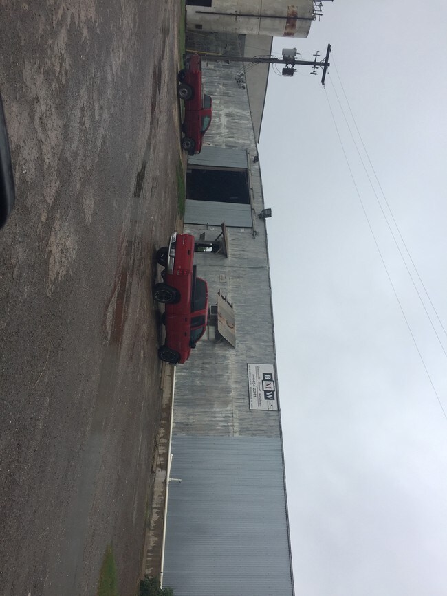
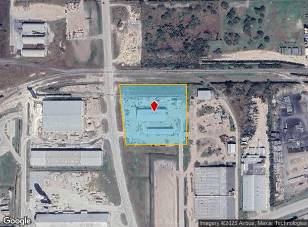
Property Record
4501 N Mineral Loop, Port Of Brownsville, TX 78521

NEARBY LISTINGS FOR SALE OR LEASE
Property Detail
4501 N Mineral Loop
793100-0310-100010
Espiritu Santo Grant Share 31
Commercialnec
ESPIRITU SANTO GRANT SHARE 31, BLDG ON LEASED LAND, LEASE # 4419
X
Cameron
48061C0585F
Texas
2024
4.33 AC
2025
Outlying Cameron County
0142022137
Brownsville/Harlingen
11,600 SF
Brownsville-Harlingen, TX
DEMOGRAPHICS near 4501 N Mineral Loop
1 Mile
3 Mile
5 Mile
2024 Total Population
1,303
27,041
80,283
2029 Population
1,328
28,087
82,686
Pop Growth 2024-2029
+ 1.92%
+ 3.87%
+ 2.99%
Average Age
32
33
35
2024 Total Households
321
7,659
23,846
HH Growth 2024-2029
+ 1.56%
+ 3.96%
+ 3.08%
Median Household Inc
$45,741
$40,938
$43,808
Avg Household Size
3.80
3.40
3.30
2024 Avg HH Vehicles
2.00
2.00
2.00
Median Home Value
$71,518
$81,695
$90,836
Median Year Built
1998
1998
1996
Nearby Places
Map Layers
Map Styles
 Street
 Aerial
- Restaurants
- Banks
- Shops
- Fitness
- Groceries
PUBLIC TRANSPORTATION
AIRPORT
Brownsville/South Padre Island International
DRIVE
WALK
Distance
Brownsville/South Padre Island International
10 min
5.2 mi
Valley International
DRIVE
WALK
Distance
Valley International
37 min
28.6 mi
Freight Ports
Port of Brownsville
DRIVE
WALK
Distance
Port of Brownsville
2 min
0.9 mi
SALE & LEASE HISTORY
LISTING DATE
SALE/LEASE

Sep 14, 2017
For Sale
Nearby Properties
Address
Land Use
TOTAL SIZE
Lot Size
Zoning
Address
Land Use
TOTAL SIZE
Lot Size
Zoning
167,737 SF
29.87 AC
Address
Land Use
TOTAL SIZE
Lot Size
Zoning
286,243 SF
19.21 AC
C
Address
Land Use
TOTAL SIZE
Lot Size
Zoning
115,463 SF
22.09 AC
Address
Land Use
TOTAL SIZE
Lot Size
Zoning
120,166 SF
12.33 AC
Address
Land Use
TOTAL SIZE
Lot Size
Zoning
112,263 SF
9.66 AC
Address
Land Use
TOTAL SIZE
Lot Size
Zoning
98,740 SF
15.56 AC
Address
Land Use
TOTAL SIZE
Lot Size
Zoning
238,221 SF
27.02 AC
Address
Land Use
TOTAL SIZE
Lot Size
Zoning
137,228 SF
18.43 AC
A-U
Address
Land Use
TOTAL SIZE
Lot Size
Zoning
0.17 AC
Address
Land Use
TOTAL SIZE
Lot Size
Zoning
48,760 SF
7 AC
C
Address
Land Use
TOTAL SIZE
Lot Size
Zoning
82,300 SF
3.20 AC
I
Address
Land Use
TOTAL SIZE
Lot Size
Zoning
100,000 SF
7.93 AC
I
Address
Land Use
TOTAL SIZE
Lot Size
Zoning
100,000 SF
7.79 AC
I
Address
Land Use
TOTAL SIZE
Lot Size
Zoning
100,000 SF
5.20 AC
I
Address
Land Use
TOTAL SIZE
Lot Size
Zoning
101,581 SF
4.14 AC
Address
Land Use
TOTAL SIZE
Lot Size
Zoning
101,189 SF
10 AC
C
Address
Land Use
TOTAL SIZE
Lot Size
Zoning
88,220 SF
11 AC
C
Address
Land Use
TOTAL SIZE
Lot Size
Zoning
64,545 SF
4.42 AC
Address
Land Use
TOTAL SIZE
Lot Size
Zoning
107,200 SF
8.53 AC
C
Address
Land Use
TOTAL SIZE
Lot Size
Zoning
100,000 SF
11.34 AC
I
Address
Land Use
TOTAL SIZE
Lot Size
Zoning
23,154 SF
2.40 AC
C
Address
Land Use
TOTAL SIZE
Lot Size
Zoning
86,200 SF
10 AC
Address
Land Use
TOTAL SIZE
Lot Size
Zoning
210,741 SF
20.06 AC
Address
Land Use
TOTAL SIZE
Lot Size
Zoning
111,736 SF
13.59 AC
Address
Land Use
TOTAL SIZE
Lot Size
Zoning
8,527 SF
13.02 AC
Address
Land Use
TOTAL SIZE
Lot Size
Zoning
48,960 SF
10 AC
Address
Land Use
TOTAL SIZE
Lot Size
Zoning
76,249 SF
3.99 AC
C
Address
Land Use
TOTAL SIZE
Lot Size
Zoning
5,620 SF
10.03 AC
Address
Land Use
TOTAL SIZE
Lot Size
Zoning
63,632 SF
10 AC
C
Address
Land Use
TOTAL SIZE
Lot Size
Zoning
48,860 SF
12.24 AC
C
The World's #1 Commercial Real Estate Marketplace
Connect with us
© 2025 CoStar Group
The information above has been obtained from sources believed reliable. While we do not doubt its accuracy we have not verified it and make no guarantee, warranty or representation about it. It is your responsibility to independently confirm its accuracy and completeness. Any projections, opinions, assumptions, or estimates used are for example only and do not represent the current or future performance of the property. The value of this transaction to you depends on tax and other factors which should be evaluated by your tax, financial, and legal advisors. You and your advisors should conduct a careful, independent investigation of the property to determine to your satisfaction the suitability of the property for your needs.