Property Record
4501 Tower Ave, Superior, WI 54880
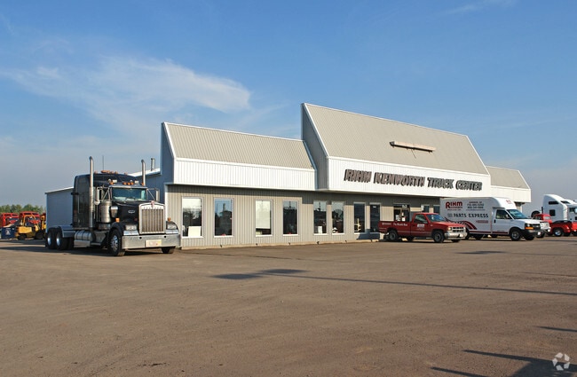


Property Detail
4501 Tower Ave
Duluth, MN-WI
LOT 2 OF CSM #1121 REC IN VOL. 8 OF CSMS PGS 137-139 AS DOC #836161, LOCATED IN THE SW 1/4 OF THE NE 1/4 SEC 34-49-14
08-808-10031-00
Douglas
Commercialnec
Wisconsin
C2
2
B and X Area of moderate flood hazard, usually the area between the limits of the 100-year and 500-year floods.
3.48 AC
2024
Superior
2024
Duluth
020800
NEARBY LISTINGS FOR SALE OR LEASE
-
-
View all Superior listings for sale on LoopNet.com
DEMOGRAPHICS near 4501 Tower Ave
1 mile
3 mile
5 mile
2025 Total Population
1,313
21,013
30,689
2030 Population
1,290
20,659
30,148
Pop Growth 2025-2030
(1.75%)
(1.68%)
(1.76%)
Average Age
42
40
40
2025 Total Households
577
9,141
13,576
HH Growth 2025-2030
(1.91%)
(1.71%)
(1.80%)
Median Household Inc
$60,187
$65,665
$61,777
Avg Household Size
2.20
2.10
2.10
2025 Avg HH Vehicles
2.00
2.00
2.00
Median Home Value
$179,654
$180,752
$178,094
Median Year Built
1972
1956
1953
Nearby Places
Map Layers
Map Styles
 Street
 Aerial
Transit
 Traffic
 Biking
Places
Listings with unknown addresses are not visible on the map
- Restaurants
- Banks
- Shops
- Fitness
- Groceries
PUBLIC TRANSPORTATION
AIRPORT
Duluth International
Drive
Walk
Distance
Duluth International
33 min
15.7 mi
Nearby Properties
Address
Land Use
TOTAL SIZE
Lot Size
Zoning
Address
Land Use
TOTAL SIZE
Lot Size
Zoning
50.82 AC
M2
Address
Land Use
TOTAL SIZE
Lot Size
Zoning
2.81 AC
PDD
Address
Land Use
TOTAL SIZE
Lot Size
Zoning
1.45 AC
C3
Address
Land Use
TOTAL SIZE
Lot Size
Zoning
135.91 AC
M2
Address
Land Use
TOTAL SIZE
Lot Size
Zoning
21.96 AC
Address
Land Use
TOTAL SIZE
Lot Size
Zoning
4.17 AC
C2
Address
Land Use
TOTAL SIZE
Lot Size
Zoning
27.99 AC
C2
Address
Land Use
TOTAL SIZE
Lot Size
Zoning
2 AC
R3
Address
Land Use
TOTAL SIZE
Lot Size
Zoning
6.01 AC
M2
Address
Land Use
TOTAL SIZE
Lot Size
Zoning
0.68 AC
R3
Address
Land Use
TOTAL SIZE
Lot Size
Zoning
1.34 AC
Address
Land Use
TOTAL SIZE
Lot Size
Zoning
3.42 AC
R3
Address
Land Use
TOTAL SIZE
Lot Size
Zoning
7.05 AC
M2
Address
Land Use
TOTAL SIZE
Lot Size
Zoning
9.84 AC
C2
Address
Land Use
TOTAL SIZE
Lot Size
Zoning
11.43 AC
R3
Address
Land Use
TOTAL SIZE
Lot Size
Zoning
1.97 AC
PDD
Address
Land Use
TOTAL SIZE
Lot Size
Zoning
Address
Land Use
TOTAL SIZE
Lot Size
Zoning
1.41 AC
C4
Address
Land Use
TOTAL SIZE
Lot Size
Zoning
7.50 AC
R3
Address
Land Use
TOTAL SIZE
Lot Size
Zoning
6.20 AC
C4
Address
Land Use
TOTAL SIZE
Lot Size
Zoning
15.76 AC
C2
Address
Land Use
TOTAL SIZE
Lot Size
Zoning
2.35 AC
M1
Address
Land Use
TOTAL SIZE
Lot Size
Zoning
2.28 AC
SUB
Address
Land Use
TOTAL SIZE
Lot Size
Zoning
0.86 AC
C3
Address
Land Use
TOTAL SIZE
Lot Size
Zoning
4.81 AC
R3
Address
Land Use
TOTAL SIZE
Lot Size
Zoning
2.42 AC
M2
Address
Land Use
TOTAL SIZE
Lot Size
Zoning
2.58 AC
R2A
Address
Land Use
TOTAL SIZE
Lot Size
Zoning
0.90 AC
C2
Address
Land Use
TOTAL SIZE
Lot Size
Zoning
1.19 AC
C2
Address
Land Use
TOTAL SIZE
Lot Size
Zoning
18.21 AC
M2
The World's #1 Commercial Real Estate Marketplace
Connect with us
© 2026 CoStar Group
The information above has been obtained from sources believed reliable. While we do not doubt its accuracy we have not verified it and make no guarantee, warranty or representation about it. It is your responsibility to independently confirm its accuracy and completeness. Any projections, opinions, assumptions, or estimates used are for example only and do not represent the current or future performance of the property. The value of this transaction to you depends on tax and other factors which should be evaluated by your tax, financial, and legal advisors. You and your advisors should conduct a careful, independent investigation of the property to determine to your satisfaction the suitability of the property for your needs.