Property Record
4503 Highway 58, Chattanooga, TN 37416

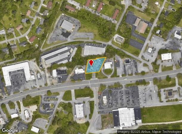

This Property Is For Sale
NEARBY LISTINGS FOR SALE OR LEASE
Property Detail
4503 Highway 58
Chattanooga, TN-GA
Steele Robert
129H-E-011
LT 2 ROBERT STEELE PB 19 PG 6 REV 85-43 3206 04 001B
Restaurantdrivein
Hamilton
X
Tennessee
47065C0354G
2
2024
0.55 AC
2024
Outlying Chattanooga
011411
Chattanooga
1,815 SF
DEMOGRAPHICS near 4503 Highway 58
1 Mile
3 Mile
5 Mile
2024 Total Population
6,094
23,928
92,065
2029 Population
6,498
25,518
98,272
Pop Growth 2024-2029
+ 6.63%
+ 6.64%
+ 6.74%
Average Age
42
42
42
2024 Total Households
2,711
10,514
39,106
HH Growth 2024-2029
+ 6.71%
+ 6.78%
+ 6.91%
Median Household Inc
$52,754
$51,809
$55,849
Avg Household Size
2.20
2.20
2.30
2024 Avg HH Vehicles
2.00
2.00
2.00
Median Home Value
$182,898
$180,087
$210,158
Median Year Built
1977
1974
1975
Nearby Places
- Restaurants
- Banks
- Shops
- Fitness
- Groceries
PUBLIC TRANSPORTATION
AIRPORT
Lovell Field
DRIVE
WALK
Distance
Lovell Field
14 min
7.4 mi
Freight Ports
Georgia Ports - Savannah
DRIVE
WALK
Distance
Georgia Ports - Savannah
409 min
365.4 mi
Nearby Properties
Address
Land Use
TOTAL SIZE
Lot Size
Zoning
Address
Land Use
TOTAL SIZE
Lot Size
Zoning
523,520 SF
12.03 AC
M1
Address
Land Use
TOTAL SIZE
Lot Size
Zoning
292,309 SF
45.28 AC
M1
Address
Land Use
TOTAL SIZE
Lot Size
Zoning
183 AC
R1
Address
Land Use
TOTAL SIZE
Lot Size
Zoning
242,788 SF
27 AC
Address
Land Use
TOTAL SIZE
Lot Size
Zoning
291,314 SF
29.69 AC
M1
Address
Land Use
TOTAL SIZE
Lot Size
Zoning
82,000 SF
22.45 AC
M1
Address
Land Use
TOTAL SIZE
Lot Size
Zoning
309,974 SF
20.57 AC
R3
Address
Land Use
TOTAL SIZE
Lot Size
Zoning
99,202 SF
17.32 AC
Address
Land Use
TOTAL SIZE
Lot Size
Zoning
236,880 SF
18.90 AC
R2
Address
Land Use
TOTAL SIZE
Lot Size
Zoning
266,271 SF
26.27 AC
R2
Address
Land Use
TOTAL SIZE
Lot Size
Zoning
32,261 SF
6.43 AC
R1
Address
Land Use
TOTAL SIZE
Lot Size
Zoning
170.82 AC
M1
Address
Land Use
TOTAL SIZE
Lot Size
Zoning
186,892 SF
19.97 AC
Address
Land Use
TOTAL SIZE
Lot Size
Zoning
147,631 SF
21.20 AC
M1
Address
Land Use
TOTAL SIZE
Lot Size
Zoning
51.50 AC
R1
Address
Land Use
TOTAL SIZE
Lot Size
Zoning
249,066 SF
19.80 AC
Address
Land Use
TOTAL SIZE
Lot Size
Zoning
48,465 SF
21.50 AC
Address
Land Use
TOTAL SIZE
Lot Size
Zoning
132,252 SF
12.74 AC
Address
Land Use
TOTAL SIZE
Lot Size
Zoning
925 SF
10.05 AC
R1
Address
Land Use
TOTAL SIZE
Lot Size
Zoning
72,906 SF
11.46 AC
M2
Address
Land Use
TOTAL SIZE
Lot Size
Zoning
86,110 SF
8.83 AC
Address
Land Use
TOTAL SIZE
Lot Size
Zoning
300,040 SF
26.51 AC
M1
Address
Land Use
TOTAL SIZE
Lot Size
Zoning
207,500 SF
17.21 AC
Address
Land Use
TOTAL SIZE
Lot Size
Zoning
255,392 SF
17.92 AC
M1
Address
Land Use
TOTAL SIZE
Lot Size
Zoning
56 AC
9999
Address
Land Use
TOTAL SIZE
Lot Size
Zoning
274,060 SF
20.11 AC
M1
Address
Land Use
TOTAL SIZE
Lot Size
Zoning
266,693 SF
21.57 AC
M1
Address
Land Use
TOTAL SIZE
Lot Size
Zoning
231,800 SF
11.51 AC
M1
Address
Land Use
TOTAL SIZE
Lot Size
Zoning
140,672 SF
12 AC
Address
Land Use
TOTAL SIZE
Lot Size
Zoning
63,800 SF
7.81 AC
M2
The World's #1 Commercial Real Estate Marketplace
Connect with us
© 2025 CoStar Group
The information above has been obtained from sources believed reliable. While we do not doubt its accuracy we have not verified it and make no guarantee, warranty or representation about it. It is your responsibility to independently confirm its accuracy and completeness. Any projections, opinions, assumptions, or estimates used are for example only and do not represent the current or future performance of the property. The value of this transaction to you depends on tax and other factors which should be evaluated by your tax, financial, and legal advisors. You and your advisors should conduct a careful, independent investigation of the property to determine to your satisfaction the suitability of the property for your needs.