Property Record
4505 18Th St, Bacliff, TX 77518


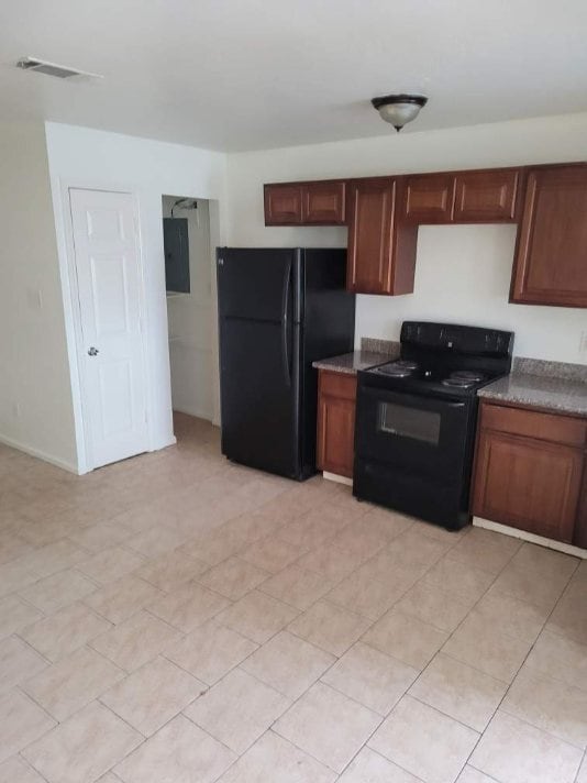
This Property Is For Sale
Property Detail
4505 18Th St
Houston-Pasadena-The Woodlands, TX
ABST 164 E PAYNE SUR LOTS 5 THRU 10 BLK 126 CLIFTON BY THE SEA REPLAT
2655-0126-0005-000
Galveston
Apartment
Texas
C and X Area of minimal flood hazard, usually depicted on FIRMs as above the 500-year flood level.
5-10
2024
0.43 AC
2025
Clifton By The Sea
721702
Houston
13,200 SF
NEARBY LISTINGS FOR SALE OR LEASE
DEMOGRAPHICS near 4505 18Th St
1 mile
3 mile
5 mile
2025 Total Population
8,200
28,551
81,804
2030 Population
8,522
29,547
84,571
Pop Growth 2025-2030
+ 3.93%
+ 3.49%
+ 3.38%
Average Age
36
37
39
2025 Total Households
2,834
10,036
30,244
HH Growth 2025-2030
+ 3.88%
+ 3.42%
+ 3.38%
Median Household Inc
$53,399
$93,615
$96,673
Avg Household Size
2.80
2.80
2.60
2025 Avg HH Vehicles
2.00
2.00
2.00
Median Home Value
$195,454
$302,840
$319,634
Median Year Built
1986
1997
1995
Nearby Places
Map Layers
Map Styles
 Street
 Aerial
Layers
 Traffic
 Biking
Places
Listings with unknown addresses are not visible on the map
- Restaurants
- Banks
- Shops
- Fitness
- Groceries
PUBLIC TRANSPORTATION
AIRPORT
William P Hobby
Drive
Walk
Distance
William P Hobby
40 min
23.6 mi
George Bush Intcntl/Houston
Drive
Walk
Distance
George Bush Intcntl/Houston
62 min
48.4 mi
Nearby Properties
Address
Land Use
TOTAL SIZE
Lot Size
Zoning
Address
Land Use
TOTAL SIZE
Lot Size
Zoning
500,000 SF
125.06 AC
Address
Land Use
TOTAL SIZE
Lot Size
Zoning
320,892 SF
15 AC
Address
Land Use
TOTAL SIZE
Lot Size
Zoning
372,456 SF
20.15 AC
Address
Land Use
TOTAL SIZE
Lot Size
Zoning
415,941 SF
14.35 AC
Address
Land Use
TOTAL SIZE
Lot Size
Zoning
291,161 SF
68.71 AC
Address
Land Use
TOTAL SIZE
Lot Size
Zoning
Address
Land Use
TOTAL SIZE
Lot Size
Zoning
38.73 AC
Address
Land Use
TOTAL SIZE
Lot Size
Zoning
120,000 SF
23.37 AC
Address
Land Use
TOTAL SIZE
Lot Size
Zoning
437,619 SF
29.38 AC
NONE
Address
Land Use
TOTAL SIZE
Lot Size
Zoning
206,147 SF
20.51 AC
Address
Land Use
TOTAL SIZE
Lot Size
Zoning
79,018 SF
9.34 AC
Address
Land Use
TOTAL SIZE
Lot Size
Zoning
114,488 SF
20 AC
Address
Land Use
TOTAL SIZE
Lot Size
Zoning
105,218 SF
4.91 AC
Address
Land Use
TOTAL SIZE
Lot Size
Zoning
130,457 SF
14.12 AC
Address
Land Use
TOTAL SIZE
Lot Size
Zoning
121,266 SF
9.09 AC
Address
Land Use
TOTAL SIZE
Lot Size
Zoning
98,011 SF
13.88 AC
Address
Land Use
TOTAL SIZE
Lot Size
Zoning
94,720 SF
10.73 AC
Address
Land Use
TOTAL SIZE
Lot Size
Zoning
137,088 SF
10.08 AC
Address
Land Use
TOTAL SIZE
Lot Size
Zoning
95,882 SF
5.41 AC
Address
Land Use
TOTAL SIZE
Lot Size
Zoning
103,138 SF
4.84 AC
Address
Land Use
TOTAL SIZE
Lot Size
Zoning
33,788 SF
3.06 AC
Address
Land Use
TOTAL SIZE
Lot Size
Zoning
Address
Land Use
TOTAL SIZE
Lot Size
Zoning
60,807 SF
12.17 AC
Address
Land Use
TOTAL SIZE
Lot Size
Zoning
105,600 SF
10.07 AC
Address
Land Use
TOTAL SIZE
Lot Size
Zoning
11,076 SF
1.80 AC
Address
Land Use
TOTAL SIZE
Lot Size
Zoning
102,155 SF
5 AC
Address
Land Use
TOTAL SIZE
Lot Size
Zoning
17,000 SF
1.85 AC
Address
Land Use
TOTAL SIZE
Lot Size
Zoning
15,342 SF
23.22 AC
Address
Land Use
TOTAL SIZE
Lot Size
Zoning
15,288 SF
1.43 AC
Address
Land Use
TOTAL SIZE
Lot Size
Zoning
26,186 SF
2.24 AC
The World's #1 Commercial Real Estate Marketplace
Connect with us
© 2026 CoStar Group
The information above has been obtained from sources believed reliable. While we do not doubt its accuracy we have not verified it and make no guarantee, warranty or representation about it. It is your responsibility to independently confirm its accuracy and completeness. Any projections, opinions, assumptions, or estimates used are for example only and do not represent the current or future performance of the property. The value of this transaction to you depends on tax and other factors which should be evaluated by your tax, financial, and legal advisors. You and your advisors should conduct a careful, independent investigation of the property to determine to your satisfaction the suitability of the property for your needs.