Property Record
4505 Greenstone Rd, Placerville, CA 95667

Property Detail
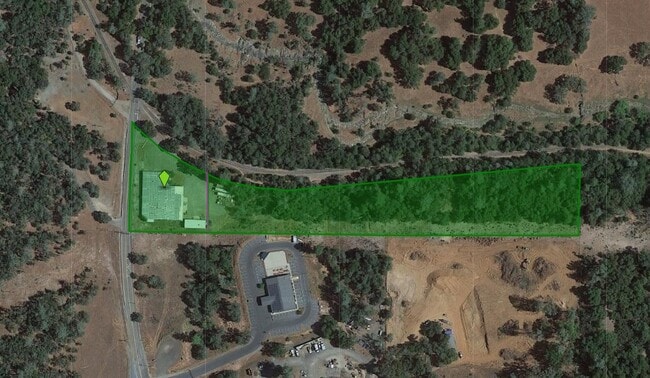
4505 Greenstone Rd
319-260-041-000
PM 24/93/2
Industrialgeneral
El Dorado
I
California
B and X Area of moderate flood hazard, usually the area between the limits of the 100-year and 500-year floods.
1.21 AC
2024
El Dorado
2025
Sacramento
031200
Sacramento-Roseville-Folsom, CA
14,960 SF
NEARBY LISTINGS FOR SALE OR LEASE
DEMOGRAPHICS near 4505 Greenstone Rd
1 mile
3 mile
5 mile
2025 Total Population
968
8,919
27,493
2030 Population
912
8,583
26,698
Pop Growth 2025-2030
(5.79%)
(3.77%)
(2.89%)
Average Age
49
48
47
2025 Total Households
392
3,521
10,927
HH Growth 2025-2030
(5.61%)
(3.72%)
(2.86%)
Median Household Inc
$125,919
$115,678
$107,050
Avg Household Size
2.40
2.50
2.50
2025 Avg HH Vehicles
3.00
2.00
2.00
Median Home Value
$752,415
$695,477
$683,895
Median Year Built
1980
1981
1983
Nearby Places
Map Layers
Map Styles
 Street
 Aerial
Transit
 Traffic
 Biking
Places
Listings with unknown addresses are not visible on the map
- Restaurants
- Banks
- Shops
- Fitness
- Groceries
Nearby Properties
Address
Land Use
TOTAL SIZE
Lot Size
Zoning
Address
Land Use
TOTAL SIZE
Lot Size
Zoning
Address
Land Use
TOTAL SIZE
Lot Size
Zoning
69,157 SF
3.13 AC
CP
Address
Land Use
TOTAL SIZE
Lot Size
Zoning
4,399 SF
1.44 AC
I
Address
Land Use
TOTAL SIZE
Lot Size
Zoning
18.20 AC
RE10
Address
Land Use
TOTAL SIZE
Lot Size
Zoning
3.81 AC
C
Address
Land Use
TOTAL SIZE
Lot Size
Zoning
26,943 SF
5.41 AC
C
Address
Land Use
TOTAL SIZE
Lot Size
Zoning
1,380 SF
4.96 AC
I
Address
Land Use
TOTAL SIZE
Lot Size
Zoning
10,824 SF
2.55 AC
C
Address
Land Use
TOTAL SIZE
Lot Size
Zoning
22,364 SF
4.38 AC
R1A
Address
Land Use
TOTAL SIZE
Lot Size
Zoning
33,841 SF
9.75 AC
R3A
Address
Land Use
TOTAL SIZE
Lot Size
Zoning
27,600 SF
3.70 AC
CP
Address
Land Use
TOTAL SIZE
Lot Size
Zoning
8,650 SF
4 AC
A
Address
Land Use
TOTAL SIZE
Lot Size
Zoning
37.74 AC
RE
Address
Land Use
TOTAL SIZE
Lot Size
Zoning
4,922 SF
2.12 AC
R1A
Address
Land Use
TOTAL SIZE
Lot Size
Zoning
2,400 SF
1.03 AC
CG
Address
Land Use
TOTAL SIZE
Lot Size
Zoning
9,180 SF
1.11 AC
C
Address
Land Use
TOTAL SIZE
Lot Size
Zoning
102,429 SF
9.77 AC
Address
Land Use
TOTAL SIZE
Lot Size
Zoning
9,840 SF
3.62 AC
I
Address
Land Use
TOTAL SIZE
Lot Size
Zoning
8,254 SF
2.20 AC
C
Address
Land Use
TOTAL SIZE
Lot Size
Zoning
0.72 AC
C
Address
Land Use
TOTAL SIZE
Lot Size
Zoning
37,779 SF
2.66 AC
CP
Address
Land Use
TOTAL SIZE
Lot Size
Zoning
6,367 SF
7.61 AC
R1
Address
Land Use
TOTAL SIZE
Lot Size
Zoning
8,715 SF
2.20 AC
C
Address
Land Use
TOTAL SIZE
Lot Size
Zoning
14,648 SF
1 AC
C
Address
Land Use
TOTAL SIZE
Lot Size
Zoning
2,374 SF
1.64 AC
C
Address
Land Use
TOTAL SIZE
Lot Size
Zoning
12,700 SF
1 AC
C
Address
Land Use
TOTAL SIZE
Lot Size
Zoning
6,984 SF
0.55 AC
R2
Address
Land Use
TOTAL SIZE
Lot Size
Zoning
0.46 AC
C
Address
Land Use
TOTAL SIZE
Lot Size
Zoning
6,876 SF
4.74 AC
RE
Address
Land Use
TOTAL SIZE
Lot Size
Zoning
8,732 SF
1.01 AC
C
The World's #1 Commercial Real Estate Marketplace
Connect with us
© 2026 CoStar Group
The information above has been obtained from sources believed reliable. While we do not doubt its accuracy we have not verified it and make no guarantee, warranty or representation about it. It is your responsibility to independently confirm its accuracy and completeness. Any projections, opinions, assumptions, or estimates used are for example only and do not represent the current or future performance of the property. The value of this transaction to you depends on tax and other factors which should be evaluated by your tax, financial, and legal advisors. You and your advisors should conduct a careful, independent investigation of the property to determine to your satisfaction the suitability of the property for your needs.