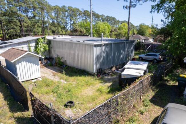
Property Record
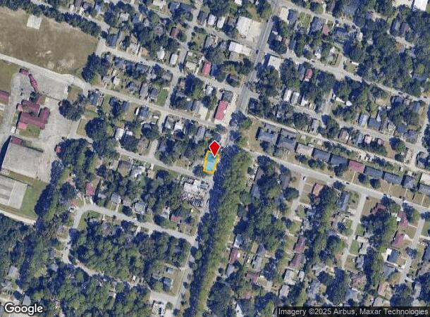
4505 Montgomery St, Savannah, GA 31405
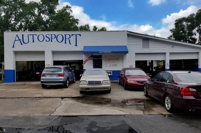
This Property Is For Sale
NEARBY LISTINGS FOR SALE OR LEASE
Property Detail
4505 Montgomery St
2010702007
LOT 1 RECOMBINATION OF LOTS 56 57 58 WILSON WARD HUSS AR S TC
Storebuilding
Chatham
X
Georgia
45053C0550D
1,56-58
2024
0.10 AC
2025
Greater Savannah
003400
Savannah
1,651 SF
Savannah, GA
DEMOGRAPHICS near 4505 Montgomery St
1 Mile
3 Mile
5 Mile
2024 Total Population
13,163
83,752
153,839
2029 Population
14,655
93,430
171,126
Pop Growth 2024-2029
+ 11.33%
+ 11.56%
+ 11.24%
Average Age
40
39
39
2024 Total Households
5,249
35,144
62,858
HH Growth 2024-2029
+ 11.79%
+ 12.12%
+ 11.84%
Median Household Inc
$51,031
$49,997
$51,299
Avg Household Size
2.20
2.20
2.20
2024 Avg HH Vehicles
2.00
1.00
1.00
Median Home Value
$242,547
$229,018
$198,175
Median Year Built
1958
1957
1968
Nearby Places
Map Layers
Map Styles
 Street
 Aerial
- Restaurants
- Banks
- Shops
- Fitness
- Groceries
PUBLIC TRANSPORTATION
COMMUTER RAIL
DRIVE
WALK
Distance
11 min
5.4 mi
AIRPORT
Savannah/Hilton Head International
DRIVE
WALK
Distance
Savannah/Hilton Head International
23 min
12.2 mi
Hilton Head
DRIVE
WALK
Distance
Hilton Head
63 min
39.5 mi
Freight Ports
Georgia Ports - Savannah
DRIVE
WALK
Distance
Georgia Ports - Savannah
17 min
8.7 mi
Nearby Properties
Address
Land Use
TOTAL SIZE
Lot Size
Zoning
Address
Land Use
TOTAL SIZE
Lot Size
Zoning
14,252 SF
52.91 AC
RIP
Address
Land Use
TOTAL SIZE
Lot Size
Zoning
1,400 SF
6.97 AC
D-X
Address
Land Use
TOTAL SIZE
Lot Size
Zoning
0.12 AC
R6
Address
Land Use
TOTAL SIZE
Lot Size
Zoning
559,705 SF
44.25 AC
BC
Address
Land Use
TOTAL SIZE
Lot Size
Zoning
4,930 SF
1.18 AC
I-L
Address
Land Use
TOTAL SIZE
Lot Size
Zoning
6,245 SF
13.52 AC
PUDISB
Address
Land Use
TOTAL SIZE
Lot Size
Zoning
33,000 SF
1.92 AC
I-L
Address
Land Use
TOTAL SIZE
Lot Size
Zoning
199,424 SF
2.49 AC
BN
Address
Land Use
TOTAL SIZE
Lot Size
Zoning
479,600 SF
28.24 AC
IH
Address
Land Use
TOTAL SIZE
Lot Size
Zoning
77,610 SF
0.33 AC
BC1
Address
Land Use
TOTAL SIZE
Lot Size
Zoning
245,610 SF
1.10 AC
RIPC
Address
Land Use
TOTAL SIZE
Lot Size
Zoning
29,304 SF
27.20 AC
R3
Address
Land Use
TOTAL SIZE
Lot Size
Zoning
115,069 SF
1.14 AC
BC1
Address
Land Use
TOTAL SIZE
Lot Size
Zoning
52,272 SF
82.59 AC
RIP
Address
Land Use
TOTAL SIZE
Lot Size
Zoning
810 SF
20 AC
Address
Land Use
TOTAL SIZE
Lot Size
Zoning
100 SF
15.62 AC
RM25
Address
Land Use
TOTAL SIZE
Lot Size
Zoning
7,900 SF
1.98 AC
RIPB1
Address
Land Use
TOTAL SIZE
Lot Size
Zoning
67,656 SF
59.88 AC
M
Address
Land Use
TOTAL SIZE
Lot Size
Zoning
8,480 SF
16.50 AC
PUDM25
Address
Land Use
TOTAL SIZE
Lot Size
Zoning
141,489 SF
1.60 AC
BC
Address
Land Use
TOTAL SIZE
Lot Size
Zoning
175,552 SF
1.12 AC
RM25
Address
Land Use
TOTAL SIZE
Lot Size
Zoning
14,249 SF
14.92 AC
BC
Address
Land Use
TOTAL SIZE
Lot Size
Zoning
88,080 SF
0.51 AC
BC1
Address
Land Use
TOTAL SIZE
Lot Size
Zoning
59.65 AC
RIP
Address
Land Use
TOTAL SIZE
Lot Size
Zoning
128,061 SF
29.78 AC
R6
Address
Land Use
TOTAL SIZE
Lot Size
Zoning
85,606 SF
16.30 AC
BC
Address
Land Use
TOTAL SIZE
Lot Size
Zoning
11,888 SF
24.99 AC
I-H
Address
Land Use
TOTAL SIZE
Lot Size
Zoning
107,844 SF
1.19 AC
BC
Address
Land Use
TOTAL SIZE
Lot Size
Zoning
115,859 SF
1.85 AC
Address
Land Use
TOTAL SIZE
Lot Size
Zoning
388,944 SF
7 AC
BC1
The World's #1 Commercial Real Estate Marketplace
Connect with us
© 2026 CoStar Group
The information above has been obtained from sources believed reliable. While we do not doubt its accuracy we have not verified it and make no guarantee, warranty or representation about it. It is your responsibility to independently confirm its accuracy and completeness. Any projections, opinions, assumptions, or estimates used are for example only and do not represent the current or future performance of the property. The value of this transaction to you depends on tax and other factors which should be evaluated by your tax, financial, and legal advisors. You and your advisors should conduct a careful, independent investigation of the property to determine to your satisfaction the suitability of the property for your needs.