Property Record
4505 Nathan Ln N, Minneapolis, MN 55442
NEARBY LISTINGS FOR SALE OR LEASE
Property Detail
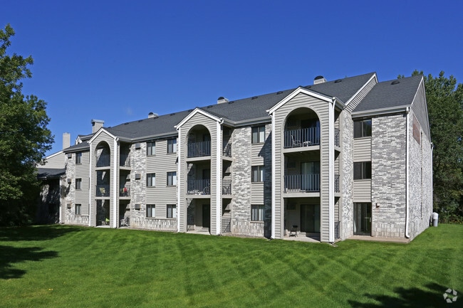
4505 Nathan Ln N
Minneapolis-St. Paul-Bloomington, MN-WI
Plymouth Ponds
12-118-22-43-0037
T PLYMOUTH PONDS OUTLOT A IRREGULAR
Apartment
Hennepin
X
Minnesota
27053C0191F
a
0
22.67 AC
2024
Glenwood Junction
026509
Minneapolis/St Paul
DEMOGRAPHICS near 4505 Nathan Ln N
1 Mile
3 Mile
5 Mile
2024 Total Population
9,737
84,091
225,287
2029 Population
9,501
82,370
221,227
Pop Growth 2024-2029
(2.42%)
(2.05%)
(1.80%)
Average Age
42
41
40
2024 Total Households
4,169
34,711
89,539
HH Growth 2024-2029
(2.57%)
(2.24%)
(1.94%)
Median Household Inc
$84,711
$84,891
$86,299
Avg Household Size
2.20
2.30
2.40
2024 Avg HH Vehicles
2.00
2.00
2.00
Median Home Value
$337,096
$302,428
$305,670
Median Year Built
1980
1974
1974
Nearby Places
Map Layers
Map Styles
 Street
 Aerial
- Restaurants
- Banks
- Shops
- Fitness
- Groceries
PUBLIC TRANSPORTATION
AIRPORT
Minneapolis-St Paul International/Wold-Chamberlain
DRIVE
WALK
Distance
Minneapolis-St Paul International/Wold-Chamberlain
34 min
22.9 mi
Freight Ports
Port Milwaukee
DRIVE
WALK
Distance
Port Milwaukee
392 min
354.0 mi
Nearby Properties
Address
Land Use
TOTAL SIZE
Lot Size
Zoning
Address
Land Use
TOTAL SIZE
Lot Size
Zoning
35.53 AC
Address
Land Use
TOTAL SIZE
Lot Size
Zoning
16.01 AC
Address
Land Use
TOTAL SIZE
Lot Size
Zoning
14.19 AC
Address
Land Use
TOTAL SIZE
Lot Size
Zoning
17.26 AC
Address
Land Use
TOTAL SIZE
Lot Size
Zoning
Address
Land Use
TOTAL SIZE
Lot Size
Zoning
Address
Land Use
TOTAL SIZE
Lot Size
Zoning
26.57 AC
Address
Land Use
TOTAL SIZE
Lot Size
Zoning
21.14 AC
Address
Land Use
TOTAL SIZE
Lot Size
Zoning
Address
Land Use
TOTAL SIZE
Lot Size
Zoning
18.95 AC
Address
Land Use
TOTAL SIZE
Lot Size
Zoning
22.20 AC
Address
Land Use
TOTAL SIZE
Lot Size
Zoning
16.35 AC
Address
Land Use
TOTAL SIZE
Lot Size
Zoning
12.38 AC
Address
Land Use
TOTAL SIZE
Lot Size
Zoning
20.48 AC
Address
Land Use
TOTAL SIZE
Lot Size
Zoning
14.04 AC
Address
Land Use
TOTAL SIZE
Lot Size
Zoning
11.96 AC
Address
Land Use
TOTAL SIZE
Lot Size
Zoning
0.80 AC
Address
Land Use
TOTAL SIZE
Lot Size
Zoning
Address
Land Use
TOTAL SIZE
Lot Size
Zoning
26.26 AC
Address
Land Use
TOTAL SIZE
Lot Size
Zoning
Address
Land Use
TOTAL SIZE
Lot Size
Zoning
Address
Land Use
TOTAL SIZE
Lot Size
Zoning
15.94 AC
Address
Land Use
TOTAL SIZE
Lot Size
Zoning
21.10 AC
Address
Land Use
TOTAL SIZE
Lot Size
Zoning
13.07 AC
Address
Land Use
TOTAL SIZE
Lot Size
Zoning
13.95 AC
Address
Land Use
TOTAL SIZE
Lot Size
Zoning
18.26 AC
Address
Land Use
TOTAL SIZE
Lot Size
Zoning
12.04 AC
Address
Land Use
TOTAL SIZE
Lot Size
Zoning
9.89 AC
Address
Land Use
TOTAL SIZE
Lot Size
Zoning
13.50 AC
The World's #1 Commercial Real Estate Marketplace
Connect with us
© 2026 CoStar Group
The information above has been obtained from sources believed reliable. While we do not doubt its accuracy we have not verified it and make no guarantee, warranty or representation about it. It is your responsibility to independently confirm its accuracy and completeness. Any projections, opinions, assumptions, or estimates used are for example only and do not represent the current or future performance of the property. The value of this transaction to you depends on tax and other factors which should be evaluated by your tax, financial, and legal advisors. You and your advisors should conduct a careful, independent investigation of the property to determine to your satisfaction the suitability of the property for your needs.