Property Record
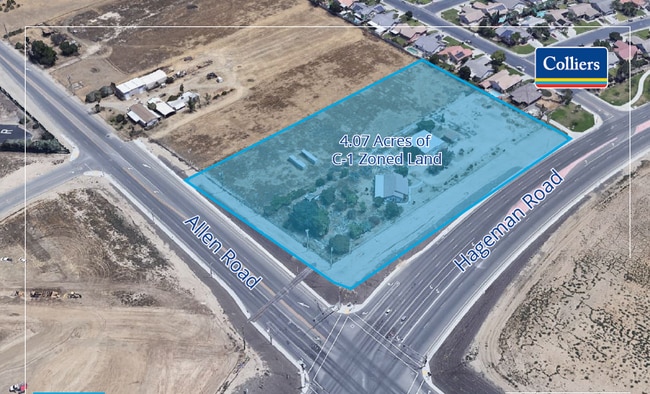
4508 Allen Rd, Bakersfield, CA 93314


This Property Is For Sale
Property Detail
4508 Allen Rd
Bakersfield-Delano, CA
SECTION 13 , TOWNSHIP 29 , RANGE 26 , QUARTER
527-020-17-00-6
KERN
Vacantlandnec
California
E1/RS/MH
25
B and X Area of moderate flood hazard, usually the area between the limits of the 100-year and 500-year floods.
2.06 AC
2025
Northwest Bakersfield
2025
Bakersfield
003815
NEARBY LISTINGS FOR SALE OR LEASE
DEMOGRAPHICS near 4508 Allen Rd
1 mile
3 mile
5 mile
2025 Total Population
12,294
73,816
128,876
2030 Population
12,389
74,288
131,233
Pop Growth 2025-2030
+ 0.77%
+ 0.64%
+ 1.83%
Average Age
35
37
38
2025 Total Households
3,737
23,645
43,057
HH Growth 2025-2030
+ 0.67%
+ 0.54%
+ 1.76%
Median Household Inc
$125,168
$121,013
$116,947
Avg Household Size
3.20
3.10
2.90
2025 Avg HH Vehicles
2.00
2.00
2.00
Median Home Value
$442,398
$458,783
$456,773
Median Year Built
2002
2001
2000
Nearby Places
Map Layers
Map Styles
 Street
 Aerial
Layers
 Traffic
 Biking
Places
Listings with unknown addresses are not visible on the map
- Restaurants
- Banks
- Shops
- Fitness
- Groceries
PUBLIC TRANSPORTATION
AIRPORT
Meadows Field
Drive
Walk
Distance
Meadows Field
18 min
9.6 mi
Freight Ports
The Port of Hueneme
Drive
Walk
Distance
The Port of Hueneme
163 min
129.0 mi
Nearby Properties
Address
Land Use
TOTAL SIZE
Lot Size
Zoning
Address
Land Use
TOTAL SIZE
Lot Size
Zoning
1,949 SF
6.43 AC
R-2
Address
Land Use
TOTAL SIZE
Lot Size
Zoning
51,666 SF
6.08 AC
C2
Address
Land Use
TOTAL SIZE
Lot Size
Zoning
144,414 SF
11.90 AC
PCD
Address
Land Use
TOTAL SIZE
Lot Size
Zoning
83,650 SF
2.43 AC
C-2
Address
Land Use
TOTAL SIZE
Lot Size
Zoning
16,991 SF
17.46 AC
R1
Address
Land Use
TOTAL SIZE
Lot Size
Zoning
86,729 SF
8.59 AC
C2
Address
Land Use
TOTAL SIZE
Lot Size
Zoning
161,685 SF
12.79 AC
C2
Address
Land Use
TOTAL SIZE
Lot Size
Zoning
115,058 SF
10.95 AC
Address
Land Use
TOTAL SIZE
Lot Size
Zoning
1,860 SF
7.86 AC
Address
Land Use
TOTAL SIZE
Lot Size
Zoning
88,255 SF
6.24 AC
C-2
Address
Land Use
TOTAL SIZE
Lot Size
Zoning
43,000 SF
3.18 AC
C2
Address
Land Use
TOTAL SIZE
Lot Size
Zoning
58,294 SF
5.33 AC
C1
Address
Land Use
TOTAL SIZE
Lot Size
Zoning
5,450 SF
4.54 AC
R-2
Address
Land Use
TOTAL SIZE
Lot Size
Zoning
41,177 SF
4.59 AC
C-2 PCD
Address
Land Use
TOTAL SIZE
Lot Size
Zoning
3,870 SF
17.53 AC
C-2
Address
Land Use
TOTAL SIZE
Lot Size
Zoning
41,217 SF
4.33 AC
C-2 PCD
Address
Land Use
TOTAL SIZE
Lot Size
Zoning
9.16 AC
Address
Land Use
TOTAL SIZE
Lot Size
Zoning
11,127 SF
2.62 AC
R-2
Address
Land Use
TOTAL SIZE
Lot Size
Zoning
50,547 SF
5.17 AC
C2 PD
Address
Land Use
TOTAL SIZE
Lot Size
Zoning
Address
Land Use
TOTAL SIZE
Lot Size
Zoning
9,535 SF
2.58 AC
C2
Address
Land Use
TOTAL SIZE
Lot Size
Zoning
8,361 SF
3.42 AC
C2
Address
Land Use
TOTAL SIZE
Lot Size
Zoning
Address
Land Use
TOTAL SIZE
Lot Size
Zoning
6,527 SF
2.20 AC
C2
Address
Land Use
TOTAL SIZE
Lot Size
Zoning
22,290 SF
23.55 AC
E
Address
Land Use
TOTAL SIZE
Lot Size
Zoning
18,954 SF
2.23 AC
R-2
Address
Land Use
TOTAL SIZE
Lot Size
Zoning
47,190 SF
3.61 AC
C2
Address
Land Use
TOTAL SIZE
Lot Size
Zoning
40,313 SF
1.25 AC
M2
The World's #1 Commercial Real Estate Marketplace
Connect with us
© 2026 CoStar Group
The information above has been obtained from sources believed reliable. While we do not doubt its accuracy we have not verified it and make no guarantee, warranty or representation about it. It is your responsibility to independently confirm its accuracy and completeness. Any projections, opinions, assumptions, or estimates used are for example only and do not represent the current or future performance of the property. The value of this transaction to you depends on tax and other factors which should be evaluated by your tax, financial, and legal advisors. You and your advisors should conduct a careful, independent investigation of the property to determine to your satisfaction the suitability of the property for your needs.