Property Record
451 Main St, Chimney Rock, NC 28720
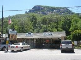

Property Detail
451 Main St
Forest City, NC
GPIN:0633172028280000; HWY 74
224088
RUTHERFORD
Vacantlandnec
North Carolina
AE The base floodplain where base flood elevations are provided. AE Zones are now used on new format FIRMs instead of A1-A30 Zones.
0.10 AC
0
North Carolina West/Cherokee Area
2025
Other Market Areas
960301
NEARBY LISTINGS FOR SALE OR LEASE
-
-
View all Chimney Rock listings for sale on LoopNet.com
DEMOGRAPHICS near 451 Main St
1 mile
3 mile
5 mile
2025 Total Population
43
1,311
6,320
2030 Population
47
1,427
6,861
Pop Growth 2025-2030
+ 9.30%
+ 8.85%
+ 8.56%
Average Age
58
53
51
2025 Total Households
23
653
2,945
HH Growth 2025-2030
+ 13.04%
+ 9.04%
+ 8.62%
Median Household Inc
$71,249
$61,164
$60,179
Avg Household Size
1.80
2.00
2.10
2025 Avg HH Vehicles
2.00
2.00
2.00
Median Home Value
$466,666
$441,129
$421,919
Median Year Built
1987
1990
1992
Nearby Places
Map Layers
Map Styles
 Street
 Aerial
Layers
 Traffic
 Biking
Places
Listings with unknown addresses are not visible on the map
- Restaurants
- Banks
- Shops
- Fitness
- Groceries
PUBLIC TRANSPORTATION
AIRPORT
Asheville Regional
Drive
Walk
Distance
Asheville Regional
38 min
24.3 mi
Freight Ports
North Charleston Terminal
Drive
Walk
Distance
North Charleston Terminal
277 min
237.1 mi
SALE & LEASE HISTORY
LISTING DATE
SALE/LEASE

Apr 26, 2022
For Sale
Nearby Properties
Address
Land Use
TOTAL SIZE
Lot Size
Zoning
Address
Land Use
TOTAL SIZE
Lot Size
Zoning
2,355 SF
996.79 AC
CG
Address
Land Use
TOTAL SIZE
Lot Size
Zoning
96 AC
R3
Address
Land Use
TOTAL SIZE
Lot Size
Zoning
2.26 AC
R1
Address
Land Use
TOTAL SIZE
Lot Size
Zoning
980.54 AC
R3
Address
Land Use
TOTAL SIZE
Lot Size
Zoning
55.94 AC
R1A
Address
Land Use
TOTAL SIZE
Lot Size
Zoning
55.63 AC
R1A
Address
Land Use
TOTAL SIZE
Lot Size
Zoning
7,088 SF
1.48 AC
CTC
Address
Land Use
TOTAL SIZE
Lot Size
Zoning
7.53 AC
R1
Address
Land Use
TOTAL SIZE
Lot Size
Zoning
5.23 AC
R1
Address
Land Use
TOTAL SIZE
Lot Size
Zoning
787.85 AC
Address
Land Use
TOTAL SIZE
Lot Size
Zoning
12.90 AC
GU
Address
Land Use
TOTAL SIZE
Lot Size
Zoning
2,400 SF
7.77 AC
GU
Address
Land Use
TOTAL SIZE
Lot Size
Zoning
509.31 AC
Address
Land Use
TOTAL SIZE
Lot Size
Zoning
4,316 SF
8.84 AC
R1A
Address
Land Use
TOTAL SIZE
Lot Size
Zoning
544 SF
4.50 AC
GU
Address
Land Use
TOTAL SIZE
Lot Size
Zoning
11,827 SF
1.45 AC
Address
Land Use
TOTAL SIZE
Lot Size
Zoning
5,364 SF
0.48 AC
CTC
Address
Land Use
TOTAL SIZE
Lot Size
Zoning
4,640 SF
0.97 AC
OU
Address
Land Use
TOTAL SIZE
Lot Size
Zoning
60.40 AC
Address
Land Use
TOTAL SIZE
Lot Size
Zoning
1.70 AC
GU
Address
Land Use
TOTAL SIZE
Lot Size
Zoning
362.92 AC
R3
Address
Land Use
TOTAL SIZE
Lot Size
Zoning
2,010 SF
3.06 AC
R3
Address
Land Use
TOTAL SIZE
Lot Size
Zoning
1,343 SF
5.43 AC
CG
Address
Land Use
TOTAL SIZE
Lot Size
Zoning
6,600 SF
1.41 AC
Address
Land Use
TOTAL SIZE
Lot Size
Zoning
251.57 AC
Address
Land Use
TOTAL SIZE
Lot Size
Zoning
5,359 SF
1.09 AC
GU
Address
Land Use
TOTAL SIZE
Lot Size
Zoning
897 SF
0.60 AC
R2
Address
Land Use
TOTAL SIZE
Lot Size
Zoning
3,630 SF
3.58 AC
9929866~R3
Address
Land Use
TOTAL SIZE
Lot Size
Zoning
672 SF
121.65 AC
S1
Address
Land Use
TOTAL SIZE
Lot Size
Zoning
6,738 SF
3.82 AC
R3
The World's #1 Commercial Real Estate Marketplace
Connect with us
© 2026 CoStar Group
The information above has been obtained from sources believed reliable. While we do not doubt its accuracy we have not verified it and make no guarantee, warranty or representation about it. It is your responsibility to independently confirm its accuracy and completeness. Any projections, opinions, assumptions, or estimates used are for example only and do not represent the current or future performance of the property. The value of this transaction to you depends on tax and other factors which should be evaluated by your tax, financial, and legal advisors. You and your advisors should conduct a careful, independent investigation of the property to determine to your satisfaction the suitability of the property for your needs.