Property Record
451 Oconnell St, North Bend, OR 97459
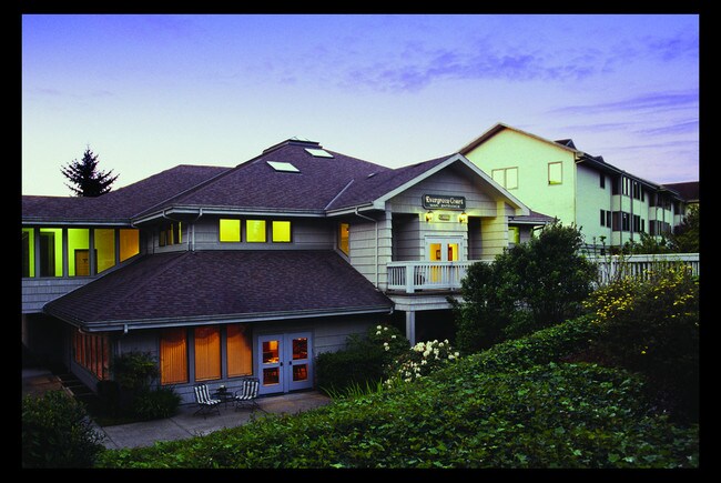
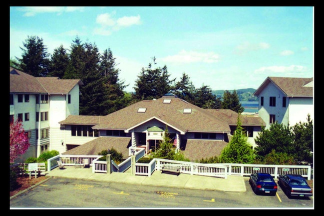
Property Detail
451 Oconnell St
Commercialnec
Coos
RM
Oregon
B and X Area of moderate flood hazard, usually the area between the limits of the 100-year and 500-year floods.
8400
2025
2.46 AC
2025
Other Market Areas
000300
Coos Bay-North Bend, OR
80,365 SF
1005509600
NEARBY LISTINGS FOR SALE OR LEASE
-
-
View all North Bend listings for sale on LoopNet.com
DEMOGRAPHICS near 451 Oconnell St
1 mile
3 mile
5 mile
2025 Total Population
4,835
27,225
32,904
2030 Population
4,728
26,630
32,208
Pop Growth 2025-2030
(2.21%)
(2.19%)
(2.12%)
Average Age
44
43
44
2025 Total Households
2,117
11,460
13,763
HH Growth 2025-2030
(2.27%)
(2.30%)
(2.24%)
Median Household Inc
$55,816
$63,414
$65,982
Avg Household Size
2.20
2.30
2.30
2025 Avg HH Vehicles
2.00
2.00
2.00
Median Home Value
$347,085
$330,902
$335,621
Median Year Built
1959
1967
1969
Nearby Places
Map Layers
Map Styles
 Street
 Aerial
Transit
 Traffic
 Biking
Places
Listings with unknown addresses are not visible on the map
- Restaurants
- Banks
- Shops
- Fitness
- Groceries
SALE & LEASE HISTORY
LISTING DATE
SALE/LEASE

Aug 15, 2019
For Sale
Nearby Properties
Address
Land Use
TOTAL SIZE
Lot Size
Zoning
Address
Land Use
TOTAL SIZE
Lot Size
Zoning
35.33 AC
QP-3
Address
Land Use
TOTAL SIZE
Lot Size
Zoning
17,842 SF
17.89 AC
QP-3
Address
Land Use
TOTAL SIZE
Lot Size
Zoning
193,825 SF
11.29 AC
MP
Address
Land Use
TOTAL SIZE
Lot Size
Zoning
376.53 AC
A-Z
Address
Land Use
TOTAL SIZE
Lot Size
Zoning
91.89 AC
QP-3
Address
Land Use
TOTAL SIZE
Lot Size
Zoning
580 SF
24.79 AC
R-7
Address
Land Use
TOTAL SIZE
Lot Size
Zoning
32.99 AC
QP-2
Address
Land Use
TOTAL SIZE
Lot Size
Zoning
9.70 AC
MP
Address
Land Use
TOTAL SIZE
Lot Size
Zoning
2.01 AC
C-2
Address
Land Use
TOTAL SIZE
Lot Size
Zoning
57,500 SF
4 AC
QP-3
Address
Land Use
TOTAL SIZE
Lot Size
Zoning
35,311 SF
13.93 AC
MP
Address
Land Use
TOTAL SIZE
Lot Size
Zoning
10.95 AC
IND
Address
Land Use
TOTAL SIZE
Lot Size
Zoning
3,922 SF
2.19 AC
Address
Land Use
TOTAL SIZE
Lot Size
Zoning
676 SF
20.66 AC
Address
Land Use
TOTAL SIZE
Lot Size
Zoning
5,360 SF
16.18 AC
CBEMP
Address
Land Use
TOTAL SIZE
Lot Size
Zoning
41,809 SF
11.59 AC
R-2
Address
Land Use
TOTAL SIZE
Lot Size
Zoning
48,000 SF
5.42 AC
CM
Address
Land Use
TOTAL SIZE
Lot Size
Zoning
1,200 SF
94.75 AC
CD-5 , CBE
Address
Land Use
TOTAL SIZE
Lot Size
Zoning
1 AC
A-Z
Address
Land Use
TOTAL SIZE
Lot Size
Zoning
138,055 SF
28.65 AC
CM
Address
Land Use
TOTAL SIZE
Lot Size
Zoning
71,300 SF
9.23 AC
C-2
Address
Land Use
TOTAL SIZE
Lot Size
Zoning
12,426 SF
23.64 AC
MP
Address
Land Use
TOTAL SIZE
Lot Size
Zoning
920 SF
6.23 AC
Address
Land Use
TOTAL SIZE
Lot Size
Zoning
18.36 AC
R-2
Address
Land Use
TOTAL SIZE
Lot Size
Zoning
28,704 SF
3.96 AC
C-2
Address
Land Use
TOTAL SIZE
Lot Size
Zoning
3.89 AC
WH-3
Address
Land Use
TOTAL SIZE
Lot Size
Zoning
2,020 SF
34.80 AC
R-5
Address
Land Use
TOTAL SIZE
Lot Size
Zoning
6.61 AC
R-10
Address
Land Use
TOTAL SIZE
Lot Size
Zoning
3.72 AC
I-C
Address
Land Use
TOTAL SIZE
Lot Size
Zoning
1.31 AC
W-I
The World's #1 Commercial Real Estate Marketplace
Connect with us
© 2026 CoStar Group
The information above has been obtained from sources believed reliable. While we do not doubt its accuracy we have not verified it and make no guarantee, warranty or representation about it. It is your responsibility to independently confirm its accuracy and completeness. Any projections, opinions, assumptions, or estimates used are for example only and do not represent the current or future performance of the property. The value of this transaction to you depends on tax and other factors which should be evaluated by your tax, financial, and legal advisors. You and your advisors should conduct a careful, independent investigation of the property to determine to your satisfaction the suitability of the property for your needs.