Property Record
451 W High St, Manheim, PA 17545


Property Detail
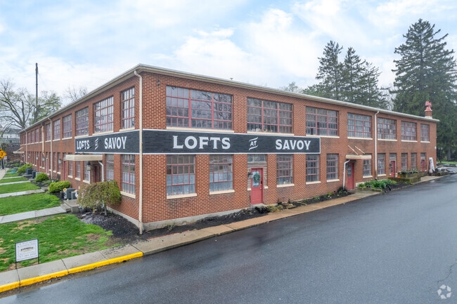
451 W High St
250-84440-0-0000
451 W HIGH ST
Apartment
LANCASTER
MU
Pennsylvania
B and X Area of moderate flood hazard, usually the area between the limits of the 100-year and 500-year floods.
8
2025
2.10 AC
2026
Elizabethtown/Mt Joy
010400
Philadelphia
42,932 SF
Lancaster, PA
NEARBY LISTINGS FOR SALE OR LEASE
-
-
View all Manheim listings for sale on LoopNet.com
DEMOGRAPHICS near 451 W High St
1 mile
3 mile
5 mile
2025 Total Population
8,312
28,356
39,813
2030 Population
8,476
28,966
40,539
Pop Growth 2025-2030
+ 1.97%
+ 2.15%
+ 1.82%
Average Age
46
43
42
2025 Total Households
3,698
10,963
15,231
HH Growth 2025-2030
+ 2.14%
+ 2.36%
+ 2.00%
Median Household Inc
$58,010
$74,826
$80,591
Avg Household Size
2.10
2.40
2.40
2025 Avg HH Vehicles
2.00
2.00
2.00
Median Home Value
$239,980
$285,326
$283,081
Median Year Built
1959
1985
1984
Nearby Places
Map Layers
Map Styles
 Street
 Aerial
Layers
 Traffic
 Biking
Places
Listings with unknown addresses are not visible on the map
- Restaurants
- Banks
- Shops
- Fitness
- Groceries
PUBLIC TRANSPORTATION
COMMUTER RAIL
Elizabethtown Amtrak Station (Keystone Service - Amtrak, Pennsylvanian - Amtrak)
Drive
Walk
Distance
Elizabethtown Amtrak Station (Keystone Service - Amtrak, Pennsylvanian - Amtrak)
0 min
2 min
0.1 mi
Mount Joy Amtrak (Keystone Service - Amtrak)
Drive
Walk
Distance
Mount Joy Amtrak (Keystone Service - Amtrak)
11 min
6.8 mi
AIRPORT
Harrisburg International
Drive
Walk
Distance
Harrisburg International
19 min
10.9 mi
Freight Ports
Port of Baltimore
Drive
Walk
Distance
Port of Baltimore
114 min
79.3 mi
SALE & LEASE HISTORY
LISTING DATE
SALE/LEASE

Jun 09, 2025
For Sale
Nearby Properties
Address
Land Use
TOTAL SIZE
Lot Size
Zoning
Address
Land Use
TOTAL SIZE
Lot Size
Zoning
1,507,078 SF
1,061.90 AC
INS
Address
Land Use
TOTAL SIZE
Lot Size
Zoning
531,932 SF
100.20 AC
Address
Land Use
TOTAL SIZE
Lot Size
Zoning
705,686 SF
90.80 AC
Address
Land Use
TOTAL SIZE
Lot Size
Zoning
993,449 SF
91.47 AC
Address
Land Use
TOTAL SIZE
Lot Size
Zoning
2,603 SF
93.78 AC
Address
Land Use
TOTAL SIZE
Lot Size
Zoning
2,160 SF
72.40 AC
Address
Land Use
TOTAL SIZE
Lot Size
Zoning
463,991 SF
89.23 AC
Address
Land Use
TOTAL SIZE
Lot Size
Zoning
750 SF
19.61 AC
Address
Land Use
TOTAL SIZE
Lot Size
Zoning
218,686 SF
6.79 AC
MU
Address
Land Use
TOTAL SIZE
Lot Size
Zoning
267,696 SF
33.78 AC
Address
Land Use
TOTAL SIZE
Lot Size
Zoning
320,000 SF
27.99 AC
Address
Land Use
TOTAL SIZE
Lot Size
Zoning
154,112 SF
18.92 AC
Address
Land Use
TOTAL SIZE
Lot Size
Zoning
200,892 SF
16.25 AC
R3
Address
Land Use
TOTAL SIZE
Lot Size
Zoning
85,268 SF
34.90 AC
Address
Land Use
TOTAL SIZE
Lot Size
Zoning
138,828 SF
17.09 AC
Address
Land Use
TOTAL SIZE
Lot Size
Zoning
303,449 SF
42.16 AC
I
Address
Land Use
TOTAL SIZE
Lot Size
Zoning
165,600 SF
19.17 AC
Address
Land Use
TOTAL SIZE
Lot Size
Zoning
172,116 SF
248 AC
IN
Address
Land Use
TOTAL SIZE
Lot Size
Zoning
144,000 SF
22.46 AC
I
Address
Land Use
TOTAL SIZE
Lot Size
Zoning
199,888 SF
17 AC
I
Address
Land Use
TOTAL SIZE
Lot Size
Zoning
495,816 SF
26.02 AC
I-G
Address
Land Use
TOTAL SIZE
Lot Size
Zoning
206,236 SF
13.70 AC
I
Address
Land Use
TOTAL SIZE
Lot Size
Zoning
201,594 SF
11.20 AC
I
Address
Land Use
TOTAL SIZE
Lot Size
Zoning
100,368 SF
7.71 AC
Address
Land Use
TOTAL SIZE
Lot Size
Zoning
127,425 SF
12.69 AC
Address
Land Use
TOTAL SIZE
Lot Size
Zoning
23,170 SF
107.91 AC
R
Address
Land Use
TOTAL SIZE
Lot Size
Zoning
95,940 SF
0.90 AC
Address
Land Use
TOTAL SIZE
Lot Size
Zoning
37,911 SF
14.40 AC
RT
Address
Land Use
TOTAL SIZE
Lot Size
Zoning
74,420 SF
43.91 AC
I-1
Address
Land Use
TOTAL SIZE
Lot Size
Zoning
41,069 SF
3.12 AC
R1
The World's #1 Commercial Real Estate Marketplace
Connect with us
© 2026 CoStar Group
The information above has been obtained from sources believed reliable. While we do not doubt its accuracy we have not verified it and make no guarantee, warranty or representation about it. It is your responsibility to independently confirm its accuracy and completeness. Any projections, opinions, assumptions, or estimates used are for example only and do not represent the current or future performance of the property. The value of this transaction to you depends on tax and other factors which should be evaluated by your tax, financial, and legal advisors. You and your advisors should conduct a careful, independent investigation of the property to determine to your satisfaction the suitability of the property for your needs.