Property Record
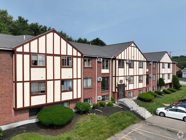
451 Winnacunnet Rd, Hampton, NH 03842


Property Detail
451 Winnacunnet Rd
Commercialnec
ROCKINGHAM
RB
New Hampshire
AE The base floodplain where base flood elevations are provided. AE Zones are now used on new format FIRMs instead of A1-A30 Zones.
9.49 AC
2025
New Hampshire Beaches
2025
Boston
065007
Boston-Cambridge-Newton, MA-NH
29,408 SF
HMPT-000221-000000-000016
NEARBY LISTINGS FOR SALE OR LEASE
-
-
View all Hampton listings for sale on LoopNet.com
DEMOGRAPHICS near 451 Winnacunnet Rd
1 mile
3 mile
5 mile
2025 Total Population
6,183
20,592
36,177
2030 Population
6,467
21,494
37,526
Pop Growth 2025-2030
+ 4.59%
+ 4.38%
+ 3.73%
Average Age
51
50
49
2025 Total Households
3,069
9,680
16,433
HH Growth 2025-2030
+ 4.92%
+ 4.65%
+ 3.96%
Median Household Inc
$97,256
$95,421
$95,969
Avg Household Size
2.00
2.10
2.10
2025 Avg HH Vehicles
2.00
2.00
2.00
Median Home Value
$600,694
$641,433
$640,857
Median Year Built
1977
1976
1979
Nearby Places
Map Layers
Map Styles
 Street
 Aerial
Layers
 Traffic
 Biking
Places
Listings with unknown addresses are not visible on the map
- Restaurants
- Banks
- Shops
- Fitness
- Groceries
PUBLIC TRANSPORTATION
COMMUTER RAIL
Exeter (Downeaster - Amtrak)
Drive
Walk
Distance
Exeter (Downeaster - Amtrak)
18 min
9.9 mi
AIRPORT
Portsmouth International at Pease
Drive
Walk
Distance
Portsmouth International at Pease
26 min
15.3 mi
Manchester Boston Regional
Drive
Walk
Distance
Manchester Boston Regional
59 min
42.9 mi
Freight Ports
Port of Boston
Drive
Walk
Distance
Port of Boston
70 min
50.0 mi
Nearby Properties
Address
Land Use
TOTAL SIZE
Lot Size
Zoning
Address
Land Use
TOTAL SIZE
Lot Size
Zoning
4,884 SF
40 AC
RB
Address
Land Use
TOTAL SIZE
Lot Size
Zoning
46,328 SF
49.50 AC
RA
Address
Land Use
TOTAL SIZE
Lot Size
Zoning
87,993 SF
8.59 AC
I
Address
Land Use
TOTAL SIZE
Lot Size
Zoning
116,112 SF
4.52 AC
BS1
Address
Land Use
TOTAL SIZE
Lot Size
Zoning
142,369 SF
8.82 AC
POR
Address
Land Use
TOTAL SIZE
Lot Size
Zoning
79,305 SF
17.18 AC
G
Address
Land Use
TOTAL SIZE
Lot Size
Zoning
850 SF
0.94 AC
BS
Address
Land Use
TOTAL SIZE
Lot Size
Zoning
25,867 SF
9.17 AC
BS
Address
Land Use
TOTAL SIZE
Lot Size
Zoning
143,468 SF
61.40 AC
IB/R
Address
Land Use
TOTAL SIZE
Lot Size
Zoning
70,876 SF
17.38 AC
RA
Address
Land Use
TOTAL SIZE
Lot Size
Zoning
11,338 SF
28.90 AC
I
Address
Land Use
TOTAL SIZE
Lot Size
Zoning
114,814 SF
12.19 AC
IB/R
Address
Land Use
TOTAL SIZE
Lot Size
Zoning
41,864 SF
7.50 AC
RA
Address
Land Use
TOTAL SIZE
Lot Size
Zoning
47,508 SF
4.94 AC
TC-S
Address
Land Use
TOTAL SIZE
Lot Size
Zoning
52,319 SF
5.90 AC
POR
Address
Land Use
TOTAL SIZE
Lot Size
Zoning
18,228 SF
4.10 AC
TC-S
Address
Land Use
TOTAL SIZE
Lot Size
Zoning
68,614 SF
30 AC
I
Address
Land Use
TOTAL SIZE
Lot Size
Zoning
26,928 SF
25.11 AC
G
Address
Land Use
TOTAL SIZE
Lot Size
Zoning
56,656 SF
6.21 AC
IB/R
Address
Land Use
TOTAL SIZE
Lot Size
Zoning
56,520 SF
6.46 AC
BUSINE
Address
Land Use
TOTAL SIZE
Lot Size
Zoning
5,120 SF
1.30 AC
BS1
Address
Land Use
TOTAL SIZE
Lot Size
Zoning
77,480 SF
35.21 AC
I
Address
Land Use
TOTAL SIZE
Lot Size
Zoning
26,652 SF
23.60 AC
I
Address
Land Use
TOTAL SIZE
Lot Size
Zoning
44,860 SF
5.54 AC
TC-N
Address
Land Use
TOTAL SIZE
Lot Size
Zoning
6,892 SF
5.70 AC
B
Address
Land Use
TOTAL SIZE
Lot Size
Zoning
33,771 SF
0.41 AC
BS
Address
Land Use
TOTAL SIZE
Lot Size
Zoning
32,499 SF
14.05 AC
I
Address
Land Use
TOTAL SIZE
Lot Size
Zoning
34,021 SF
0.22 AC
BS
Address
Land Use
TOTAL SIZE
Lot Size
Zoning
7,667 SF
4.60 AC
R2
The World's #1 Commercial Real Estate Marketplace
Connect with us
© 2026 CoStar Group
The information above has been obtained from sources believed reliable. While we do not doubt its accuracy we have not verified it and make no guarantee, warranty or representation about it. It is your responsibility to independently confirm its accuracy and completeness. Any projections, opinions, assumptions, or estimates used are for example only and do not represent the current or future performance of the property. The value of this transaction to you depends on tax and other factors which should be evaluated by your tax, financial, and legal advisors. You and your advisors should conduct a careful, independent investigation of the property to determine to your satisfaction the suitability of the property for your needs.