Property Record
4510 Intelco Loop Se, Lacey, WA 98503

NEARBY LISTINGS FOR SALE OR LEASE
Property Detail
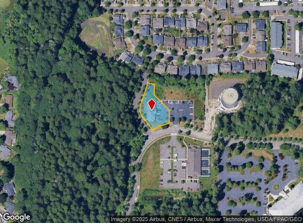
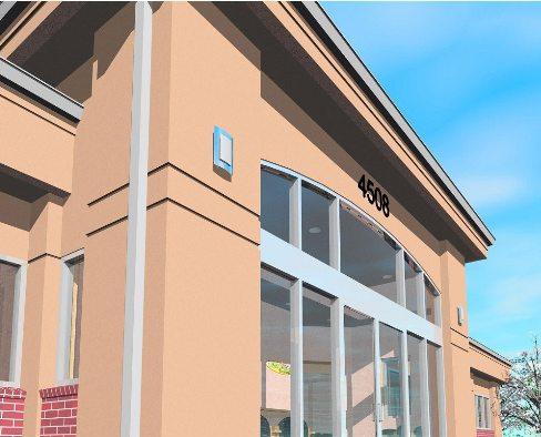
4510 Intelco Loop Se
Olympia-Lacey-Tumwater, WA
Intelco Plaza Bsp
55740000100
SECTION 32 TOWNSHIP 18 RANGE 1W QUARTER NW SE BINDING SITE PLAN INTELCO PLAZA BSP LT 1 DOCUMENT 4182277 ; AND AN UNDIVIDED INTEREST IN TRACT A (55740000001).
Commercialnec
Thurston
X
Washington
53067C0189G
1
2024
0.56 AC
2024
Lacey
011626
Olympia
4,640 SF
DEMOGRAPHICS near 4510 Intelco Loop Se
1 Mile
3 Mile
5 Mile
2024 Total Population
13,139
70,968
148,689
2029 Population
13,886
74,725
157,183
Pop Growth 2024-2029
+ 5.69%
+ 5.29%
+ 5.71%
Average Age
41
41
41
2024 Total Households
5,273
27,697
60,097
HH Growth 2024-2029
+ 5.90%
+ 5.41%
+ 5.86%
Median Household Inc
$74,889
$83,016
$78,371
Avg Household Size
2.40
2.50
2.40
2024 Avg HH Vehicles
2.00
2.00
2.00
Median Home Value
$379,942
$409,129
$399,959
Median Year Built
1996
1990
1988
Nearby Places
Map Layers
Map Styles
 Street
 Aerial
- Restaurants
- Banks
- Shops
- Fitness
- Groceries
PUBLIC TRANSPORTATION
COMMUTER RAIL
DRIVE
WALK
Distance
7 min
2.6 mi
AIRPORT
Seattle-Tacoma International
DRIVE
WALK
Distance
Seattle-Tacoma International
73 min
49.5 mi
Freight Ports
Port of Tacoma
DRIVE
WALK
Distance
Port of Tacoma
46 min
31.1 mi
Nearby Properties
Address
Land Use
TOTAL SIZE
Lot Size
Zoning
Address
Land Use
TOTAL SIZE
Lot Size
Zoning
660,544 SF
44.67 AC
MD
Address
Land Use
TOTAL SIZE
Lot Size
Zoning
224,544 SF
14.36 AC
OSI-S
Address
Land Use
TOTAL SIZE
Lot Size
Zoning
171,420 SF
63.61 AC
SMU
Address
Land Use
TOTAL SIZE
Lot Size
Zoning
204,136 SF
11.91 AC
RM-24
Address
Land Use
TOTAL SIZE
Lot Size
Zoning
197,571 SF
52.35 AC
R-4-8
Address
Land Use
TOTAL SIZE
Lot Size
Zoning
221,642 SF
4.96 AC
CBD 5
Address
Land Use
TOTAL SIZE
Lot Size
Zoning
357,949 SF
28.17 AC
WD
Address
Land Use
TOTAL SIZE
Lot Size
Zoning
185,762 SF
9.43 AC
CO
Address
Land Use
TOTAL SIZE
Lot Size
Zoning
123,538 SF
6.36 AC
RM-18
Address
Land Use
TOTAL SIZE
Lot Size
Zoning
163,167 SF
8.20 AC
CBD 5
Address
Land Use
TOTAL SIZE
Lot Size
Zoning
110,064 SF
3.47 AC
UV
Address
Land Use
TOTAL SIZE
Lot Size
Zoning
273,214 SF
19.54 AC
WD
Address
Land Use
TOTAL SIZE
Lot Size
Zoning
192,392 SF
16.15 AC
MD
Address
Land Use
TOTAL SIZE
Lot Size
Zoning
105,464 SF
3.06 AC
UV
Address
Land Use
TOTAL SIZE
Lot Size
Zoning
168,325 SF
15.35 AC
HD
Address
Land Use
TOTAL SIZE
Lot Size
Zoning
223,442 SF
6.43 AC
CO
Address
Land Use
TOTAL SIZE
Lot Size
Zoning
79,184 SF
13.83 AC
OSI-S
Address
Land Use
TOTAL SIZE
Lot Size
Zoning
161,068 SF
2.90 AC
Address
Land Use
TOTAL SIZE
Lot Size
Zoning
80,431 SF
9.09 AC
R-4-8
Address
Land Use
TOTAL SIZE
Lot Size
Zoning
94,081 SF
8.83 AC
MD
Address
Land Use
TOTAL SIZE
Lot Size
Zoning
181,675 SF
8.81 AC
MD
Address
Land Use
TOTAL SIZE
Lot Size
Zoning
128,609 SF
9.49 AC
HD
Address
Land Use
TOTAL SIZE
Lot Size
Zoning
98,890 SF
2.06 AC
WD
Address
Land Use
TOTAL SIZE
Lot Size
Zoning
48,988 SF
23.40 AC
SMU
Address
Land Use
TOTAL SIZE
Lot Size
Zoning
47,528 SF
9.34 AC
R-4-8
Address
Land Use
TOTAL SIZE
Lot Size
Zoning
57,200 SF
11.13 AC
OSI-S
Address
Land Use
TOTAL SIZE
Lot Size
Zoning
118,000 SF
11.86 AC
MD
Address
Land Use
TOTAL SIZE
Lot Size
Zoning
97,413 SF
7.85 AC
LD 0-4
Address
Land Use
TOTAL SIZE
Lot Size
Zoning
83,458 SF
2.44 AC
RM-24
Address
Land Use
TOTAL SIZE
Lot Size
Zoning
50,900 SF
16.62 AC
OSI-S
The World's #1 Commercial Real Estate Marketplace
Connect with us
© 2026 CoStar Group
The information above has been obtained from sources believed reliable. While we do not doubt its accuracy we have not verified it and make no guarantee, warranty or representation about it. It is your responsibility to independently confirm its accuracy and completeness. Any projections, opinions, assumptions, or estimates used are for example only and do not represent the current or future performance of the property. The value of this transaction to you depends on tax and other factors which should be evaluated by your tax, financial, and legal advisors. You and your advisors should conduct a careful, independent investigation of the property to determine to your satisfaction the suitability of the property for your needs.