Property Record
4610 Kansas Ave, Kansas City, KS 66106


NEARBY LISTINGS FOR SALE OR LEASE
Property Detail
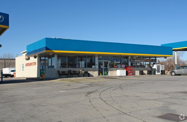
4610 Kansas Ave
Kansas City, MO-KS
Santa Fe Lands Plat
237331
SANTA FE LANDS PLAT, S18, T11, R25, ACRES 5.2472, B6 PT L4: BEG 136.36FT W OF SE COR; W 458.64FT ALG S LN, N 502.25FT, E 456.37FT, S 482FT, SLY CUR LT-20.74FT TO POB
Storebuilding
Wyandotte
X
Kansas
20209C0160E
4
2025
5.26 AC
2025
Kansas City KS
981500
Kansas City
3,792 SF
DEMOGRAPHICS near 4610 Kansas Ave
1 Mile
3 Mile
5 Mile
2024 Total Population
606
59,976
165,747
2029 Population
584
58,647
164,199
Pop Growth 2024-2029
(3.63%)
(2.22%)
(0.93%)
Average Age
35
35
37
2024 Total Households
203
20,078
63,907
HH Growth 2024-2029
(3.94%)
(2.28%)
(0.70%)
Median Household Inc
$52,941
$47,968
$54,676
Avg Household Size
2.90
2.80
2.50
2024 Avg HH Vehicles
2.00
2.00
2.00
Median Home Value
$148,275
$115,061
$153,880
Median Year Built
1955
1954
1958
Nearby Places
Map Layers
Map Styles
 Street
 Aerial
- Restaurants
- Banks
- Shops
- Fitness
- Groceries
PUBLIC TRANSPORTATION
COMMUTER RAIL
DRIVE
WALK
Distance
15 min
7.5 mi
AIRPORT
Kansas City International
DRIVE
WALK
Distance
Kansas City International
29 min
21.5 mi
Nearby Properties
Address
Land Use
TOTAL SIZE
Lot Size
Zoning
Address
Land Use
TOTAL SIZE
Lot Size
Zoning
347,991 SF
51.92 AC
1KMC
Address
Land Use
TOTAL SIZE
Lot Size
Zoning
249,363 SF
58.59 AC
Address
Land Use
TOTAL SIZE
Lot Size
Zoning
407,936 SF
37.46 AC
1
Address
Land Use
TOTAL SIZE
Lot Size
Zoning
122,217 SF
23.87 AC
KR2
Address
Land Use
TOTAL SIZE
Lot Size
Zoning
100,090 SF
48.47 AC
KR1
Address
Land Use
TOTAL SIZE
Lot Size
Zoning
21,635 SF
10.75 AC
KRP5
Address
Land Use
TOTAL SIZE
Lot Size
Zoning
75,309 SF
19.40 AC
KR1
Address
Land Use
TOTAL SIZE
Lot Size
Zoning
24,920 SF
7.84 AC
KRP5
Address
Land Use
TOTAL SIZE
Lot Size
Zoning
383,232 SF
15.93 AC
LU1
Address
Land Use
TOTAL SIZE
Lot Size
Zoning
52,374 SF
2.88 AC
KRP5
Address
Land Use
TOTAL SIZE
Lot Size
Zoning
13,210 SF
7.80 AC
KRP5
Address
Land Use
TOTAL SIZE
Lot Size
Zoning
111,880 SF
36.74 AC
KR1
Address
Land Use
TOTAL SIZE
Lot Size
Zoning
62,452 SF
14.89 AC
KR1
Address
Land Use
TOTAL SIZE
Lot Size
Zoning
132,724 SF
20.84 AC
KC1
Address
Land Use
TOTAL SIZE
Lot Size
Zoning
45,968 SF
2.58 AC
KR2
Address
Land Use
TOTAL SIZE
Lot Size
Zoning
56,700 SF
18.97 AC
KR1
Address
Land Use
TOTAL SIZE
Lot Size
Zoning
122,134 SF
3.67 AC
KRP5
Address
Land Use
TOTAL SIZE
Lot Size
Zoning
96,346 SF
3.20 AC
KR2B
Address
Land Use
TOTAL SIZE
Lot Size
Zoning
87,109 SF
6.95 AC
KR2B
Address
Land Use
TOTAL SIZE
Lot Size
Zoning
62,068 SF
17.75 AC
KR1
Address
Land Use
TOTAL SIZE
Lot Size
Zoning
1,032,141 SF
45.80 AC
LU1
Address
Land Use
TOTAL SIZE
Lot Size
Zoning
10,132 SF
0.75 AC
KE9
Address
Land Use
TOTAL SIZE
Lot Size
Zoning
48,031 SF
9.67 AC
KR1B
Address
Land Use
TOTAL SIZE
Lot Size
Zoning
53,029 SF
6.50 AC
KR1B
Address
Land Use
TOTAL SIZE
Lot Size
Zoning
43,073 SF
2.15 AC
Address
Land Use
TOTAL SIZE
Lot Size
Zoning
41,904 SF
2.48 AC
Address
Land Use
TOTAL SIZE
Lot Size
Zoning
39,588 SF
16.33 AC
KR1
Address
Land Use
TOTAL SIZE
Lot Size
Zoning
164,462 SF
23.15 AC
Address
Land Use
TOTAL SIZE
Lot Size
Zoning
56,406 SF
16.39 AC
KR2
Address
Land Use
TOTAL SIZE
Lot Size
Zoning
39,748 SF
2.37 AC
KR2
The World's #1 Commercial Real Estate Marketplace
Connect with us
© 2026 CoStar Group
The information above has been obtained from sources believed reliable. While we do not doubt its accuracy we have not verified it and make no guarantee, warranty or representation about it. It is your responsibility to independently confirm its accuracy and completeness. Any projections, opinions, assumptions, or estimates used are for example only and do not represent the current or future performance of the property. The value of this transaction to you depends on tax and other factors which should be evaluated by your tax, financial, and legal advisors. You and your advisors should conduct a careful, independent investigation of the property to determine to your satisfaction the suitability of the property for your needs.