Property Record
4510 S 3Rd St Rd, Waco, TX 76706
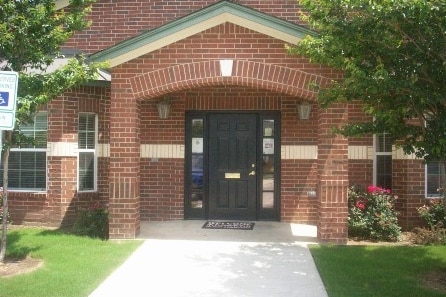

Property Detail
4510 S 3Rd St Rd
48-034520-000102-0
RED OAK ADDITION LOT 2 BLOCK 1 ACRES 13.887 LIHTC IRC 42
Apartment
McLennan
R-3B
Texas
AE The base floodplain where base flood elevations are provided. AE Zones are now used on new format FIRMs instead of A1-A30 Zones.
2
2024
13.89 AC
2025
Waco
003701
Other Market Areas
105,369 SF
Waco, TX
NEARBY LISTINGS FOR SALE OR LEASE
DEMOGRAPHICS near 4510 S 3Rd St Rd
1 mile
3 mile
5 mile
2025 Total Population
1,201
28,292
78,568
2030 Population
1,257
29,183
81,816
Pop Growth 2025-2030
+ 4.66%
+ 3.15%
+ 4.13%
Average Age
34
29
34
2025 Total Households
467
9,790
28,268
HH Growth 2025-2030
+ 4.71%
+ 3.50%
+ 4.39%
Median Household Inc
$30,869
$31,792
$42,493
Avg Household Size
2.50
2.30
2.50
2025 Avg HH Vehicles
2.00
2.00
2.00
Median Home Value
$163,333
$169,999
$186,741
Median Year Built
1999
1989
1979
Nearby Places
Map Layers
Map Styles
 Street
 Aerial
Layers
 Traffic
 Biking
Places
Listings with unknown addresses are not visible on the map
- Restaurants
- Banks
- Shops
- Fitness
- Groceries
PUBLIC TRANSPORTATION
AIRPORT
Waco Regional
Drive
Walk
Distance
Waco Regional
29 min
16.3 mi
Freight Ports
Port of Houston
Drive
Walk
Distance
Port of Houston
211 min
183.5 mi
Nearby Properties
Address
Land Use
TOTAL SIZE
Lot Size
Zoning
Address
Land Use
TOTAL SIZE
Lot Size
Zoning
549,274 SF
34.05 AC
O2
Address
Land Use
TOTAL SIZE
Lot Size
Zoning
120,623 SF
55.15 AC
2007 TIF
Address
Land Use
TOTAL SIZE
Lot Size
Zoning
560,620 SF
3.70 AC
O2
Address
Land Use
TOTAL SIZE
Lot Size
Zoning
576,501 SF
4.21 AC
Address
Land Use
TOTAL SIZE
Lot Size
Zoning
394,674 SF
21.31 AC
O2
Address
Land Use
TOTAL SIZE
Lot Size
Zoning
206,452 SF
11.97 AC
2007 TIF
Address
Land Use
TOTAL SIZE
Lot Size
Zoning
88 AC
O1
Address
Land Use
TOTAL SIZE
Lot Size
Zoning
339,476 SF
Address
Land Use
TOTAL SIZE
Lot Size
Zoning
250,924 SF
17.73 AC
O-2
Address
Land Use
TOTAL SIZE
Lot Size
Zoning
27.28 AC
C
Address
Land Use
TOTAL SIZE
Lot Size
Zoning
399,747 SF
2.86 AC
C-3,C
Address
Land Use
TOTAL SIZE
Lot Size
Zoning
139,104 SF
12.86 AC
M1
Address
Land Use
TOTAL SIZE
Lot Size
Zoning
24.75 AC
O2
Address
Land Use
TOTAL SIZE
Lot Size
Zoning
3,096 SF
51.73 AC
2007 TIF
Address
Land Use
TOTAL SIZE
Lot Size
Zoning
188,746 SF
1.14 AC
O2
Address
Land Use
TOTAL SIZE
Lot Size
Zoning
136,295 SF
6.09 AC
2007 TIF
Address
Land Use
TOTAL SIZE
Lot Size
Zoning
237,081 SF
12.52 AC
2007 TIF
Address
Land Use
TOTAL SIZE
Lot Size
Zoning
200,028 SF
9.23 AC
PUD
Address
Land Use
TOTAL SIZE
Lot Size
Zoning
200,951 SF
7.09 AC
R-3E
Address
Land Use
TOTAL SIZE
Lot Size
Zoning
77,089 SF
5.09 AC
O2
Address
Land Use
TOTAL SIZE
Lot Size
Zoning
155,900 SF
2.85 AC
O2
Address
Land Use
TOTAL SIZE
Lot Size
Zoning
13.31 AC
Address
Land Use
TOTAL SIZE
Lot Size
Zoning
3.29 AC
2007 TIF
Address
Land Use
TOTAL SIZE
Lot Size
Zoning
21.14 AC
2007 TIF
Address
Land Use
TOTAL SIZE
Lot Size
Zoning
124,525 SF
4.17 AC
O2
Address
Land Use
TOTAL SIZE
Lot Size
Zoning
34,048 SF
6.28 AC
Address
Land Use
TOTAL SIZE
Lot Size
Zoning
203,812 SF
12.35 AC
R3C
Address
Land Use
TOTAL SIZE
Lot Size
Zoning
221,433 SF
3.97 AC
O2
Address
Land Use
TOTAL SIZE
Lot Size
Zoning
184,376 SF
7.07 AC
M3
Address
Land Use
TOTAL SIZE
Lot Size
Zoning
173,492 SF
15.50 AC
O-2
The World's #1 Commercial Real Estate Marketplace
Connect with us
© 2026 CoStar Group
The information above has been obtained from sources believed reliable. While we do not doubt its accuracy we have not verified it and make no guarantee, warranty or representation about it. It is your responsibility to independently confirm its accuracy and completeness. Any projections, opinions, assumptions, or estimates used are for example only and do not represent the current or future performance of the property. The value of this transaction to you depends on tax and other factors which should be evaluated by your tax, financial, and legal advisors. You and your advisors should conduct a careful, independent investigation of the property to determine to your satisfaction the suitability of the property for your needs.