Property Record
4511 John Tyler Hwy, Williamsburg, VA 23185
NEARBY LISTINGS FOR SALE OR LEASE
Property Detail
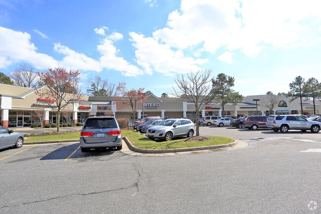
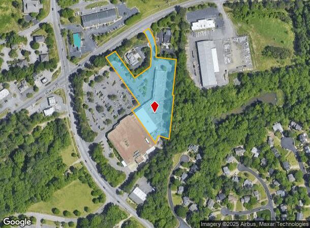
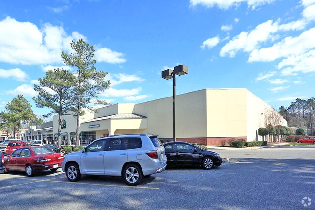
4511 John Tyler Hwy
47-1-01-0-0111
Governors Green
Commercialnec
PH-2 GOVERNOR'S GREEN
X
James City
51095C0119D
Virginia
2025
2.79 AC
2025
Williamsburg
080202
Hampton Roads
31,750 SF
Virginia Beach-Chesapeake-Norfolk, VA-NC
DEMOGRAPHICS near 4511 John Tyler Hwy
1 Mile
3 Mile
5 Mile
2024 Total Population
4,504
33,147
66,688
2029 Population
4,875
36,114
72,737
Pop Growth 2024-2029
+ 8.24%
+ 8.95%
+ 9.07%
Average Age
44
46
44
2024 Total Households
1,826
13,610
26,792
HH Growth 2024-2029
+ 8.05%
+ 9.10%
+ 9.63%
Median Household Inc
$93,005
$100,039
$87,842
Avg Household Size
2.40
2.30
2.20
2024 Avg HH Vehicles
2.00
2.00
2.00
Median Home Value
$355,194
$400,549
$413,522
Median Year Built
1994
1995
1994
Nearby Places
Map Layers
Map Styles
 Street
 Aerial
- Restaurants
- Banks
- Shops
- Fitness
- Groceries
PUBLIC TRANSPORTATION
COMMUTER RAIL
Williamsburg Amtrak Station (Northeast Regional - Amtrak)
DRIVE
WALK
Distance
Williamsburg Amtrak Station (Northeast Regional - Amtrak)
11 min
4.5 mi
AIRPORT
Newport News/Williamsburg International
DRIVE
WALK
Distance
Newport News/Williamsburg International
33 min
20.5 mi
Freight Ports
Virginia Port Authority - Newport News
DRIVE
WALK
Distance
Virginia Port Authority - Newport News
46 min
34.5 mi
SALE & LEASE HISTORY
LISTING DATE
SALE/LEASE

Sep 25, 2016
For Lease
Sep 02, 2020
For Sale
May 16, 2022
For Lease
Feb 20, 2024
For Sale
Nearby Properties
Address
Land Use
TOTAL SIZE
Lot Size
Zoning
Address
Land Use
TOTAL SIZE
Lot Size
Zoning
55,136 SF
348.94 AC
WM (WILLIA
Address
Land Use
TOTAL SIZE
Lot Size
Zoning
46,192 SF
88.59 AC
R4 RESIDEN
Address
Land Use
TOTAL SIZE
Lot Size
Zoning
257 SF
105.86 AC
MU MIXED U
Address
Land Use
TOTAL SIZE
Lot Size
Zoning
10,144 SF
87.57 AC
R5 MULTIFA
Address
Land Use
TOTAL SIZE
Lot Size
Zoning
2,317 SF
50.01 AC
R5 MULTIFA
Address
Land Use
TOTAL SIZE
Lot Size
Zoning
263,288 SF
34.22 AC
MU MIXED U
Address
Land Use
TOTAL SIZE
Lot Size
Zoning
625,352 SF
13.60 AC
MU MIXED U
Address
Land Use
TOTAL SIZE
Lot Size
Zoning
491.07 AC
PL PUBLIC
Address
Land Use
TOTAL SIZE
Lot Size
Zoning
2,387.90 AC
PL PUBLIC
Address
Land Use
TOTAL SIZE
Lot Size
Zoning
501.93 AC
WM (WILLIA
Address
Land Use
TOTAL SIZE
Lot Size
Zoning
113,000 SF
22.20 AC
WM (WILLIA
Address
Land Use
TOTAL SIZE
Lot Size
Zoning
2 SF
17.45 AC
R4 RESIDEN
Address
Land Use
TOTAL SIZE
Lot Size
Zoning
167,811 SF
51.70 AC
PUDR PLANN
Address
Land Use
TOTAL SIZE
Lot Size
Zoning
190,936 SF
15.60 AC
R4 RESIDEN
Address
Land Use
TOTAL SIZE
Lot Size
Zoning
60,344 SF
11.41 AC
LB-4 (LIMI
Address
Land Use
TOTAL SIZE
Lot Size
Zoning
38,577 SF
16.58 AC
MU MIXED U
Address
Land Use
TOTAL SIZE
Lot Size
Zoning
6,500 SF
76.99 AC
PL PUBLIC
Address
Land Use
TOTAL SIZE
Lot Size
Zoning
46,100 SF
32.78 AC
RS-1 (SING
Address
Land Use
TOTAL SIZE
Lot Size
Zoning
12,690 SF
4.46 AC
RM-2 (MULT
Address
Land Use
TOTAL SIZE
Lot Size
Zoning
105,208 SF
15.48 AC
B1 GENERAL
Address
Land Use
TOTAL SIZE
Lot Size
Zoning
156,842 SF
19.92 AC
MU MIXED U
Address
Land Use
TOTAL SIZE
Lot Size
Zoning
76,100 SF
23.87 AC
RS-2 (SING
Address
Land Use
TOTAL SIZE
Lot Size
Zoning
178,186 SF
15.06 AC
R8 RURAL R
Address
Land Use
TOTAL SIZE
Lot Size
Zoning
26,300 SF
6.81 AC
R4 RESIDEN
Address
Land Use
TOTAL SIZE
Lot Size
Zoning
123,131 SF
11 AC
R4 RESIDEN
Address
Land Use
TOTAL SIZE
Lot Size
Zoning
2.15 AC
MU MIXED U
Address
Land Use
TOTAL SIZE
Lot Size
Zoning
9,458 SF
5.68 AC
MU MIXED U
Address
Land Use
TOTAL SIZE
Lot Size
Zoning
1 SF
4.31 AC
R4 RESIDEN
Address
Land Use
TOTAL SIZE
Lot Size
Zoning
66,432 SF
42.50 AC
R8 RURAL R
Address
Land Use
TOTAL SIZE
Lot Size
Zoning
67,932 SF
3.11 AC
MU MIXED U
The World's #1 Commercial Real Estate Marketplace
Connect with us
© 2026 CoStar Group
The information above has been obtained from sources believed reliable. While we do not doubt its accuracy we have not verified it and make no guarantee, warranty or representation about it. It is your responsibility to independently confirm its accuracy and completeness. Any projections, opinions, assumptions, or estimates used are for example only and do not represent the current or future performance of the property. The value of this transaction to you depends on tax and other factors which should be evaluated by your tax, financial, and legal advisors. You and your advisors should conduct a careful, independent investigation of the property to determine to your satisfaction the suitability of the property for your needs.