Property Record
4511 N Northview Ave, Sioux Falls, SD 57107

Property Detail
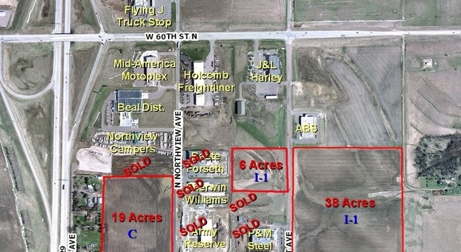
4511 N Northview Ave
Sioux Falls, SD-MN
LOT 2B JOHNSONS SECOND ADDN GOVT LOT 2 NW14 31 102 49
88040
MINNEHAHA
Manufacturinglight
South Dakota
B and X Area of moderate flood hazard, usually the area between the limits of the 100-year and 500-year floods.
2b
2025
11.77 AC
2025
Sioux Falls
010405
Other Market Areas
134,102 SF
NEARBY LISTINGS FOR SALE OR LEASE
DEMOGRAPHICS near 4511 N Northview Ave
1 mile
3 mile
5 mile
2025 Total Population
1,018
14,533
73,129
2030 Population
1,121
15,338
77,009
Pop Growth 2025-2030
+ 10.12%
+ 5.54%
+ 5.31%
Average Age
38
38
38
2025 Total Households
422
5,604
30,558
HH Growth 2025-2030
+ 10.43%
+ 6.26%
+ 5.82%
Median Household Inc
$70,293
$63,993
$63,687
Avg Household Size
2.30
2.20
2.20
2025 Avg HH Vehicles
2.00
2.00
2.00
Median Home Value
$313,333
$254,778
$236,830
Median Year Built
2010
2004
1982
Nearby Places
Map Layers
Map Styles
 Street
 Aerial
Layers
 Traffic
 Biking
Places
Listings with unknown addresses are not visible on the map
- Restaurants
- Banks
- Shops
- Fitness
- Groceries
PUBLIC TRANSPORTATION
AIRPORT
Joe Foss Field
Drive
Walk
Distance
Joe Foss Field
23 min
6.0 mi
Freight Ports
Port Milwaukee
Drive
Walk
Distance
Port Milwaukee
547 min
502.8 mi
SALE & LEASE HISTORY
LISTING DATE
SALE/LEASE

Sep 24, 2016
For Sale
Nearby Properties
Address
Land Use
TOTAL SIZE
Lot Size
Zoning
Address
Land Use
TOTAL SIZE
Lot Size
Zoning
2,596,487 SF
80.61 AC
Address
Land Use
TOTAL SIZE
Lot Size
Zoning
195,766 SF
47.93 AC
Address
Land Use
TOTAL SIZE
Lot Size
Zoning
349,950 SF
32.99 AC
Address
Land Use
TOTAL SIZE
Lot Size
Zoning
340,204 SF
36.85 AC
Address
Land Use
TOTAL SIZE
Lot Size
Zoning
199,500 SF
29.45 AC
Address
Land Use
TOTAL SIZE
Lot Size
Zoning
5,725 SF
77.41 AC
Address
Land Use
TOTAL SIZE
Lot Size
Zoning
140,816 SF
13.80 AC
Address
Land Use
TOTAL SIZE
Lot Size
Zoning
Address
Land Use
TOTAL SIZE
Lot Size
Zoning
77,853 SF
10.42 AC
Address
Land Use
TOTAL SIZE
Lot Size
Zoning
36,986 SF
8.49 AC
FP;FP
Address
Land Use
TOTAL SIZE
Lot Size
Zoning
195,113 SF
34.68 AC
Address
Land Use
TOTAL SIZE
Lot Size
Zoning
205,572 SF
22.50 AC
Address
Land Use
TOTAL SIZE
Lot Size
Zoning
200,880 SF
49.95 AC
C;COMMERCI
Address
Land Use
TOTAL SIZE
Lot Size
Zoning
35,688 SF
8.27 AC
FP;FP
Address
Land Use
TOTAL SIZE
Lot Size
Zoning
75,786 SF
7.14 AC
Address
Land Use
TOTAL SIZE
Lot Size
Zoning
47,142 SF
6.09 AC
Address
Land Use
TOTAL SIZE
Lot Size
Zoning
105,638 SF
6.04 AC
Address
Land Use
TOTAL SIZE
Lot Size
Zoning
46,647 SF
14.22 AC
Address
Land Use
TOTAL SIZE
Lot Size
Zoning
137,609 SF
22.28 AC
Address
Land Use
TOTAL SIZE
Lot Size
Zoning
146,719 SF
1.65 AC
Address
Land Use
TOTAL SIZE
Lot Size
Zoning
171,429 SF
18.37 AC
Address
Land Use
TOTAL SIZE
Lot Size
Zoning
173,905 SF
10 AC
Address
Land Use
TOTAL SIZE
Lot Size
Zoning
189,312 SF
23.87 AC
Address
Land Use
TOTAL SIZE
Lot Size
Zoning
168,359 SF
9.65 AC
NO;SPECIAL
Address
Land Use
TOTAL SIZE
Lot Size
Zoning
239,450 SF
21.92 AC
NO;SPECIAL
Address
Land Use
TOTAL SIZE
Lot Size
Zoning
Address
Land Use
TOTAL SIZE
Lot Size
Zoning
11,844 SF
7.22 AC
Address
Land Use
TOTAL SIZE
Lot Size
Zoning
105,048 SF
9.68 AC
The World's #1 Commercial Real Estate Marketplace
Connect with us
© 2026 CoStar Group
The information above has been obtained from sources believed reliable. While we do not doubt its accuracy we have not verified it and make no guarantee, warranty or representation about it. It is your responsibility to independently confirm its accuracy and completeness. Any projections, opinions, assumptions, or estimates used are for example only and do not represent the current or future performance of the property. The value of this transaction to you depends on tax and other factors which should be evaluated by your tax, financial, and legal advisors. You and your advisors should conduct a careful, independent investigation of the property to determine to your satisfaction the suitability of the property for your needs.