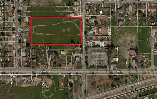
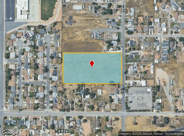
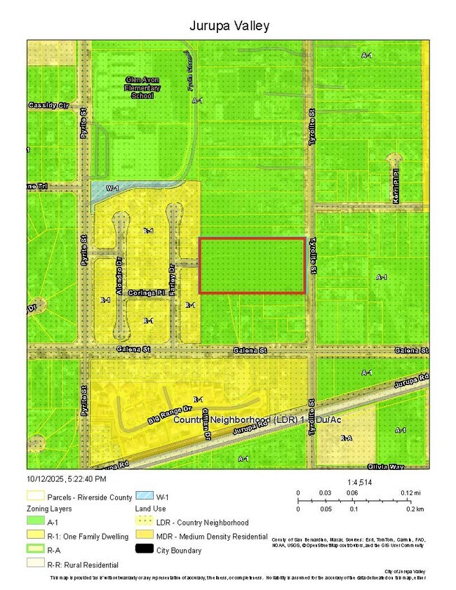
Property Record
4511 Tyrolite St, Jurupa Valley, CA 92509

This Property Is For Sale
NEARBY LISTINGS FOR SALE OR LEASE
Property Detail
4511 Tyrolite St
Riverside-San Bernardino-Ontario, CA
Jurupa Rancho
171-150-008
Riverside
Residentialnec
California
X
4.80 AC
06065C0039G
Riverside
636 SF
Inland Empire (California)
DEMOGRAPHICS near 4511 Tyrolite St
1 Mile
3 Mile
5 Mile
2024 Total Population
8,967
80,547
223,103
2029 Population
9,359
83,749
231,482
Pop Growth 2024-2029
+ 4.37%
+ 3.98%
+ 3.76%
Average Age
36
36
36
2024 Total Households
2,247
20,677
60,285
HH Growth 2024-2029
+ 3.83%
+ 3.59%
+ 3.46%
Median Household Inc
$91,324
$90,002
$81,008
Avg Household Size
3.70
3.70
3.50
2024 Avg HH Vehicles
3.00
3.00
2.00
Median Home Value
$555,671
$455,530
$448,682
Median Year Built
1984
1982
1977
Nearby Places
- Restaurants
- Banks
- Shops
- Fitness
- Groceries
PUBLIC TRANSPORTATION
COMMUTER RAIL
Pedley (Riverside Line - Southern California Regional Rail Authority (Metrolink))
DRIVE
WALK
Distance
Pedley (Riverside Line - Southern California Regional Rail Authority (Metrolink))
7 min
2.7 mi
Riverside-Downtown (91 Line - Southern California Regional Rail Authority (Metrolink), Inland Empire-Orange County Line - Southern California Regional Rail Authority (Metrolink), Riverside Line - Southern California Regional Rail Authority (Metrolink))
DRIVE
WALK
Distance
Riverside-Downtown (91 Line - Southern California Regional Rail Authority (Metrolink), Inland Empire-Orange County Line - Southern California Regional Rail Authority (Metrolink), Riverside Line - Southern California Regional Rail Authority (Metrolink))
14 min
6.6 mi
AIRPORT
Ontario International
DRIVE
WALK
Distance
Ontario International
18 min
11.6 mi
Freight Ports
Port of Long Beach
DRIVE
WALK
Distance
Port of Long Beach
74 min
58.1 mi
Nearby Properties
Address
Land Use
TOTAL SIZE
Lot Size
Zoning
Address
Land Use
TOTAL SIZE
Lot Size
Zoning
444,668 SF
20.74 AC
Address
Land Use
TOTAL SIZE
Lot Size
Zoning
70.13 AC
Address
Land Use
TOTAL SIZE
Lot Size
Zoning
118,644 SF
6.42 AC
Address
Land Use
TOTAL SIZE
Lot Size
Zoning
180,840 SF
9.36 AC
Address
Land Use
TOTAL SIZE
Lot Size
Zoning
52.42 AC
Address
Land Use
TOTAL SIZE
Lot Size
Zoning
180,215 SF
14.73 AC
Address
Land Use
TOTAL SIZE
Lot Size
Zoning
80,257 SF
5.02 AC
C1CP
Address
Land Use
TOTAL SIZE
Lot Size
Zoning
125,804 SF
12.70 AC
Address
Land Use
TOTAL SIZE
Lot Size
Zoning
139,000 SF
8.24 AC
MH5
Address
Land Use
TOTAL SIZE
Lot Size
Zoning
62,619 SF
3.08 AC
C1CP
Address
Land Use
TOTAL SIZE
Lot Size
Zoning
4.32 AC
Address
Land Use
TOTAL SIZE
Lot Size
Zoning
101,515 SF
5.20 AC
Address
Land Use
TOTAL SIZE
Lot Size
Zoning
50.54 AC
MSC
Address
Land Use
TOTAL SIZE
Lot Size
Zoning
144,158 SF
8.90 AC
Address
Land Use
TOTAL SIZE
Lot Size
Zoning
23.33 AC
Address
Land Use
TOTAL SIZE
Lot Size
Zoning
6,664 SF
15.89 AC
C1CP
Address
Land Use
TOTAL SIZE
Lot Size
Zoning
48,434 SF
2.33 AC
C1CP
Address
Land Use
TOTAL SIZE
Lot Size
Zoning
53,428 SF
2.53 AC
C1CP
Address
Land Use
TOTAL SIZE
Lot Size
Zoning
16.76 AC
MSC
Address
Land Use
TOTAL SIZE
Lot Size
Zoning
20.25 AC
Address
Land Use
TOTAL SIZE
Lot Size
Zoning
6.45 AC
CPS
Address
Land Use
TOTAL SIZE
Lot Size
Zoning
32,074 SF
3.78 AC
W2
Address
Land Use
TOTAL SIZE
Lot Size
Zoning
90,500 SF
19.96 AC
MSC
Address
Land Use
TOTAL SIZE
Lot Size
Zoning
83,858 SF
2.53 AC
Address
Land Use
TOTAL SIZE
Lot Size
Zoning
25,357 SF
3.16 AC
RR
Address
Land Use
TOTAL SIZE
Lot Size
Zoning
92,960 SF
4.43 AC
C1CP
Address
Land Use
TOTAL SIZE
Lot Size
Zoning
78,390 SF
5.02 AC
R3
Address
Land Use
TOTAL SIZE
Lot Size
Zoning
5,670 SF
10.06 AC
MIX
The World's #1 Commercial Real Estate Marketplace
Connect with us
© 2025 CoStar Group
The information above has been obtained from sources believed reliable. While we do not doubt its accuracy we have not verified it and make no guarantee, warranty or representation about it. It is your responsibility to independently confirm its accuracy and completeness. Any projections, opinions, assumptions, or estimates used are for example only and do not represent the current or future performance of the property. The value of this transaction to you depends on tax and other factors which should be evaluated by your tax, financial, and legal advisors. You and your advisors should conduct a careful, independent investigation of the property to determine to your satisfaction the suitability of the property for your needs.