Property Record
4511 W Cheyenne Ave, North Las Vegas, NV 89032
NEARBY LISTINGS FOR SALE OR LEASE
Property Detail
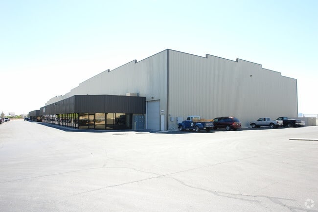
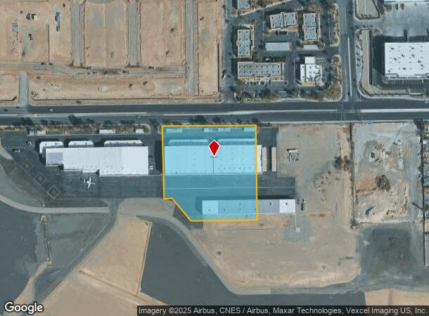
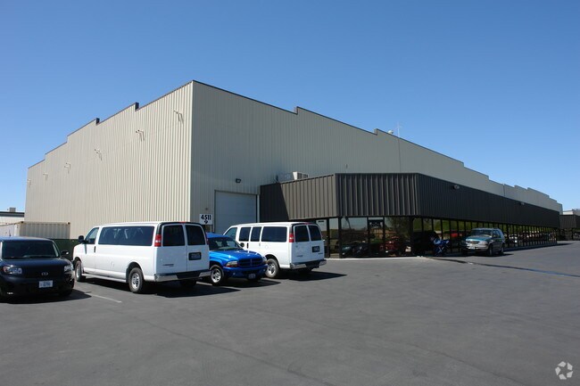
4511 W Cheyenne Ave
139-18-101-007
PT NE4 NW4 SEC 18 20 61
Governmentalpublicusegeneral
Clark
X
Nevada
32003C2155F
3.92 AC
2025
North Las Vegas
2025
Las Vegas
003616
Las Vegas-Henderson-Paradise, NV
90,800 SF
DEMOGRAPHICS near 4511 W Cheyenne Ave
1 Mile
3 Mile
5 Mile
2024 Total Population
14,633
179,731
474,964
2029 Population
15,513
192,327
508,892
Pop Growth 2024-2029
+ 6.01%
+ 7.01%
+ 7.14%
Average Age
38
38
38
2024 Total Households
5,121
61,617
167,252
HH Growth 2024-2029
+ 5.98%
+ 6.97%
+ 7.18%
Median Household Inc
$53,960
$54,936
$56,356
Avg Household Size
2.80
2.80
2.70
2024 Avg HH Vehicles
2.00
2.00
2.00
Median Home Value
$321,951
$293,610
$319,732
Median Year Built
1996
1991
1992
Nearby Places
Map Layers
Map Styles
 Street
 Aerial
- Restaurants
- Banks
- Shops
- Fitness
- Groceries
PUBLIC TRANSPORTATION
AIRPORT
Harry Reid International
DRIVE
WALK
Distance
Harry Reid International
23 min
11.9 mi
Boulder City Municipal
DRIVE
WALK
Distance
Boulder City Municipal
43 min
31.9 mi
Nearby Properties
Address
Land Use
TOTAL SIZE
Lot Size
Zoning
Address
Land Use
TOTAL SIZE
Lot Size
Zoning
34.83 AC
CV
Address
Land Use
TOTAL SIZE
Lot Size
Zoning
724,845 SF
37.33 AC
M2
Address
Land Use
TOTAL SIZE
Lot Size
Zoning
9,738 SF
20.40 AC
Address
Land Use
TOTAL SIZE
Lot Size
Zoning
35.49 AC
R1
Address
Land Use
TOTAL SIZE
Lot Size
Zoning
49,716 SF
59.37 AC
CV
Address
Land Use
TOTAL SIZE
Lot Size
Zoning
390,851 SF
48.43 AC
PUD
Address
Land Use
TOTAL SIZE
Lot Size
Zoning
36.24 AC
M2
Address
Land Use
TOTAL SIZE
Lot Size
Zoning
14,793 SF
9.57 AC
CPB
Address
Land Use
TOTAL SIZE
Lot Size
Zoning
346,277 SF
37.61 AC
PUD
Address
Land Use
TOTAL SIZE
Lot Size
Zoning
378,212 SF
6.38 AC
Address
Land Use
TOTAL SIZE
Lot Size
Zoning
3,518 SF
11.95 AC
Address
Land Use
TOTAL SIZE
Lot Size
Zoning
407,991 SF
26.52 AC
M2
Address
Land Use
TOTAL SIZE
Lot Size
Zoning
445,206 SF
24.81 AC
M2
Address
Land Use
TOTAL SIZE
Lot Size
Zoning
7,704 SF
22.18 AC
N:PUD
Address
Land Use
TOTAL SIZE
Lot Size
Zoning
5,750 SF
19.67 AC
R3
Address
Land Use
TOTAL SIZE
Lot Size
Zoning
4,084 SF
1.84 AC
CPB
Address
Land Use
TOTAL SIZE
Lot Size
Zoning
17.80 AC
M2
Address
Land Use
TOTAL SIZE
Lot Size
Zoning
7,234 SF
9.21 AC
Address
Land Use
TOTAL SIZE
Lot Size
Zoning
6,280 SF
8.72 AC
RPD18
Address
Land Use
TOTAL SIZE
Lot Size
Zoning
1,883 SF
18.13 AC
C2
Address
Land Use
TOTAL SIZE
Lot Size
Zoning
40,434 SF
25.46 AC
C3
Address
Land Use
TOTAL SIZE
Lot Size
Zoning
2.22 AC
CV
Address
Land Use
TOTAL SIZE
Lot Size
Zoning
86,946 SF
162.05 AC
M2
Address
Land Use
TOTAL SIZE
Lot Size
Zoning
7,103 SF
14.27 AC
L:R-3
Address
Land Use
TOTAL SIZE
Lot Size
Zoning
17.97 AC
RE
Address
Land Use
TOTAL SIZE
Lot Size
Zoning
3,646 SF
10.36 AC
PUD
The World's #1 Commercial Real Estate Marketplace
Connect with us
© 2025 CoStar Group
The information above has been obtained from sources believed reliable. While we do not doubt its accuracy we have not verified it and make no guarantee, warranty or representation about it. It is your responsibility to independently confirm its accuracy and completeness. Any projections, opinions, assumptions, or estimates used are for example only and do not represent the current or future performance of the property. The value of this transaction to you depends on tax and other factors which should be evaluated by your tax, financial, and legal advisors. You and your advisors should conduct a careful, independent investigation of the property to determine to your satisfaction the suitability of the property for your needs.