Property Record
4512 Olgers Rd, Sutherland, VA 23885
Property Detail
4512 Olgers Rd
8-9
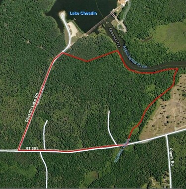
APPOMATTOX RIVER TRACT 601B DB-158/019 8-9
Residentialacreage
DINWIDDIE
A2
Virginia
A Areas with a 1% annual chance of flooding and a 26% chance of flooding over the life of a 30-year mortgage.
61.70 AC
2025
Dinwiddie County
2025
Richmond VA
840200
Richmond, VA
NEARBY LISTINGS FOR SALE OR LEASE
DEMOGRAPHICS near 4512 Olgers Rd
1 mile
3 mile
5 mile
2025 Total Population
600
8,802
21,767
2030 Population
611
9,056
22,557
Pop Growth 2025-2030
+ 1.83%
+ 2.89%
+ 3.63%
Average Age
42
41
41
2025 Total Households
234
3,396
8,292
HH Growth 2025-2030
+ 1.71%
+ 2.94%
+ 3.73%
Median Household Inc
$101,389
$89,101
$83,198
Avg Household Size
2.60
2.60
2.50
2025 Avg HH Vehicles
3.00
2.00
2.00
Median Home Value
$286,486
$281,326
$283,357
Median Year Built
1983
1980
1979
Nearby Places
Map Layers
Map Styles
 Street
 Aerial
Layers
 Traffic
 Biking
Places
Listings with unknown addresses are not visible on the map
- Restaurants
- Banks
- Shops
- Fitness
- Groceries
PUBLIC TRANSPORTATION
COMMUTER RAIL
Petersburg Amtrak Station (Carolinian - Amtrak, Northeast Regional - Amtrak, Palmetto - Amtrak, Silver Meteor - Amtrak, Silver Star - Amtrak)
Drive
Walk
Distance
Petersburg Amtrak Station (Carolinian - Amtrak, Northeast Regional - Amtrak, Palmetto - Amtrak, Silver Meteor - Amtrak, Silver Star - Amtrak)
15 min
7.0 mi
AIRPORT
Richmond International
Drive
Walk
Distance
Richmond International
51 min
35.3 mi
Freight Ports
Virginia Port Authority - Richmond
Drive
Walk
Distance
Virginia Port Authority - Richmond
41 min
26.3 mi
Nearby Properties
Address
Land Use
TOTAL SIZE
Lot Size
Zoning
Address
Land Use
TOTAL SIZE
Lot Size
Zoning
1,015,740 SF
112.09 AC
PDC
Address
Land Use
TOTAL SIZE
Lot Size
Zoning
177.70 AC
M1
Address
Land Use
TOTAL SIZE
Lot Size
Zoning
63 AC
A2
Address
Land Use
TOTAL SIZE
Lot Size
Zoning
800 SF
52.52 AC
A - AGRICU
Address
Land Use
TOTAL SIZE
Lot Size
Zoning
2,676 SF
606.71 AC
M2
Address
Land Use
TOTAL SIZE
Lot Size
Zoning
113,880 SF
32.36 AC
M2
Address
Land Use
TOTAL SIZE
Lot Size
Zoning
15.97 AC
B2
Address
Land Use
TOTAL SIZE
Lot Size
Zoning
1.27 AC
M2
Address
Land Use
TOTAL SIZE
Lot Size
Zoning
3.66 AC
M2
Address
Land Use
TOTAL SIZE
Lot Size
Zoning
408.17 AC
R88 - SING
Address
Land Use
TOTAL SIZE
Lot Size
Zoning
28,944 SF
30.59 AC
R1
Address
Land Use
TOTAL SIZE
Lot Size
Zoning
51,880 SF
7.44 AC
R7 - SINGL
Address
Land Use
TOTAL SIZE
Lot Size
Zoning
6.90 AC
M1
Address
Land Use
TOTAL SIZE
Lot Size
Zoning
3,280 SF
0.69 AC
C3 - COMMU
Address
Land Use
TOTAL SIZE
Lot Size
Zoning
16.95 AC
PUDC
Address
Land Use
TOTAL SIZE
Lot Size
Zoning
106,371 SF
6.54 AC
M2
Address
Land Use
TOTAL SIZE
Lot Size
Zoning
3,800 SF
2.60 AC
B2
Address
Land Use
TOTAL SIZE
Lot Size
Zoning
9,180 SF
4.34 AC
A - AGRICU
Address
Land Use
TOTAL SIZE
Lot Size
Zoning
122.75 AC
A2
Address
Land Use
TOTAL SIZE
Lot Size
Zoning
9,042 SF
1.07 AC
A - AGRICU
Address
Land Use
TOTAL SIZE
Lot Size
Zoning
19,012 SF
7.75 AC
R1
Address
Land Use
TOTAL SIZE
Lot Size
Zoning
2.58 AC
B2
Address
Land Use
TOTAL SIZE
Lot Size
Zoning
435.76 AC
RR
Address
Land Use
TOTAL SIZE
Lot Size
Zoning
33,792 SF
10 AC
M2
Address
Land Use
TOTAL SIZE
Lot Size
Zoning
2.17 AC
Address
Land Use
TOTAL SIZE
Lot Size
Zoning
61,448 SF
5.95 AC
M2
Address
Land Use
TOTAL SIZE
Lot Size
Zoning
9,981 SF
3.97 AC
R1
Address
Land Use
TOTAL SIZE
Lot Size
Zoning
8,538 SF
0.40 AC
C3 - COMMU
Address
Land Use
TOTAL SIZE
Lot Size
Zoning
1,614 SF
34.81 AC
A - AGRICU
Address
Land Use
TOTAL SIZE
Lot Size
Zoning
39,375 SF
5.95 AC
M2
The World's #1 Commercial Real Estate Marketplace
Connect with us
© 2026 CoStar Group
The information above has been obtained from sources believed reliable. While we do not doubt its accuracy we have not verified it and make no guarantee, warranty or representation about it. It is your responsibility to independently confirm its accuracy and completeness. Any projections, opinions, assumptions, or estimates used are for example only and do not represent the current or future performance of the property. The value of this transaction to you depends on tax and other factors which should be evaluated by your tax, financial, and legal advisors. You and your advisors should conduct a careful, independent investigation of the property to determine to your satisfaction the suitability of the property for your needs.