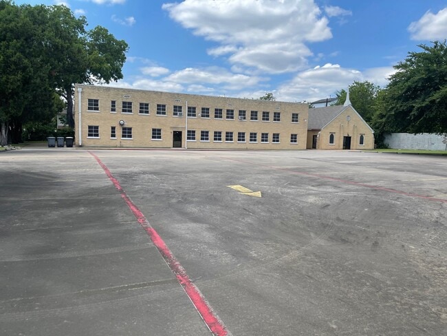
Property Record
4513 Munger Ave, Dallas, TX 75204
NEARBY LISTINGS FOR SALE OR LEASE
Property Detail
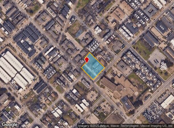
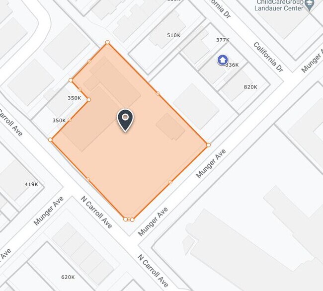
4513 Munger Ave
Dallas-Fort Worth-Arlington, TX
Alexanders Park Addn
0006680D0001A0000
ALEXANDERS PARK ADDN BLK D/668 LT 1A ACS 0.9723 INT202200031109 DD01312022 CO-DC 0668 D00 01A00 7DA0668 D00
Apartment
Dallas
X
Texas
48113C0345J
1a
2024
0.97 AC
2025
Central Expressway
000801
Dallas/Ft Worth
8,538 SF
DEMOGRAPHICS near 4513 Munger Ave
1 Mile
3 Mile
5 Mile
2024 Total Population
39,771
215,619
412,066
2029 Population
40,565
218,493
415,864
Pop Growth 2024-2029
+ 2.00%
+ 1.33%
+ 0.92%
Average Age
34
37
37
2024 Total Households
22,963
114,212
197,091
HH Growth 2024-2029
+ 1.81%
+ 1.44%
+ 1.00%
Median Household Inc
$71,930
$82,219
$71,794
Avg Household Size
1.70
1.80
2.00
2024 Avg HH Vehicles
1.00
1.00
1.00
Median Home Value
$437,233
$487,901
$464,265
Median Year Built
2003
1997
1990
Nearby Places
Map Layers
Map Styles
 Street
 Aerial
- Restaurants
- Banks
- Shops
- Fitness
- Groceries
PUBLIC TRANSPORTATION
TRANSIT/SUBWAY
Cityplace/Uptown (Blue Line - Dallas Area Rapid Transit (DART), Orange Line - Dallas Area Rapid Transit (DART), Red Line - Dallas Area Rapid Transit (DART))
DRIVE
WALK
Distance
Cityplace/Uptown (Blue Line - Dallas Area Rapid Transit (DART), Orange Line - Dallas Area Rapid Transit (DART), Red Line - Dallas Area Rapid Transit (DART))
5 min
18 min
1.0 mi
Cityplace (Mckinney Avenue) (McKinney Avenue Streetcar - Dallas Area Rapid Transit (DART))
DRIVE
WALK
Distance
Cityplace (Mckinney Avenue) (McKinney Avenue Streetcar - Dallas Area Rapid Transit (DART))
3 min
20 min
1.1 mi
COMMUTER RAIL
Victory Station (DART LIGHT RAIL - GREEN LINE - Dallas Area Rapid Transit (DART), DART LIGHT RAIL - ORANGE LINE - Dallas Area Rapid Transit (DART), TRINITY RAILWAY - Dallas Area Rapid Transit (DART))
DRIVE
WALK
Distance
Victory Station (DART LIGHT RAIL - GREEN LINE - Dallas Area Rapid Transit (DART), DART LIGHT RAIL - ORANGE LINE - Dallas Area Rapid Transit (DART), TRINITY RAILWAY - Dallas Area Rapid Transit (DART))
7 min
3.2 mi
Medical/Market Ctr Station (TRINITY RAILWAY - Dallas Area Rapid Transit (DART))
DRIVE
WALK
Distance
Medical/Market Ctr Station (TRINITY RAILWAY - Dallas Area Rapid Transit (DART))
10 min
4.4 mi
AIRPORT
Dallas Love Field
DRIVE
WALK
Distance
Dallas Love Field
13 min
5.6 mi
Dallas-Fort Worth International
DRIVE
WALK
Distance
Dallas-Fort Worth International
30 min
21.4 mi
Freight Ports
Port of Shreveport
DRIVE
WALK
Distance
Port of Shreveport
211 min
195.4 mi
SALE & LEASE HISTORY
LISTING DATE
SALE/LEASE

Jun 28, 2021
For Sale
Nearby Properties
Address
Land Use
TOTAL SIZE
Lot Size
Zoning
Address
Land Use
TOTAL SIZE
Lot Size
Zoning
1,634,356 SF
92.90 AC
Z421
Address
Land Use
TOTAL SIZE
Lot Size
Zoning
3,713,071 SF
9.94 AC
Address
Land Use
TOTAL SIZE
Lot Size
Zoning
815,000 SF
7.20 AC
Z239
Address
Land Use
TOTAL SIZE
Lot Size
Zoning
1,676,176 SF
2.18 AC
Z239
Address
Land Use
TOTAL SIZE
Lot Size
Zoning
906,730 SF
3.09 AC
Z239
Address
Land Use
TOTAL SIZE
Lot Size
Zoning
858,872 SF
23.90 AC
Z421
Address
Land Use
TOTAL SIZE
Lot Size
Zoning
1,308,710 SF
8.42 AC
Z21
Address
Land Use
TOTAL SIZE
Lot Size
Zoning
299,170 SF
9.71 AC
Z97
Address
Land Use
TOTAL SIZE
Lot Size
Zoning
731,849 SF
3.13 AC
Z239
Address
Land Use
TOTAL SIZE
Lot Size
Zoning
1,896,570 SF
18.08 AC
Z151
Address
Land Use
TOTAL SIZE
Lot Size
Zoning
1,480,246 SF
1.86 AC
Z21
Address
Land Use
TOTAL SIZE
Lot Size
Zoning
1,291,660 SF
2.56 AC
Z248
Address
Land Use
TOTAL SIZE
Lot Size
Zoning
1,026,046 SF
2.89 AC
Z248
Address
Land Use
TOTAL SIZE
Lot Size
Zoning
864,909 SF
3.02 AC
Z248
Address
Land Use
TOTAL SIZE
Lot Size
Zoning
1,001,504 SF
3.37 AC
Z151
Address
Land Use
TOTAL SIZE
Lot Size
Zoning
1,424,070 SF
1.36 AC
Z21
Address
Land Use
TOTAL SIZE
Lot Size
Zoning
724,979 SF
1.05 AC
Z239
Address
Land Use
TOTAL SIZE
Lot Size
Zoning
893,159 SF
1.17 AC
Z21
Address
Land Use
TOTAL SIZE
Lot Size
Zoning
100 SF
27.05 AC
Z421
Address
Land Use
TOTAL SIZE
Lot Size
Zoning
1,980,000 SF
2.57 AC
Z21
Address
Land Use
TOTAL SIZE
Lot Size
Zoning
857,292 SF
1.47 AC
Z239
Address
Land Use
TOTAL SIZE
Lot Size
Zoning
602,716 SF
11.21 AC
Z239
Address
Land Use
TOTAL SIZE
Lot Size
Zoning
763,198 SF
3.01 AC
Z248
Address
Land Use
TOTAL SIZE
Lot Size
Zoning
638,046 SF
2.11 AC
Z239
Address
Land Use
TOTAL SIZE
Lot Size
Zoning
486,300 SF
1.55 AC
Z239
Address
Land Use
TOTAL SIZE
Lot Size
Zoning
906,627 SF
3.83 AC
Z239
Address
Land Use
TOTAL SIZE
Lot Size
Zoning
226,331 SF
1.12 AC
Address
Land Use
TOTAL SIZE
Lot Size
Zoning
653,557 SF
0.68 AC
Z248
Address
Land Use
TOTAL SIZE
Lot Size
Zoning
676,930 SF
1.38 AC
Z248
Address
Land Use
TOTAL SIZE
Lot Size
Zoning
536,874 SF
1.03 AC
Z239
The World's #1 Commercial Real Estate Marketplace
Connect with us
© 2025 CoStar Group
The information above has been obtained from sources believed reliable. While we do not doubt its accuracy we have not verified it and make no guarantee, warranty or representation about it. It is your responsibility to independently confirm its accuracy and completeness. Any projections, opinions, assumptions, or estimates used are for example only and do not represent the current or future performance of the property. The value of this transaction to you depends on tax and other factors which should be evaluated by your tax, financial, and legal advisors. You and your advisors should conduct a careful, independent investigation of the property to determine to your satisfaction the suitability of the property for your needs.