Property Record
4513 N Access Rd, Chattanooga, TN 37415


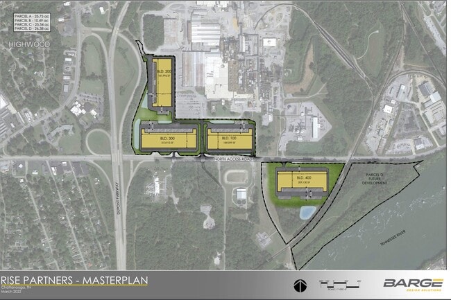
Property Detail
4513 N Access Rd
110P-B-001.07
TRACT 5 ACCESS ROAD OUT OF 110P B 001.02 FOR 2022
Distributionwarehouseregional
HAMILTON
B and X Area of moderate flood hazard, usually the area between the limits of the 100-year and 500-year floods.
Tennessee
2025
10.39 AC
2025
Outlying Hamilton County
010433
Chattanooga
189,000 SF
Chattanooga, TN-GA
NEARBY LISTINGS FOR SALE OR LEASE
DEMOGRAPHICS near 4513 N Access Rd
1 mile
3 mile
5 mile
2025 Total Population
2,494
34,508
103,938
2030 Population
2,571
36,201
109,580
Pop Growth 2025-2030
+ 3.09%
+ 4.91%
+ 5.43%
Average Age
41
41
41
2025 Total Households
1,063
15,085
45,540
HH Growth 2025-2030
+ 3.29%
+ 5.14%
+ 5.66%
Median Household Inc
$58,644
$70,140
$68,114
Avg Household Size
2.20
2.20
2.20
2025 Avg HH Vehicles
2.00
2.00
2.00
Median Home Value
$288,082
$285,481
$308,138
Median Year Built
1957
1970
1975
Nearby Places
Map Layers
Map Styles
 Street
 Aerial
Layers
 Traffic
 Biking
Places
Listings with unknown addresses are not visible on the map
- Restaurants
- Banks
- Shops
- Fitness
- Groceries
PUBLIC TRANSPORTATION
AIRPORT
Lovell Field
Drive
Walk
Distance
Lovell Field
19 min
10.7 mi
Freight Ports
Georgia Ports - Savannah
Drive
Walk
Distance
Georgia Ports - Savannah
414 min
368.7 mi
SALE & LEASE HISTORY
LISTING DATE
SALE/LEASE

Sep 07, 2021
For Lease
Nearby Properties
Address
Land Use
TOTAL SIZE
Lot Size
Zoning
Address
Land Use
TOTAL SIZE
Lot Size
Zoning
183 AC
R1
Address
Land Use
TOTAL SIZE
Lot Size
Zoning
308,910 SF
53.60 AC
M1
Address
Land Use
TOTAL SIZE
Lot Size
Zoning
103.37 AC
Address
Land Use
TOTAL SIZE
Lot Size
Zoning
197,214 SF
19.39 AC
R4
Address
Land Use
TOTAL SIZE
Lot Size
Zoning
309,974 SF
20.57 AC
R3
Address
Land Use
TOTAL SIZE
Lot Size
Zoning
48,465 SF
21.50 AC
Address
Land Use
TOTAL SIZE
Lot Size
Zoning
7,693 SF
115.99 AC
R1
Address
Land Use
TOTAL SIZE
Lot Size
Zoning
68,635 SF
44.47 AC
Address
Land Use
TOTAL SIZE
Lot Size
Zoning
139,820 SF
12.67 AC
R3
Address
Land Use
TOTAL SIZE
Lot Size
Zoning
21,330 SF
15 AC
M1
Address
Land Use
TOTAL SIZE
Lot Size
Zoning
32,261 SF
6.43 AC
R1
Address
Land Use
TOTAL SIZE
Lot Size
Zoning
341,649 SF
38.44 AC
C2
Address
Land Use
TOTAL SIZE
Lot Size
Zoning
186,480 SF
11.83 AC
Address
Land Use
TOTAL SIZE
Lot Size
Zoning
88,449 SF
4 AC
Address
Land Use
TOTAL SIZE
Lot Size
Zoning
20,880 SF
14.13 AC
R3
Address
Land Use
TOTAL SIZE
Lot Size
Zoning
479,004 SF
22.70 AC
Address
Land Use
TOTAL SIZE
Lot Size
Zoning
91,520 SF
10.99 AC
C2
Address
Land Use
TOTAL SIZE
Lot Size
Zoning
125,681 SF
5.55 AC
M3
Address
Land Use
TOTAL SIZE
Lot Size
Zoning
365,529 SF
24.50 AC
M1
Address
Land Use
TOTAL SIZE
Lot Size
Zoning
215,672 SF
21.28 AC
Address
Land Use
TOTAL SIZE
Lot Size
Zoning
60.53 AC
R1
Address
Land Use
TOTAL SIZE
Lot Size
Zoning
7,440 SF
12.74 AC
Address
Land Use
TOTAL SIZE
Lot Size
Zoning
480,601 SF
45.50 AC
M1
Address
Land Use
TOTAL SIZE
Lot Size
Zoning
147,631 SF
21.20 AC
M1
Address
Land Use
TOTAL SIZE
Lot Size
Zoning
Address
Land Use
TOTAL SIZE
Lot Size
Zoning
121,276 SF
10.50 AC
R3
Address
Land Use
TOTAL SIZE
Lot Size
Zoning
31,511 SF
5.48 AC
Address
Land Use
TOTAL SIZE
Lot Size
Zoning
365,000 SF
14.39 AC
M1
Address
Land Use
TOTAL SIZE
Lot Size
Zoning
160,149 SF
12.89 AC
C2
The World's #1 Commercial Real Estate Marketplace
Connect with us
© 2026 CoStar Group
The information above has been obtained from sources believed reliable. While we do not doubt its accuracy we have not verified it and make no guarantee, warranty or representation about it. It is your responsibility to independently confirm its accuracy and completeness. Any projections, opinions, assumptions, or estimates used are for example only and do not represent the current or future performance of the property. The value of this transaction to you depends on tax and other factors which should be evaluated by your tax, financial, and legal advisors. You and your advisors should conduct a careful, independent investigation of the property to determine to your satisfaction the suitability of the property for your needs.