Property Record
4519 Morris Ln Ne, Rochester, MN 55906


NEARBY LISTINGS FOR SALE OR LEASE
Property Detail
4519 Morris Ln Ne
74.13.31.076873
SECT-13 TWP-107 RANGE-014 3.89 AC TH PT NE14 SW14 SEC 13 DES AS FOL COM SWCOR NE14 SW14 TH N 450FT AL E LN SD NE14 TO POB TH
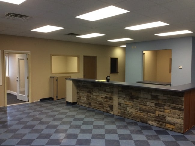
Warehouse
Olmsted
AE
Minnesota
27109C0154F
3.89 AC
2025
Rochester
2024
Other Market Areas
001603
Rochester, MN
17,600 SF
DEMOGRAPHICS near 4519 Morris Ln Ne
1 Mile
3 Mile
5 Mile
2024 Total Population
2,842
48,308
106,501
2029 Population
2,938
49,261
109,332
Pop Growth 2024-2029
+ 3.38%
+ 1.97%
+ 2.66%
Average Age
42
40
39
2024 Total Households
1,137
20,021
44,238
HH Growth 2024-2029
+ 3.43%
+ 1.92%
+ 2.67%
Median Household Inc
$100,086
$79,914
$78,089
Avg Household Size
2.40
2.30
2.30
2024 Avg HH Vehicles
2.00
2.00
2.00
Median Home Value
$344,036
$272,341
$275,804
Median Year Built
1995
1981
1985
Nearby Places
Map Layers
Map Styles
 Street
 Aerial
- Restaurants
- Banks
- Shops
- Fitness
- Groceries
PUBLIC TRANSPORTATION
AIRPORT
Rochester International
DRIVE
WALK
Distance
Rochester International
22 min
12.0 mi
Freight Ports
Port Milwaukee
DRIVE
WALK
Distance
Port Milwaukee
313 min
280.0 mi
SALE & LEASE HISTORY
LISTING DATE
SALE/LEASE

Nov 03, 2016
For Lease
Nearby Properties
Address
Land Use
TOTAL SIZE
Lot Size
Zoning
Address
Land Use
TOTAL SIZE
Lot Size
Zoning
960 SF
38.12 AC
Address
Land Use
TOTAL SIZE
Lot Size
Zoning
1,836 SF
80.90 AC
Address
Land Use
TOTAL SIZE
Lot Size
Zoning
13,946 SF
34.10 AC
Address
Land Use
TOTAL SIZE
Lot Size
Zoning
53.73 AC
Address
Land Use
TOTAL SIZE
Lot Size
Zoning
136,031 SF
35.28 AC
Address
Land Use
TOTAL SIZE
Lot Size
Zoning
170,843 SF
13.66 AC
Address
Land Use
TOTAL SIZE
Lot Size
Zoning
10,920 SF
38.88 AC
Address
Land Use
TOTAL SIZE
Lot Size
Zoning
Address
Land Use
TOTAL SIZE
Lot Size
Zoning
8.12 AC
Address
Land Use
TOTAL SIZE
Lot Size
Zoning
142,236 SF
13.78 AC
Address
Land Use
TOTAL SIZE
Lot Size
Zoning
117,897 SF
34.12 AC
Address
Land Use
TOTAL SIZE
Lot Size
Zoning
2,880 SF
9.49 AC
Address
Land Use
TOTAL SIZE
Lot Size
Zoning
66,713 SF
8.79 AC
Address
Land Use
TOTAL SIZE
Lot Size
Zoning
528 SF
15.22 AC
Address
Land Use
TOTAL SIZE
Lot Size
Zoning
16,792 SF
7.07 AC
Address
Land Use
TOTAL SIZE
Lot Size
Zoning
Address
Land Use
TOTAL SIZE
Lot Size
Zoning
44,352 SF
10.93 AC
Address
Land Use
TOTAL SIZE
Lot Size
Zoning
308,992 SF
8.53 AC
Address
Land Use
TOTAL SIZE
Lot Size
Zoning
23,268 SF
10.22 AC
Address
Land Use
TOTAL SIZE
Lot Size
Zoning
11,984 SF
6.52 AC
Address
Land Use
TOTAL SIZE
Lot Size
Zoning
55.70 AC
Address
Land Use
TOTAL SIZE
Lot Size
Zoning
2,064 SF
5.80 AC
Address
Land Use
TOTAL SIZE
Lot Size
Zoning
205,404 SF
17.17 AC
Address
Land Use
TOTAL SIZE
Lot Size
Zoning
2.44 AC
Address
Land Use
TOTAL SIZE
Lot Size
Zoning
47,298 SF
0.86 AC
Address
Land Use
TOTAL SIZE
Lot Size
Zoning
118,183 SF
9.66 AC
Address
Land Use
TOTAL SIZE
Lot Size
Zoning
164,424 SF
8.05 AC
Address
Land Use
TOTAL SIZE
Lot Size
Zoning
221,003 SF
17.60 AC
Address
Land Use
TOTAL SIZE
Lot Size
Zoning
98,633 SF
17.49 AC
Address
Land Use
TOTAL SIZE
Lot Size
Zoning
9,680 SF
7.72 AC
The World's #1 Commercial Real Estate Marketplace
Connect with us
© 2026 CoStar Group
The information above has been obtained from sources believed reliable. While we do not doubt its accuracy we have not verified it and make no guarantee, warranty or representation about it. It is your responsibility to independently confirm its accuracy and completeness. Any projections, opinions, assumptions, or estimates used are for example only and do not represent the current or future performance of the property. The value of this transaction to you depends on tax and other factors which should be evaluated by your tax, financial, and legal advisors. You and your advisors should conduct a careful, independent investigation of the property to determine to your satisfaction the suitability of the property for your needs.