Property Record
452 Route 9, Waretown, NJ 08758


Property Detail
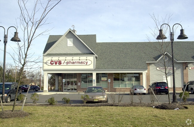
452 Route 9
21-00194-0000-00026-01
1.79 ACRES
Commercialnec
Ocean
C-2
New Jersey
B and X Area of moderate flood hazard, usually the area between the limits of the 100-year and 500-year floods.
26.1
2025
1.79 AC
2025
Ocean County
733001
Northern New Jersey
13,092 SF
Lakewood-New Brunswick, NJ
NEARBY LISTINGS FOR SALE OR LEASE
DEMOGRAPHICS near 452 Route 9
1 mile
3 mile
5 mile
2025 Total Population
3,654
21,170
52,929
2030 Population
3,856
22,079
54,552
Pop Growth 2025-2030
+ 5.53%
+ 4.29%
+ 3.07%
Average Age
44
44
43
2025 Total Households
1,522
8,656
20,710
HH Growth 2025-2030
+ 4.86%
+ 3.80%
+ 2.61%
Median Household Inc
$99,801
$98,044
$96,297
Avg Household Size
2.40
2.40
2.50
2025 Avg HH Vehicles
2.00
2.00
2.00
Median Home Value
$429,325
$443,800
$405,227
Median Year Built
1981
1984
1985
Nearby Places
Map Layers
Map Styles
 Street
 Aerial
Layers
 Traffic
 Biking
Places
Listings with unknown addresses are not visible on the map
- Restaurants
- Banks
- Shops
- Fitness
- Groceries
PUBLIC TRANSPORTATION
AIRPORT
Atlantic City International
Drive
Walk
Distance
Atlantic City International
68 min
37.9 mi
Freight Ports
South Jersey Port
Drive
Walk
Distance
South Jersey Port
74 min
55.3 mi
SALE & LEASE HISTORY
LISTING DATE
SALE/LEASE

Sep 17, 2018
For Sale
Nov 14, 2017
For Sale
Jun 01, 2017
For Sale
Nearby Properties
Address
Land Use
TOTAL SIZE
Lot Size
Zoning
Address
Land Use
TOTAL SIZE
Lot Size
Zoning
139.60 AC
M6
Address
Land Use
TOTAL SIZE
Lot Size
Zoning
85.65 AC
R40
Address
Land Use
TOTAL SIZE
Lot Size
Zoning
528.70 AC
M6
Address
Land Use
TOTAL SIZE
Lot Size
Zoning
15.27 AC
C-2
Address
Land Use
TOTAL SIZE
Lot Size
Zoning
46.40 AC
ML-4
Address
Land Use
TOTAL SIZE
Lot Size
Zoning
85.65 AC
R40
Address
Land Use
TOTAL SIZE
Lot Size
Zoning
2.76 AC
TC
Address
Land Use
TOTAL SIZE
Lot Size
Zoning
15.12 AC
R-2
Address
Land Use
TOTAL SIZE
Lot Size
Zoning
9.32 AC
TCO+
Address
Land Use
TOTAL SIZE
Lot Size
Zoning
6,600 SF
10.67 AC
PRD
Address
Land Use
TOTAL SIZE
Lot Size
Zoning
11.24 AC
R-2
Address
Land Use
TOTAL SIZE
Lot Size
Zoning
1,456 SF
9.65 AC
R-75
Address
Land Use
TOTAL SIZE
Lot Size
Zoning
37.70 AC
TCMX
Address
Land Use
TOTAL SIZE
Lot Size
Zoning
23.70 AC
BCWD
Address
Land Use
TOTAL SIZE
Lot Size
Zoning
89.90 AC
R-2
Address
Land Use
TOTAL SIZE
Lot Size
Zoning
56.23 AC
BC
Address
Land Use
TOTAL SIZE
Lot Size
Zoning
2,557 SF
633.96 AC
Address
Land Use
TOTAL SIZE
Lot Size
Zoning
18.15 AC
TCMX
Address
Land Use
TOTAL SIZE
Lot Size
Zoning
4,230 SF
10.65 AC
CPHD
Address
Land Use
TOTAL SIZE
Lot Size
Zoning
40 AC
TCEC
Address
Land Use
TOTAL SIZE
Lot Size
Zoning
4.85 AC
CPHD
Address
Land Use
TOTAL SIZE
Lot Size
Zoning
18,980 SF
4.19 AC
TCEC
Address
Land Use
TOTAL SIZE
Lot Size
Zoning
3.34 AC
C-1
Address
Land Use
TOTAL SIZE
Lot Size
Zoning
6.25 AC
C100
Address
Land Use
TOTAL SIZE
Lot Size
Zoning
16,992 SF
31.88 AC
FO
Address
Land Use
TOTAL SIZE
Lot Size
Zoning
6.39 AC
ML-1
Address
Land Use
TOTAL SIZE
Lot Size
Zoning
6,976 SF
1.29 AC
C150
Address
Land Use
TOTAL SIZE
Lot Size
Zoning
4.70 AC
ML5
Address
Land Use
TOTAL SIZE
Lot Size
Zoning
31.49 AC
M6
The World's #1 Commercial Real Estate Marketplace
Connect with us
© 2026 CoStar Group
The information above has been obtained from sources believed reliable. While we do not doubt its accuracy we have not verified it and make no guarantee, warranty or representation about it. It is your responsibility to independently confirm its accuracy and completeness. Any projections, opinions, assumptions, or estimates used are for example only and do not represent the current or future performance of the property. The value of this transaction to you depends on tax and other factors which should be evaluated by your tax, financial, and legal advisors. You and your advisors should conduct a careful, independent investigation of the property to determine to your satisfaction the suitability of the property for your needs.