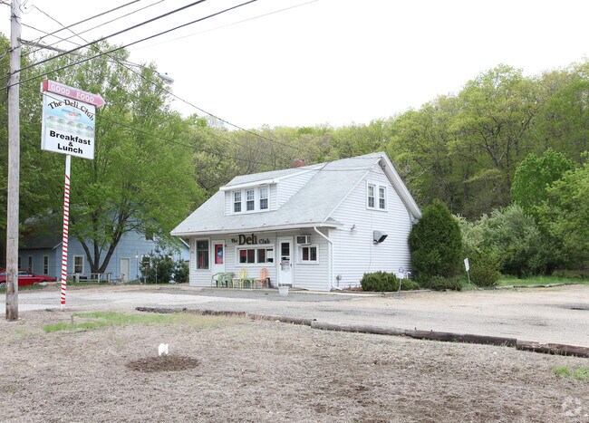
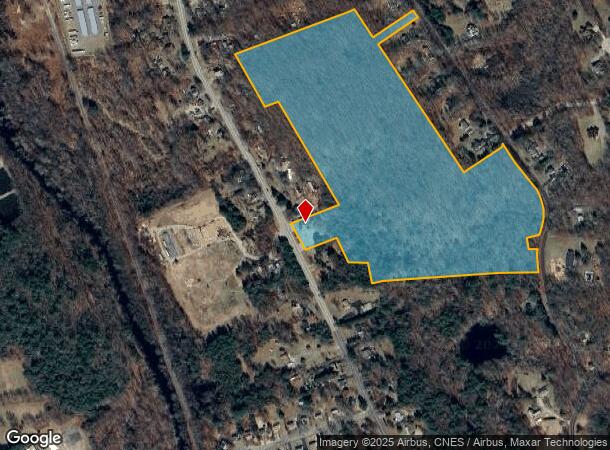
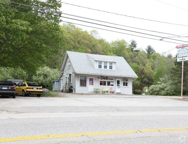
Property Record
452 Stafford Rd, Mansfield Center, CT 06250
NEARBY LISTINGS FOR SALE OR LEASE
Property Detail
452 Stafford Rd
Hartford-West Hartford-East Hartford, CT
Tolland
MANS-000026-000077-000010
Connecticut
Timberlandforesttreesagricultural
10
2025
36.89 AC
2025
Tolland County
881500
Hartford
1,056 SF
DEMOGRAPHICS near 452 Stafford Rd
1 Mile
3 Mile
5 Mile
2024 Total Population
923
13,758
56,157
2029 Population
913
13,819
56,146
Pop Growth 2024-2029
(1.08%)
+ 0.44%
(0.02%)
Average Age
43
38
35
2024 Total Households
362
4,536
16,691
HH Growth 2024-2029
(1.10%)
+ 0.46%
(0.07%)
Median Household Inc
$78,885
$58,495
$50,387
Avg Household Size
2.50
2.40
2.30
2024 Avg HH Vehicles
2.00
2.00
2.00
Median Home Value
$260,431
$265,550
$240,499
Median Year Built
1955
1969
1968
Nearby Places
Map Layers
Map Styles
 Street
 Aerial
- Restaurants
- Banks
- Shops
- Fitness
- Groceries
PUBLIC TRANSPORTATION
AIRPORT
Bradley International
DRIVE
WALK
Distance
Bradley International
63 min
39.7 mi
Freight Ports
Port of Davisville, RI
DRIVE
WALK
Distance
Port of Davisville, RI
88 min
64.9 mi
Nearby Properties
Address
Land Use
TOTAL SIZE
Lot Size
Zoning
Address
Land Use
TOTAL SIZE
Lot Size
Zoning
111,757 SF
6.74 AC
RL
Address
Land Use
TOTAL SIZE
Lot Size
Zoning
93.53 AC
RAR90
Address
Land Use
TOTAL SIZE
Lot Size
Zoning
49,319 SF
1 AC
I
Address
Land Use
TOTAL SIZE
Lot Size
Zoning
14.12 AC
B2A
Address
Land Use
TOTAL SIZE
Lot Size
Zoning
142 AC
R5 - 1
Address
Land Use
TOTAL SIZE
Lot Size
Zoning
53.16 AC
M4
Address
Land Use
TOTAL SIZE
Lot Size
Zoning
22.70 AC
RAR90
Address
Land Use
TOTAL SIZE
Lot Size
Zoning
19.60 AC
RAR90
Address
Land Use
TOTAL SIZE
Lot Size
Zoning
14.59 AC
R5
Address
Land Use
TOTAL SIZE
Lot Size
Zoning
62,452 SF
20 AC
GR80
Address
Land Use
TOTAL SIZE
Lot Size
Zoning
4.49 AC
RAR90
Address
Land Use
TOTAL SIZE
Lot Size
Zoning
30,379 SF
5.80 AC
C
Address
Land Use
TOTAL SIZE
Lot Size
Zoning
50,098 SF
16.96 AC
RAR90
Address
Land Use
TOTAL SIZE
Lot Size
Zoning
17.53 AC
RL
Address
Land Use
TOTAL SIZE
Lot Size
Zoning
90,983 SF
16.31 AC
M4
Address
Land Use
TOTAL SIZE
Lot Size
Zoning
60,564 SF
6.23 AC
B2A
Address
Land Use
TOTAL SIZE
Lot Size
Zoning
1,296 SF
9.29 AC
GR40
Address
Land Use
TOTAL SIZE
Lot Size
Zoning
73.19 AC
I
Address
Land Use
TOTAL SIZE
Lot Size
Zoning
6,150 SF
7.79 AC
M
Address
Land Use
TOTAL SIZE
Lot Size
Zoning
14.09 AC
GR40
Address
Land Use
TOTAL SIZE
Lot Size
Zoning
6 AC
RAR90
Address
Land Use
TOTAL SIZE
Lot Size
Zoning
78,825 SF
7.77 AC
C
Address
Land Use
TOTAL SIZE
Lot Size
Zoning
6.20 AC
VR
Address
Land Use
TOTAL SIZE
Lot Size
Zoning
6,810 SF
4 AC
RAR90
Address
Land Use
TOTAL SIZE
Lot Size
Zoning
22.05 AC
RAR90
Address
Land Use
TOTAL SIZE
Lot Size
Zoning
10,984 SF
8.88 AC
GR80
Address
Land Use
TOTAL SIZE
Lot Size
Zoning
8.49 AC
C
Address
Land Use
TOTAL SIZE
Lot Size
Zoning
7,007 SF
1.99 AC
VC
Address
Land Use
TOTAL SIZE
Lot Size
Zoning
12,696 SF
1.16 AC
B2A
Address
Land Use
TOTAL SIZE
Lot Size
Zoning
13.97 AC
M4
The World's #1 Commercial Real Estate Marketplace
Connect with us
© 2025 CoStar Group
The information above has been obtained from sources believed reliable. While we do not doubt its accuracy we have not verified it and make no guarantee, warranty or representation about it. It is your responsibility to independently confirm its accuracy and completeness. Any projections, opinions, assumptions, or estimates used are for example only and do not represent the current or future performance of the property. The value of this transaction to you depends on tax and other factors which should be evaluated by your tax, financial, and legal advisors. You and your advisors should conduct a careful, independent investigation of the property to determine to your satisfaction the suitability of the property for your needs.