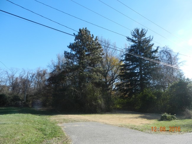
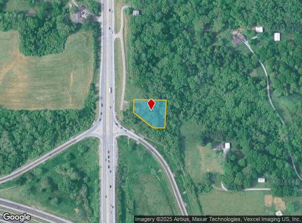
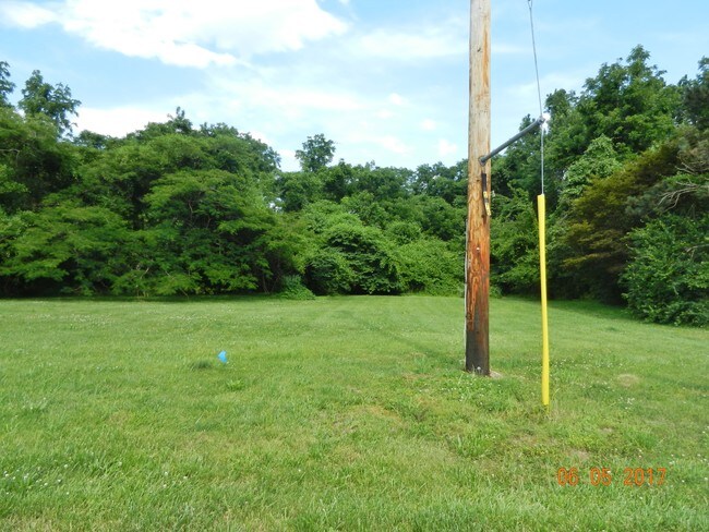
Property Record
4520 S State Route 159, Glen Carbon, IL 62034
NEARBY LISTINGS FOR SALE OR LEASE
Property Detail
4520 S State Route 159
St. Louis, MO-IL
PT NW/C NE EXC 164.38X265
14-1-15-35-02-201-003
Madison
Residentialacreage
Illinois
2024
0.71 AC
2024
Illinois
403122
St. Louis
818 SF
DEMOGRAPHICS near 4520 S State Route 159
1 Mile
3 Mile
5 Mile
2024 Total Population
3,761
35,592
70,926
2029 Population
3,700
35,127
70,223
Pop Growth 2024-2029
(1.62%)
(1.31%)
(0.99%)
Average Age
40
41
40
2024 Total Households
1,527
14,014
27,304
HH Growth 2024-2029
(1.64%)
(1.33%)
(1.02%)
Median Household Inc
$90,897
$90,629
$84,719
Avg Household Size
2.40
2.50
2.40
2024 Avg HH Vehicles
2.00
2.00
2.00
Median Home Value
$241,930
$250,137
$227,054
Median Year Built
1989
1990
1986
Nearby Places
Map Layers
Map Styles
 Street
 Aerial
- Restaurants
- Banks
- Shops
- Fitness
- Groceries
PUBLIC TRANSPORTATION
AIRPORT
St Louis Lambert International
DRIVE
WALK
Distance
St Louis Lambert International
32 min
23.8 mi
Scott AFB/Midamerica St Louis
DRIVE
WALK
Distance
Scott AFB/Midamerica St Louis
40 min
24.6 mi
Freight Ports
Port Milwaukee
DRIVE
WALK
Distance
Port Milwaukee
397 min
353.0 mi
SALE & LEASE HISTORY
LISTING DATE
SALE/LEASE

Sep 22, 2023
For Sale
Jun 06, 2017
For Sale
Nearby Properties
Address
Land Use
TOTAL SIZE
Lot Size
Zoning
Address
Land Use
TOTAL SIZE
Lot Size
Zoning
149,417 SF
26.44 AC
Address
Land Use
TOTAL SIZE
Lot Size
Zoning
4.40 AC
Address
Land Use
TOTAL SIZE
Lot Size
Zoning
75,367 SF
12.25 AC
Address
Land Use
TOTAL SIZE
Lot Size
Zoning
28,164 SF
9.31 AC
Address
Land Use
TOTAL SIZE
Lot Size
Zoning
56,126 SF
10 AC
Address
Land Use
TOTAL SIZE
Lot Size
Zoning
10.83 AC
Address
Land Use
TOTAL SIZE
Lot Size
Zoning
126,578 SF
3.74 AC
Address
Land Use
TOTAL SIZE
Lot Size
Zoning
3,209 SF
8.62 AC
Address
Land Use
TOTAL SIZE
Lot Size
Zoning
218,837 SF
4.81 AC
Address
Land Use
TOTAL SIZE
Lot Size
Zoning
50,968 SF
4.23 AC
Address
Land Use
TOTAL SIZE
Lot Size
Zoning
25,675 SF
3 AC
Address
Land Use
TOTAL SIZE
Lot Size
Zoning
16,274 SF
19.78 AC
Address
Land Use
TOTAL SIZE
Lot Size
Zoning
187,818 SF
12.47 AC
Address
Land Use
TOTAL SIZE
Lot Size
Zoning
85,519 SF
10.09 AC
Address
Land Use
TOTAL SIZE
Lot Size
Zoning
22,816 SF
40.45 AC
Address
Land Use
TOTAL SIZE
Lot Size
Zoning
13,104 SF
5.80 AC
Address
Land Use
TOTAL SIZE
Lot Size
Zoning
58,359 SF
5 AC
Address
Land Use
TOTAL SIZE
Lot Size
Zoning
77,411 SF
9.11 AC
Address
Land Use
TOTAL SIZE
Lot Size
Zoning
53,192 SF
1.10 AC
Address
Land Use
TOTAL SIZE
Lot Size
Zoning
127,592 SF
11.63 AC
Address
Land Use
TOTAL SIZE
Lot Size
Zoning
12.02 AC
Address
Land Use
TOTAL SIZE
Lot Size
Zoning
131,853 SF
14.60 AC
Address
Land Use
TOTAL SIZE
Lot Size
Zoning
55,292 SF
13.31 AC
Address
Land Use
TOTAL SIZE
Lot Size
Zoning
37,432 SF
2 AC
Address
Land Use
TOTAL SIZE
Lot Size
Zoning
56,935 SF
0.61 AC
Address
Land Use
TOTAL SIZE
Lot Size
Zoning
30,968 SF
6.32 AC
Address
Land Use
TOTAL SIZE
Lot Size
Zoning
70,484 SF
9.26 AC
Address
Land Use
TOTAL SIZE
Lot Size
Zoning
65,894 SF
9.08 AC
Address
Land Use
TOTAL SIZE
Lot Size
Zoning
89,378 SF
8.56 AC
Address
Land Use
TOTAL SIZE
Lot Size
Zoning
93,098 SF
15.82 AC
The World's #1 Commercial Real Estate Marketplace
Connect with us
© 2025 CoStar Group
The information above has been obtained from sources believed reliable. While we do not doubt its accuracy we have not verified it and make no guarantee, warranty or representation about it. It is your responsibility to independently confirm its accuracy and completeness. Any projections, opinions, assumptions, or estimates used are for example only and do not represent the current or future performance of the property. The value of this transaction to you depends on tax and other factors which should be evaluated by your tax, financial, and legal advisors. You and your advisors should conduct a careful, independent investigation of the property to determine to your satisfaction the suitability of the property for your needs.