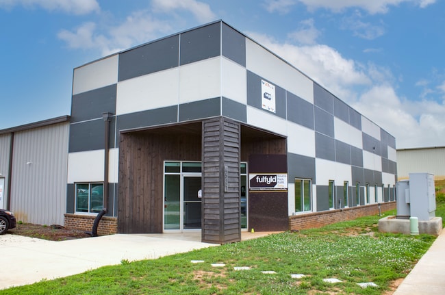
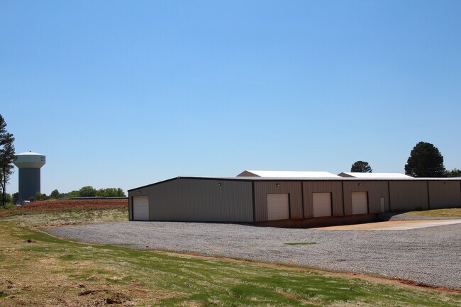
Property Record
4521 Old Railroad Bed Rd, Harvest, AL 35749
NEARBY LISTINGS FOR SALE OR LEASE
-
-
View all Harvest listings for lease on LoopNet.com
Property Detail
4521 Old Railroad Bed Rd
Huntsville, AL
Tuck Estates
06-05-16-0-000-006.013
LOT 14 TUCK ESTATES PB # 20071001000690620
Autorepair
Madison
X
Alabama
01089C0155F
14
2025
3.40 AC
2025
North Madison County
010504
Huntsville
30,000 SF
DEMOGRAPHICS near 4521 Old Railroad Bed Rd
1 Mile
3 Mile
5 Mile
2024 Total Population
2,017
13,445
35,782
2029 Population
2,245
14,972
39,898
Pop Growth 2024-2029
+ 11.30%
+ 11.36%
+ 11.50%
Average Age
39
39
40
2024 Total Households
730
4,823
12,504
HH Growth 2024-2029
+ 11.64%
+ 11.82%
+ 11.99%
Median Household Inc
$100,534
$96,040
$101,766
Avg Household Size
2.70
2.70
2.60
2024 Avg HH Vehicles
2.00
2.00
2.00
Median Home Value
$224,456
$235,105
$239,790
Median Year Built
2001
2002
2000
Nearby Places
Map Layers
Map Styles
 Street
 Aerial
- Restaurants
- Banks
- Shops
- Fitness
- Groceries
PUBLIC TRANSPORTATION
AIRPORT
Huntsville International-Carl T Jones Field
DRIVE
WALK
Distance
Huntsville International-Carl T Jones Field
33 min
16.8 mi
Freight Ports
Port of Mobile
DRIVE
WALK
Distance
Port of Mobile
400 min
357.2 mi
SALE & LEASE HISTORY
LISTING DATE
SALE/LEASE

Sep 27, 2019
For Lease
Sep 27, 2019
For Sale
Jun 15, 2022
For Lease
Nearby Properties
Address
Land Use
TOTAL SIZE
Lot Size
Zoning
Address
Land Use
TOTAL SIZE
Lot Size
Zoning
45,790 SF
13.39 AC
Address
Land Use
TOTAL SIZE
Lot Size
Zoning
Address
Land Use
TOTAL SIZE
Lot Size
Zoning
11,414 SF
7.60 AC
Address
Land Use
TOTAL SIZE
Lot Size
Zoning
22,990 SF
18 AC
Address
Land Use
TOTAL SIZE
Lot Size
Zoning
Address
Land Use
TOTAL SIZE
Lot Size
Zoning
8,448 SF
5 AC
Address
Land Use
TOTAL SIZE
Lot Size
Zoning
24,300 SF
9.28 AC
Address
Land Use
TOTAL SIZE
Lot Size
Zoning
2.51 AC
Address
Land Use
TOTAL SIZE
Lot Size
Zoning
6,967 SF
3.25 AC
Address
Land Use
TOTAL SIZE
Lot Size
Zoning
5,760 SF
3.40 AC
Address
Land Use
TOTAL SIZE
Lot Size
Zoning
11,743 SF
0.95 AC
Address
Land Use
TOTAL SIZE
Lot Size
Zoning
10,000 SF
2.78 AC
Address
Land Use
TOTAL SIZE
Lot Size
Zoning
11,243 SF
9.10 AC
Address
Land Use
TOTAL SIZE
Lot Size
Zoning
7,870 SF
2.17 AC
Address
Land Use
TOTAL SIZE
Lot Size
Zoning
3,679 SF
1.31 AC
Address
Land Use
TOTAL SIZE
Lot Size
Zoning
3,511 SF
1.12 AC
Address
Land Use
TOTAL SIZE
Lot Size
Zoning
3,440 SF
1.49 AC
Address
Land Use
TOTAL SIZE
Lot Size
Zoning
1,152 SF
35 AC
Address
Land Use
TOTAL SIZE
Lot Size
Zoning
9,100 SF
1.68 AC
Address
Land Use
TOTAL SIZE
Lot Size
Zoning
10,962 SF
2.28 AC
Address
Land Use
TOTAL SIZE
Lot Size
Zoning
2,790 SF
1.04 AC
Address
Land Use
TOTAL SIZE
Lot Size
Zoning
8,164 SF
6.50 AC
Address
Land Use
TOTAL SIZE
Lot Size
Zoning
3,630 SF
1.09 AC
Address
Land Use
TOTAL SIZE
Lot Size
Zoning
1,508 SF
89 AC
Address
Land Use
TOTAL SIZE
Lot Size
Zoning
7,500 SF
1.32 AC
Address
Land Use
TOTAL SIZE
Lot Size
Zoning
3,600 SF
3 AC
Address
Land Use
TOTAL SIZE
Lot Size
Zoning
5,810 SF
5.10 AC
Address
Land Use
TOTAL SIZE
Lot Size
Zoning
900 SF
4.90 AC
Address
Land Use
TOTAL SIZE
Lot Size
Zoning
14,058 SF
1.69 AC
The World's #1 Commercial Real Estate Marketplace
Connect with us
© 2026 CoStar Group
The information above has been obtained from sources believed reliable. While we do not doubt its accuracy we have not verified it and make no guarantee, warranty or representation about it. It is your responsibility to independently confirm its accuracy and completeness. Any projections, opinions, assumptions, or estimates used are for example only and do not represent the current or future performance of the property. The value of this transaction to you depends on tax and other factors which should be evaluated by your tax, financial, and legal advisors. You and your advisors should conduct a careful, independent investigation of the property to determine to your satisfaction the suitability of the property for your needs.