Property Record
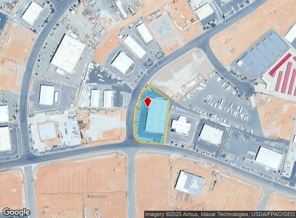
4521 S Factory Dr, Saint George, UT 84790


NEARBY LISTINGS FOR SALE OR LEASE
Property Detail
4521 S Factory Dr
1089863
Fort Pierce Business Park
Commercialnec
S: 19 T: 43S R: 15W TOWNSHIP 43 SOUTH, RANGE 15 WEST, SLB&M WITHIN SECTION 19 BEGINNING AT A POINT NORTH 11051 EAST 256.43 FEET ALONG THE SECTION LINE AND NORTH 90 0000 WEST 316.58 FEET FROM THE EAST CORNER OF SECTION 19, TOWNSHIP 43 SOUTH, RANGE 15
X
Washington
49053C1037G
Utah
2024
1.49 AC
2025
Cedar City & St George
271702
Other Market Areas
25,840 SF
St. George, UT
DEMOGRAPHICS near 4521 S Factory Dr
1 Mile
3 Mile
5 Mile
2024 Total Population
101
28,162
62,927
2029 Population
130
34,941
78,162
Pop Growth 2024-2029
+ 28.71%
+ 24.07%
+ 24.21%
Average Age
33
41
40
2024 Total Households
29
9,320
20,816
HH Growth 2024-2029
+ 27.59%
+ 23.99%
+ 24.34%
Median Household Inc
$87,500
$77,745
$77,449
Avg Household Size
3.60
3.00
2.90
2024 Avg HH Vehicles
2.00
2.00
2.00
Median Home Value
$483,333
$461,491
$469,711
Median Year Built
2010
2006
2004
Nearby Places
Map Layers
Map Styles
 Street
 Aerial
- Restaurants
- Banks
- Shops
- Fitness
- Groceries
PUBLIC TRANSPORTATION
AIRPORT
St George Regional
DRIVE
WALK
Distance
St George Regional
18 min
8.2 mi
SALE & LEASE HISTORY
LISTING DATE
SALE/LEASE

Aug 16, 2024
For Lease
Nearby Properties
Address
Land Use
TOTAL SIZE
Lot Size
Zoning
Address
Land Use
TOTAL SIZE
Lot Size
Zoning
823,767 SF
88.46 AC
Address
Land Use
TOTAL SIZE
Lot Size
Zoning
322,075 SF
26.62 AC
Address
Land Use
TOTAL SIZE
Lot Size
Zoning
1,063.96 AC
R110
Address
Land Use
TOTAL SIZE
Lot Size
Zoning
259,012 SF
22 AC
M-1
Address
Land Use
TOTAL SIZE
Lot Size
Zoning
173,917 SF
50 AC
M-1
Address
Land Use
TOTAL SIZE
Lot Size
Zoning
196,334 SF
22.87 AC
PDCOM
Address
Land Use
TOTAL SIZE
Lot Size
Zoning
152,090 SF
25 AC
M-1
Address
Land Use
TOTAL SIZE
Lot Size
Zoning
87,750 SF
15.92 AC
Address
Land Use
TOTAL SIZE
Lot Size
Zoning
123,028 SF
12.87 AC
Address
Land Use
TOTAL SIZE
Lot Size
Zoning
91,798 SF
5 AC
M-1
Address
Land Use
TOTAL SIZE
Lot Size
Zoning
15,476 SF
7.71 AC
Address
Land Use
TOTAL SIZE
Lot Size
Zoning
169,923 SF
9.41 AC
Address
Land Use
TOTAL SIZE
Lot Size
Zoning
405 SF
407.69 AC
R110
Address
Land Use
TOTAL SIZE
Lot Size
Zoning
209,687 SF
7.54 AC
M-1
Address
Land Use
TOTAL SIZE
Lot Size
Zoning
16,800 SF
250 AC
OS
Address
Land Use
TOTAL SIZE
Lot Size
Zoning
40,908 SF
6.89 AC
Address
Land Use
TOTAL SIZE
Lot Size
Zoning
122,761 SF
10.22 AC
M-1
Address
Land Use
TOTAL SIZE
Lot Size
Zoning
97,357 SF
5.67 AC
M-1
Address
Land Use
TOTAL SIZE
Lot Size
Zoning
100,110 SF
8.48 AC
M-1
Address
Land Use
TOTAL SIZE
Lot Size
Zoning
57,607 SF
11.03 AC
M-1
Address
Land Use
TOTAL SIZE
Lot Size
Zoning
77,649 SF
2.43 AC
Address
Land Use
TOTAL SIZE
Lot Size
Zoning
67,583 SF
2.99 AC
PDCOM
Address
Land Use
TOTAL SIZE
Lot Size
Zoning
22,954 SF
10.79 AC
Address
Land Use
TOTAL SIZE
Lot Size
Zoning
102,157 SF
8 AC
M-1
Address
Land Use
TOTAL SIZE
Lot Size
Zoning
53,536 SF
11.04 AC
M-1
Address
Land Use
TOTAL SIZE
Lot Size
Zoning
81,279 SF
4.92 AC
M-1
Address
Land Use
TOTAL SIZE
Lot Size
Zoning
41,160 SF
5 AC
M-1
Address
Land Use
TOTAL SIZE
Lot Size
Zoning
31,917 SF
9.63 AC
Address
Land Use
TOTAL SIZE
Lot Size
Zoning
20,971 SF
12 AC
M-1
The World's #1 Commercial Real Estate Marketplace
Connect with us
© 2025 CoStar Group
The information above has been obtained from sources believed reliable. While we do not doubt its accuracy we have not verified it and make no guarantee, warranty or representation about it. It is your responsibility to independently confirm its accuracy and completeness. Any projections, opinions, assumptions, or estimates used are for example only and do not represent the current or future performance of the property. The value of this transaction to you depends on tax and other factors which should be evaluated by your tax, financial, and legal advisors. You and your advisors should conduct a careful, independent investigation of the property to determine to your satisfaction the suitability of the property for your needs.