Property Record
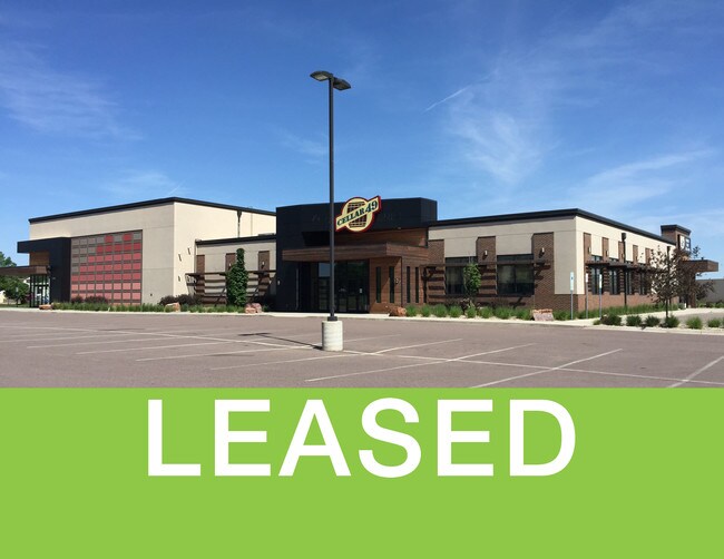
4521 W Empire Pl, Sioux Falls, SD 57106


Property Detail
4521 W Empire Pl
46852
TR 7 (EX PART DAYTONS & PART SEARS PARCELS & LOTS 1 THRU 3 & S50` ROW & EX LOT 4 IN TR 7 & EX SIOUX EMPIRE 2ND ADDN) SIOUX EM
Restaurantbuilding
MINNEHAHA
FP;FP
South Dakota
B and X Area of moderate flood hazard, usually the area between the limits of the 100-year and 500-year floods.
1,4
2025
9.35 AC
2025
Sioux Falls
001109
Other Market Areas
26,710 SF
Sioux Falls, SD-MN
NEARBY LISTINGS FOR SALE OR LEASE
DEMOGRAPHICS near 4521 W Empire Pl
1 mile
3 mile
5 mile
2025 Total Population
11,331
86,012
163,252
2030 Population
11,980
91,713
174,586
Pop Growth 2025-2030
+ 5.73%
+ 6.63%
+ 6.94%
Average Age
41
38
38
2025 Total Households
5,823
35,513
67,464
HH Growth 2025-2030
+ 6.27%
+ 6.94%
+ 7.32%
Median Household Inc
$49,694
$74,347
$71,982
Avg Household Size
1.90
2.30
2.30
2025 Avg HH Vehicles
1.00
2.00
2.00
Median Home Value
$234,267
$299,690
$296,901
Median Year Built
1990
1996
1994
Nearby Places
Map Layers
Map Styles
 Street
 Aerial
Layers
 Traffic
 Biking
Places
Listings with unknown addresses are not visible on the map
- Restaurants
- Banks
- Shops
- Fitness
- Groceries
PUBLIC TRANSPORTATION
AIRPORT
Joe Foss Field
Drive
Walk
Distance
Joe Foss Field
27 min
8.8 mi
SALE & LEASE HISTORY
LISTING DATE
SALE/LEASE

May 30, 2017
For Sale
Jun 02, 2017
For Sale
Jul 31, 2018
For Lease
Jan 30, 2017
For Sale
Jan 16, 2018
For Lease
Feb 28, 2017
For Sale
Nearby Properties
Address
Land Use
TOTAL SIZE
Lot Size
Zoning
Address
Land Use
TOTAL SIZE
Lot Size
Zoning
32.77 AC
Address
Land Use
TOTAL SIZE
Lot Size
Zoning
80,415 SF
13.13 AC
Address
Land Use
TOTAL SIZE
Lot Size
Zoning
8.89 AC
MUNICIPALI
Address
Land Use
TOTAL SIZE
Lot Size
Zoning
Address
Land Use
TOTAL SIZE
Lot Size
Zoning
408,018 SF
53.02 AC
FP;FP
Address
Land Use
TOTAL SIZE
Lot Size
Zoning
8.90 AC
C1;NEIGHBO
Address
Land Use
TOTAL SIZE
Lot Size
Zoning
8.80 AC
MUNICIPALI
Address
Land Use
TOTAL SIZE
Lot Size
Zoning
8.25 AC
MUNICIPALI
Address
Land Use
TOTAL SIZE
Lot Size
Zoning
32,169 SF
9.91 AC
Address
Land Use
TOTAL SIZE
Lot Size
Zoning
7,252 SF
12.07 AC
Address
Land Use
TOTAL SIZE
Lot Size
Zoning
9.41 AC
Address
Land Use
TOTAL SIZE
Lot Size
Zoning
11.26 AC
MUNICIPALI
Address
Land Use
TOTAL SIZE
Lot Size
Zoning
317,992 SF
27 AC
Address
Land Use
TOTAL SIZE
Lot Size
Zoning
51,004 SF
3.99 AC
Address
Land Use
TOTAL SIZE
Lot Size
Zoning
201,028 SF
5.42 AC
FP;FP
Address
Land Use
TOTAL SIZE
Lot Size
Zoning
8.52 AC
MUNICIPALI
Address
Land Use
TOTAL SIZE
Lot Size
Zoning
149,610 SF
0.97 AC
Address
Land Use
TOTAL SIZE
Lot Size
Zoning
4.60 AC
MUNICIPALI
Address
Land Use
TOTAL SIZE
Lot Size
Zoning
15.40 AC
MUNICIPALI
Address
Land Use
TOTAL SIZE
Lot Size
Zoning
10.75 AC
MUNICIPALI
Address
Land Use
TOTAL SIZE
Lot Size
Zoning
172,212 SF
15.89 AC
Address
Land Use
TOTAL SIZE
Lot Size
Zoning
9.45 AC
MUNICIPALI
Address
Land Use
TOTAL SIZE
Lot Size
Zoning
80,964 SF
23.34 AC
Address
Land Use
TOTAL SIZE
Lot Size
Zoning
99,834 SF
6.58 AC
Address
Land Use
TOTAL SIZE
Lot Size
Zoning
7.91 AC
MUNICIPALI
Address
Land Use
TOTAL SIZE
Lot Size
Zoning
100,053 SF
8.50 AC
FP;FP
Address
Land Use
TOTAL SIZE
Lot Size
Zoning
9.56 AC
MUNICIPALI
Address
Land Use
TOTAL SIZE
Lot Size
Zoning
9.59 AC
MUNICIPALI
Address
Land Use
TOTAL SIZE
Lot Size
Zoning
8.57 AC
MUNICIPALI
Address
Land Use
TOTAL SIZE
Lot Size
Zoning
16.45 AC
MUNICIPALI
The World's #1 Commercial Real Estate Marketplace
Connect with us
© 2026 CoStar Group
The information above has been obtained from sources believed reliable. While we do not doubt its accuracy we have not verified it and make no guarantee, warranty or representation about it. It is your responsibility to independently confirm its accuracy and completeness. Any projections, opinions, assumptions, or estimates used are for example only and do not represent the current or future performance of the property. The value of this transaction to you depends on tax and other factors which should be evaluated by your tax, financial, and legal advisors. You and your advisors should conduct a careful, independent investigation of the property to determine to your satisfaction the suitability of the property for your needs.