Property Record
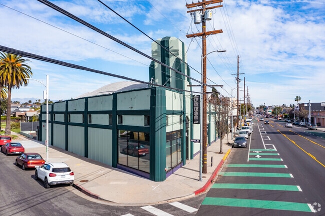
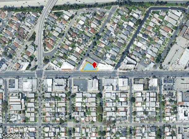
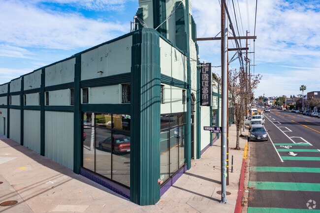
4525 W Adams Blvd, Los Angeles, CA 90016

Current Lease Availabilities
NEARBY LISTINGS FOR SALE OR LEASE
Property Detail
4525 W Adams Blvd
Los Angeles-Long Beach-Glendale, CA
2072
5050-008-057
TRACT NO 2072 LOT 45 BLK 5
Storemultistory
Los Angeles
X
California
06037C1612G
45
2024
0.23 AC
2025
Culver City
218702
Los Angeles
9,295 SF
DEMOGRAPHICS near 4525 W Adams Blvd
1 Mile
3 Mile
5 Mile
2024 Total Population
45,774
402,450
1,251,516
2029 Population
44,609
391,701
1,219,682
Pop Growth 2024-2029
(2.55%)
(2.67%)
(2.54%)
Average Age
39
39
39
2024 Total Households
15,981
153,679
503,938
HH Growth 2024-2029
(2.80%)
(2.80%)
(2.46%)
Median Household Inc
$55,742
$61,471
$63,073
Avg Household Size
2.70
2.50
2.40
2024 Avg HH Vehicles
2.00
1.00
1.00
Median Home Value
$804,295
$922,666
$940,155
Median Year Built
1948
1950
1960
Nearby Places
Map Layers
Map Styles
 Street
 Aerial
- Restaurants
- Banks
- Shops
- Fitness
- Groceries
PUBLIC TRANSPORTATION
COMMUTER RAIL
DRIVE
WALK
Distance
12 min
7.1 mi
Union Station (91 Line - Southern California Regional Rail Authority (Metrolink), Antelope Valley Line - Southern California Regional Rail Authority (Metrolink), Orange County Line - Southern California Regional Rail Authority (Metrolink), Riverside Line - Southern California Regional Rail Authority (Metrolink), San Bernardino Line - Southern California Regional Rail Authority (Metrolink), Ventura County Line - Southern California Regional Rail Authority (Metrolink))
DRIVE
WALK
Distance
Union Station (91 Line - Southern California Regional Rail Authority (Metrolink), Antelope Valley Line - Southern California Regional Rail Authority (Metrolink), Orange County Line - Southern California Regional Rail Authority (Metrolink), Riverside Line - Southern California Regional Rail Authority (Metrolink), San Bernardino Line - Southern California Regional Rail Authority (Metrolink), Ventura County Line - Southern California Regional Rail Authority (Metrolink))
14 min
7.3 mi
AIRPORT
Los Angeles International
DRIVE
WALK
Distance
Los Angeles International
18 min
9.0 mi
Bob Hope
DRIVE
WALK
Distance
Bob Hope
26 min
14.9 mi
Long Beach (Daugherty Field)
DRIVE
WALK
Distance
Long Beach (Daugherty Field)
33 min
25.0 mi
Freight Ports
Port of Long Beach
DRIVE
WALK
Distance
Port of Long Beach
36 min
26.9 mi
Nearby Properties
Address
Land Use
TOTAL SIZE
Lot Size
Zoning
Address
Land Use
TOTAL SIZE
Lot Size
Zoning
1,002,990 SF
8.42 AC
LAC4
Address
Land Use
TOTAL SIZE
Lot Size
Zoning
252,523 SF
2.26 AC
LAC2
Address
Land Use
TOTAL SIZE
Lot Size
Zoning
871,235 SF
14.56 AC
LAC2
Address
Land Use
TOTAL SIZE
Lot Size
Zoning
476,779 SF
1.57 AC
LAC4
Address
Land Use
TOTAL SIZE
Lot Size
Zoning
728,063 SF
2.08 AC
LAC4
Address
Land Use
TOTAL SIZE
Lot Size
Zoning
472,363 SF
3.24 AC
LAC4
Address
Land Use
TOTAL SIZE
Lot Size
Zoning
368,411 SF
10.91 AC
C2-2D-CPIO
Address
Land Use
TOTAL SIZE
Lot Size
Zoning
793,274 SF
7.80 AC
LAR4
Address
Land Use
TOTAL SIZE
Lot Size
Zoning
110,580 SF
6.88 AC
LAC2
Address
Land Use
TOTAL SIZE
Lot Size
Zoning
453,182 SF
2.76 AC
LAC4
Address
Land Use
TOTAL SIZE
Lot Size
Zoning
337,025 SF
14.59 AC
LAUSC-1A
Address
Land Use
TOTAL SIZE
Lot Size
Zoning
8.93 AC
LAC2
Address
Land Use
TOTAL SIZE
Lot Size
Zoning
679,557 SF
6.41 AC
LAC2
Address
Land Use
TOTAL SIZE
Lot Size
Zoning
786,423 SF
11.74 AC
LAC2
Address
Land Use
TOTAL SIZE
Lot Size
Zoning
78,793 SF
3.53 AC
LAMR1
Address
Land Use
TOTAL SIZE
Lot Size
Zoning
216,433 SF
1.38 AC
LAR5
Address
Land Use
TOTAL SIZE
Lot Size
Zoning
426,106 SF
2.34 AC
BHC3*
Address
Land Use
TOTAL SIZE
Lot Size
Zoning
417,118 SF
1.58 AC
LAC4
Address
Land Use
TOTAL SIZE
Lot Size
Zoning
310,063 SF
2.22 AC
LAC2
Address
Land Use
TOTAL SIZE
Lot Size
Zoning
93,785 SF
3.95 AC
LAR5
Address
Land Use
TOTAL SIZE
Lot Size
Zoning
200,893 SF
1 AC
LAC4
Address
Land Use
TOTAL SIZE
Lot Size
Zoning
377,946 SF
5.03 AC
LAUSC-1A
Address
Land Use
TOTAL SIZE
Lot Size
Zoning
303,124 SF
2.63 AC
LAC2
Address
Land Use
TOTAL SIZE
Lot Size
Zoning
106,000 SF
4.26 AC
LAMR 1
Address
Land Use
TOTAL SIZE
Lot Size
Zoning
186,798 SF
1.34 AC
LAC1.5
Address
Land Use
TOTAL SIZE
Lot Size
Zoning
237,673 SF
3.73 AC
M1-2D-CPIO
Address
Land Use
TOTAL SIZE
Lot Size
Zoning
190,164 SF
1.18 AC
LAR4
Address
Land Use
TOTAL SIZE
Lot Size
Zoning
128,347 SF
2.83 AC
LACM
Address
Land Use
TOTAL SIZE
Lot Size
Zoning
169,555 SF
0.88 AC
LAC4
Address
Land Use
TOTAL SIZE
Lot Size
Zoning
73,918 SF
3.86 AC
LAM1
The World's #1 Commercial Real Estate Marketplace
Connect with us
© 2026 CoStar Group
The information above has been obtained from sources believed reliable. While we do not doubt its accuracy we have not verified it and make no guarantee, warranty or representation about it. It is your responsibility to independently confirm its accuracy and completeness. Any projections, opinions, assumptions, or estimates used are for example only and do not represent the current or future performance of the property. The value of this transaction to you depends on tax and other factors which should be evaluated by your tax, financial, and legal advisors. You and your advisors should conduct a careful, independent investigation of the property to determine to your satisfaction the suitability of the property for your needs.