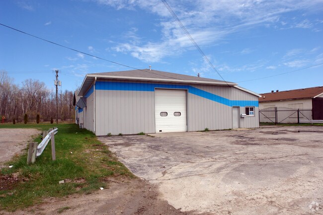
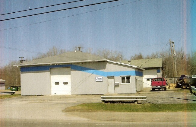
Property Record
4526 Griswold Rd, Kimball, MI 48074

Property Detail
4526 Griswold Rd
25-805-0007-000
LOT 7 WANDA SUBDIVISION
Manufacturinglight
Saint Clair
C-1 COMM
Michigan
B and X Area of moderate flood hazard, usually the area between the limits of the 100-year and 500-year floods.
7
2025
0.36 AC
2025
St Clair & Lapeer Counties
634600
Detroit
5,706 SF
Detroit-Warren-Dearborn, MI
NEARBY LISTINGS FOR SALE OR LEASE
DEMOGRAPHICS near 4526 Griswold Rd
1 mile
3 mile
5 mile
2025 Total Population
1,391
20,759
64,498
2030 Population
1,390
20,632
64,206
Pop Growth 2025-2030
(0.07%)
(0.61%)
(0.45%)
Average Age
42
41
41
2025 Total Households
542
7,988
26,276
HH Growth 2025-2030
(0.18%)
(0.78%)
(0.54%)
Median Household Inc
$49,499
$63,761
$60,911
Avg Household Size
2.40
2.50
2.40
2025 Avg HH Vehicles
2.00
2.00
2.00
Median Home Value
$155,223
$191,355
$182,579
Median Year Built
1963
1976
1970
Nearby Places
Map Layers
Map Styles
 Street
 Aerial
Layers
 Traffic
 Biking
Places
Listings with unknown addresses are not visible on the map
- Restaurants
- Banks
- Shops
- Fitness
- Groceries
PUBLIC TRANSPORTATION
COMMUTER RAIL
Port Huron Amtrak Station (Blue Water - Amtrak)
Drive
Walk
Distance
Port Huron Amtrak Station (Blue Water - Amtrak)
11 min
5.8 mi
Freight Ports
Port of Toledo
Drive
Walk
Distance
Port of Toledo
141 min
117.4 mi
Nearby Properties
Address
Land Use
TOTAL SIZE
Lot Size
Zoning
Address
Land Use
TOTAL SIZE
Lot Size
Zoning
241,664 SF
50.15 AC
B-3
Address
Land Use
TOTAL SIZE
Lot Size
Zoning
134,379 SF
15 AC
RM-2
Address
Land Use
TOTAL SIZE
Lot Size
Zoning
173,584 SF
9.50 AC
M1
Address
Land Use
TOTAL SIZE
Lot Size
Zoning
149,732 SF
12.48 AC
M1
Address
Land Use
TOTAL SIZE
Lot Size
Zoning
137,720 SF
12.04 AC
B-3
Address
Land Use
TOTAL SIZE
Lot Size
Zoning
94,537 SF
12.63 AC
B-3
Address
Land Use
TOTAL SIZE
Lot Size
Zoning
39,747 SF
3.11 AC
R-2 RES
Address
Land Use
TOTAL SIZE
Lot Size
Zoning
112,566 SF
7.20 AC
B-3
Address
Land Use
TOTAL SIZE
Lot Size
Zoning
77,868 SF
8.91 AC
RM-2
Address
Land Use
TOTAL SIZE
Lot Size
Zoning
73,882 SF
6.50 AC
B-3
Address
Land Use
TOTAL SIZE
Lot Size
Zoning
333,076 SF
23.19 AC
M2
Address
Land Use
TOTAL SIZE
Lot Size
Zoning
85,200 SF
4.23 AC
M1
Address
Land Use
TOTAL SIZE
Lot Size
Zoning
45,750 SF
M1
Address
Land Use
TOTAL SIZE
Lot Size
Zoning
198,647 SF
26.04 AC
B-3
Address
Land Use
TOTAL SIZE
Lot Size
Zoning
168,310 SF
8.90 AC
M1
Address
Land Use
TOTAL SIZE
Lot Size
Zoning
105,269 SF
6 AC
M1
Address
Land Use
TOTAL SIZE
Lot Size
Zoning
81,940 SF
3.50 AC
M1
Address
Land Use
TOTAL SIZE
Lot Size
Zoning
86,480 SF
4.40 AC
M1
Address
Land Use
TOTAL SIZE
Lot Size
Zoning
70,020 SF
7.15 AC
M1
Address
Land Use
TOTAL SIZE
Lot Size
Zoning
61,855 SF
4.51 AC
M1
Address
Land Use
TOTAL SIZE
Lot Size
Zoning
20,736 SF
10.20 AC
R-1
Address
Land Use
TOTAL SIZE
Lot Size
Zoning
5,359 SF
42.87 AC
R-4 RES
Address
Land Use
TOTAL SIZE
Lot Size
Zoning
47,332 SF
19.33 AC
M-1
Address
Land Use
TOTAL SIZE
Lot Size
Zoning
125,367 SF
19.45 AC
M1
Address
Land Use
TOTAL SIZE
Lot Size
Zoning
87,100 SF
9.33 AC
M1
Address
Land Use
TOTAL SIZE
Lot Size
Zoning
7,785 SF
35.62 AC
C-2 COMM
Address
Land Use
TOTAL SIZE
Lot Size
Zoning
4,480 SF
40 AC
MH
Address
Land Use
TOTAL SIZE
Lot Size
Zoning
102,223 SF
6.71 AC
B-3
Address
Land Use
TOTAL SIZE
Lot Size
Zoning
78,320 SF
3.30 AC
M1
Address
Land Use
TOTAL SIZE
Lot Size
Zoning
63,210 SF
6.70 AC
M1
The World's #1 Commercial Real Estate Marketplace
Connect with us
© 2026 CoStar Group
The information above has been obtained from sources believed reliable. While we do not doubt its accuracy we have not verified it and make no guarantee, warranty or representation about it. It is your responsibility to independently confirm its accuracy and completeness. Any projections, opinions, assumptions, or estimates used are for example only and do not represent the current or future performance of the property. The value of this transaction to you depends on tax and other factors which should be evaluated by your tax, financial, and legal advisors. You and your advisors should conduct a careful, independent investigation of the property to determine to your satisfaction the suitability of the property for your needs.