Property Record
45274 Highway 22, Saint Amant, LA 70774


Save to a Folder
{{folder.Name}}
{{folder.ListingIds.length}} Properties
{{folder.ListingIds.length}} Property
Create a New Folder
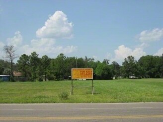
Property Detail
45274 Highway 22
Baton Rouge, LA
2.75 AC. FRC. POR. NE1/4 SEC. 31-9-4, LOT GF-1-A-1
20018-195
Ascension
Commercialnec
Louisiana
CC
gf1a
AE The base floodplain where base flood elevations are provided. AE Zones are now used on new format FIRMs instead of A1-A30 Zones.
2.75 AC
2025
Ascension Parish
2025
Baton Rouge
030502
NEARBY LISTINGS FOR SALE OR LEASE
DEMOGRAPHICS near 45274 Highway 22
1 mile
3 mile
5 mile
2025 Total Population
1,146
12,547
30,589
2030 Population
1,205
13,132
32,039
Pop Growth 2025-2030
+ 5.15%
+ 4.66%
+ 4.74%
Average Age
40
41
40
2025 Total Households
417
4,698
11,618
HH Growth 2025-2030
+ 5.04%
+ 4.66%
+ 4.76%
Median Household Inc
$108,064
$89,072
$82,309
Avg Household Size
2.70
2.60
2.60
2025 Avg HH Vehicles
2.00
2.00
2.00
Median Home Value
$332,432
$273,466
$263,797
Median Year Built
1998
1997
1994
Nearby Places
Map Layers
Map Styles
 Street
 Aerial
Layers
 Traffic
 Biking
Places
Listings with unknown addresses are not visible on the map
- Restaurants
- Banks
- Shops
- Fitness
- Groceries
PUBLIC TRANSPORTATION
AIRPORT
Baton Rouge Metro Ryan Field
Drive
Walk
Distance
Baton Rouge Metro Ryan Field
46 min
31.1 mi
Freight Ports
Port of Greater Baton Rouge
Drive
Walk
Distance
Port of Greater Baton Rouge
44 min
34.8 mi
Nearby Properties
Address
Land Use
TOTAL SIZE
Lot Size
Zoning
Address
Land Use
TOTAL SIZE
Lot Size
Zoning
Address
Land Use
TOTAL SIZE
Lot Size
Zoning
Address
Land Use
TOTAL SIZE
Lot Size
Zoning
22.47 AC
RM
Address
Land Use
TOTAL SIZE
Lot Size
Zoning
0.22 AC
Address
Land Use
TOTAL SIZE
Lot Size
Zoning
699.06 AC
R
Address
Land Use
TOTAL SIZE
Lot Size
Zoning
Address
Land Use
TOTAL SIZE
Lot Size
Zoning
20.22 AC
MU
Address
Land Use
TOTAL SIZE
Lot Size
Zoning
4.66 AC
R
Address
Land Use
TOTAL SIZE
Lot Size
Zoning
3.75 AC
MU
Address
Land Use
TOTAL SIZE
Lot Size
Zoning
Address
Land Use
TOTAL SIZE
Lot Size
Zoning
Address
Land Use
TOTAL SIZE
Lot Size
Zoning
2.76 AC
R
Address
Land Use
TOTAL SIZE
Lot Size
Zoning
1.61 AC
CC
Address
Land Use
TOTAL SIZE
Lot Size
Zoning
1.75 AC
Address
Land Use
TOTAL SIZE
Lot Size
Zoning
0.85 AC
CC
Address
Land Use
TOTAL SIZE
Lot Size
Zoning
16.08 AC
R
Address
Land Use
TOTAL SIZE
Lot Size
Zoning
3.54 AC
R
Address
Land Use
TOTAL SIZE
Lot Size
Zoning
3.75 AC
MU
Address
Land Use
TOTAL SIZE
Lot Size
Zoning
0.80 AC
CC
Address
Land Use
TOTAL SIZE
Lot Size
Zoning
Address
Land Use
TOTAL SIZE
Lot Size
Zoning
Address
Land Use
TOTAL SIZE
Lot Size
Zoning
0.42 AC
CC
Address
Land Use
TOTAL SIZE
Lot Size
Zoning
1.34 AC
CC
Address
Land Use
TOTAL SIZE
Lot Size
Zoning
0.86 AC
CC
Address
Land Use
TOTAL SIZE
Lot Size
Zoning
7.16 AC
RM
Address
Land Use
TOTAL SIZE
Lot Size
Zoning
Address
Land Use
TOTAL SIZE
Lot Size
Zoning
0.68 AC
CC
Address
Land Use
TOTAL SIZE
Lot Size
Zoning
7.67 AC
Address
Land Use
TOTAL SIZE
Lot Size
Zoning
2.07 AC
CC
The World's #1 Commercial Real Estate Marketplace
Connect with us
© 2026 CoStar Group
The information above has been obtained from sources believed reliable. While we do not doubt its accuracy we have not verified it and make no guarantee, warranty or representation about it. It is your responsibility to independently confirm its accuracy and completeness. Any projections, opinions, assumptions, or estimates used are for example only and do not represent the current or future performance of the property. The value of this transaction to you depends on tax and other factors which should be evaluated by your tax, financial, and legal advisors. You and your advisors should conduct a careful, independent investigation of the property to determine to your satisfaction the suitability of the property for your needs.