Property Record
4529 State Highway 28, Milford, NY 13807


NEARBY LISTINGS FOR SALE OR LEASE
-
-
View all Milford listings for sale on LoopNet.com
Property Detail
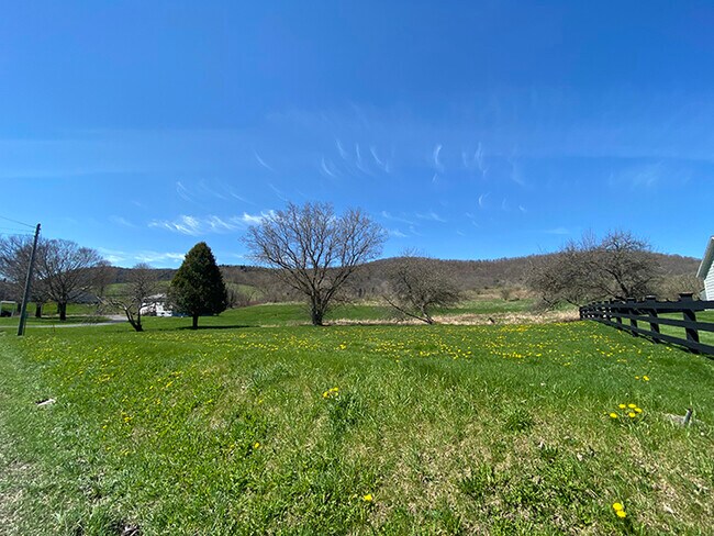
4529 State Highway 28
363200-162-000-0001-035-000-0000
975 0 0
Officebuilding
Otsego
X
New York
36077C0340E
35.000
2025
1.37 AC
2024
Otsego County
590201
Albany/Schenectady/Troy
1,152 SF
Oneonta, NY
DEMOGRAPHICS near 4529 State Highway 28
1 Mile
3 Mile
5 Mile
2024 Total Population
90
1,088
5,933
2029 Population
93
1,097
5,906
Pop Growth 2024-2029
+ 3.33%
+ 0.83%
(0.46%)
Average Age
44
45
46
2024 Total Households
38
460
2,599
HH Growth 2024-2029
+ 2.63%
+ 0.87%
(0.42%)
Median Household Inc
$61,500
$64,200
$68,955
Avg Household Size
2.40
2.30
2.10
2024 Avg HH Vehicles
2.00
2.00
2.00
Median Home Value
$192,856
$205,000
$233,772
Median Year Built
1981
1976
1950
Nearby Places
Map Layers
Map Styles
 Street
 Aerial
- Restaurants
- Banks
- Shops
- Fitness
- Groceries
SALE & LEASE HISTORY
LISTING DATE
SALE/LEASE

Oct 27, 2020
For Sale
May 13, 2020
For Sale
Dec 01, 2021
For Sale
Nearby Properties
Address
Land Use
TOTAL SIZE
Lot Size
Zoning
Address
Land Use
TOTAL SIZE
Lot Size
Zoning
Address
Land Use
TOTAL SIZE
Lot Size
Zoning
62.15 AC
Address
Land Use
TOTAL SIZE
Lot Size
Zoning
Address
Land Use
TOTAL SIZE
Lot Size
Zoning
137.56 AC
Address
Land Use
TOTAL SIZE
Lot Size
Zoning
41,620 SF
6.56 AC
Address
Land Use
TOTAL SIZE
Lot Size
Zoning
53,871 SF
7.15 AC
Address
Land Use
TOTAL SIZE
Lot Size
Zoning
34,420 SF
3.57 AC
Address
Land Use
TOTAL SIZE
Lot Size
Zoning
27,560 SF
6.97 AC
Address
Land Use
TOTAL SIZE
Lot Size
Zoning
Address
Land Use
TOTAL SIZE
Lot Size
Zoning
40,692 SF
7.48 AC
Address
Land Use
TOTAL SIZE
Lot Size
Zoning
20,464 SF
1.53 AC
Address
Land Use
TOTAL SIZE
Lot Size
Zoning
31.90 AC
Address
Land Use
TOTAL SIZE
Lot Size
Zoning
42.47 AC
Address
Land Use
TOTAL SIZE
Lot Size
Zoning
12,224 SF
15.49 AC
Address
Land Use
TOTAL SIZE
Lot Size
Zoning
17,045 SF
3 AC
Address
Land Use
TOTAL SIZE
Lot Size
Zoning
7,304 SF
8.31 AC
Address
Land Use
TOTAL SIZE
Lot Size
Zoning
7,800 SF
4.36 AC
Address
Land Use
TOTAL SIZE
Lot Size
Zoning
12,000 SF
3.02 AC
Address
Land Use
TOTAL SIZE
Lot Size
Zoning
14,720 SF
2.05 AC
01 - NOT Z
Address
Land Use
TOTAL SIZE
Lot Size
Zoning
9,100 SF
1.39 AC
Address
Land Use
TOTAL SIZE
Lot Size
Zoning
3,046 SF
0.68 AC
Address
Land Use
TOTAL SIZE
Lot Size
Zoning
1,614 SF
1.95 AC
Address
Land Use
TOTAL SIZE
Lot Size
Zoning
101.86 AC
Address
Land Use
TOTAL SIZE
Lot Size
Zoning
3,890 SF
57.91 AC
Address
Land Use
TOTAL SIZE
Lot Size
Zoning
2,536 SF
1.03 AC
Address
Land Use
TOTAL SIZE
Lot Size
Zoning
945 SF
259.23 AC
Address
Land Use
TOTAL SIZE
Lot Size
Zoning
1,456 SF
32.12 AC
Address
Land Use
TOTAL SIZE
Lot Size
Zoning
8,612 SF
2.96 AC
Address
Land Use
TOTAL SIZE
Lot Size
Zoning
2,000 SF
0.37 AC
Address
Land Use
TOTAL SIZE
Lot Size
Zoning
3,252 SF
0.80 AC
The World's #1 Commercial Real Estate Marketplace
Connect with us
© 2026 CoStar Group
The information above has been obtained from sources believed reliable. While we do not doubt its accuracy we have not verified it and make no guarantee, warranty or representation about it. It is your responsibility to independently confirm its accuracy and completeness. Any projections, opinions, assumptions, or estimates used are for example only and do not represent the current or future performance of the property. The value of this transaction to you depends on tax and other factors which should be evaluated by your tax, financial, and legal advisors. You and your advisors should conduct a careful, independent investigation of the property to determine to your satisfaction the suitability of the property for your needs.