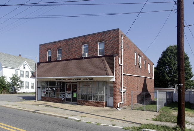
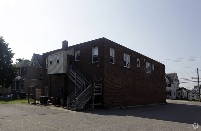
Property Record
453 W Broad St, Paulsboro, NJ 08066
NEARBY LISTINGS FOR SALE OR LEASE
Property Detail
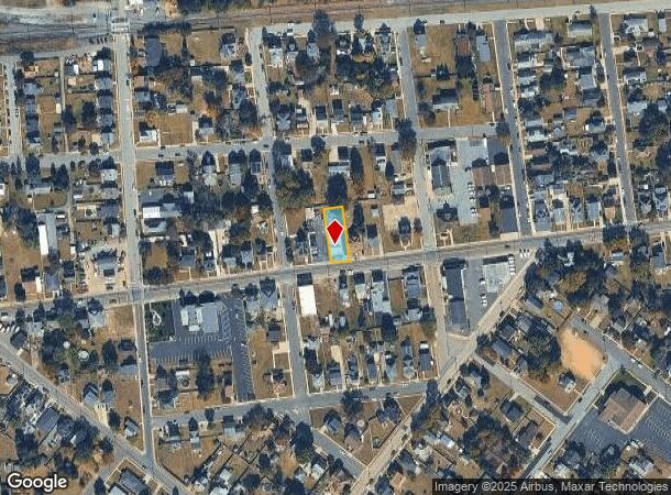
453 W Broad St
Philadelphia-Camden-Wilmington, PA-NJ-DE-MD
Incl
07-00072-0000-00008
7
Commercialofficeresidentialmixeduse
Gloucester
X
New Jersey
34015C0058F
8
2024
0.34 AC
2025
Gloucester County
500500
Philadelphia
4,440 SF
DEMOGRAPHICS near 453 W Broad St
1 Mile
3 Mile
5 Mile
2024 Total Population
2,942
15,315
96,038
2029 Population
3,050
15,737
96,922
Pop Growth 2024-2029
+ 3.67%
+ 2.76%
+ 0.92%
Average Age
42
40
39
2024 Total Households
1,136
5,950
36,352
HH Growth 2024-2029
+ 3.70%
+ 2.71%
+ 0.85%
Median Household Inc
$93,103
$71,659
$63,792
Avg Household Size
2.60
2.50
2.50
2024 Avg HH Vehicles
2.00
2.00
2.00
Median Home Value
$198,988
$196,472
$194,078
Median Year Built
1955
1955
1954
Nearby Places
Map Layers
Map Styles
 Street
 Aerial
- Restaurants
- Banks
- Shops
- Fitness
- Groceries
PUBLIC TRANSPORTATION
AIRPORT
Philadelphia International
DRIVE
WALK
Distance
Philadelphia International
26 min
15.8 mi
Freight Ports
Broadway Terminal - Pier 5
DRIVE
WALK
Distance
Broadway Terminal - Pier 5
20 min
12.7 mi
Nearby Properties
Address
Land Use
TOTAL SIZE
Lot Size
Zoning
Address
Land Use
TOTAL SIZE
Lot Size
Zoning
653.90 AC
Address
Land Use
TOTAL SIZE
Lot Size
Zoning
28 AC
IC
Address
Land Use
TOTAL SIZE
Lot Size
Zoning
47.40 AC
C2
Address
Land Use
TOTAL SIZE
Lot Size
Zoning
112,896 SF
95 AC
Address
Land Use
TOTAL SIZE
Lot Size
Zoning
Address
Land Use
TOTAL SIZE
Lot Size
Zoning
40.25 AC
M
Address
Land Use
TOTAL SIZE
Lot Size
Zoning
64,995 SF
132 AC
Address
Land Use
TOTAL SIZE
Lot Size
Zoning
34.58 AC
Address
Land Use
TOTAL SIZE
Lot Size
Zoning
86.10 AC
Address
Land Use
TOTAL SIZE
Lot Size
Zoning
Address
Land Use
TOTAL SIZE
Lot Size
Zoning
Address
Land Use
TOTAL SIZE
Lot Size
Zoning
994 AC
R3
Address
Land Use
TOTAL SIZE
Lot Size
Zoning
212,231 SF
28 AC
Address
Land Use
TOTAL SIZE
Lot Size
Zoning
99,456 SF
12.66 AC
Address
Land Use
TOTAL SIZE
Lot Size
Zoning
30.76 AC
BP
Address
Land Use
TOTAL SIZE
Lot Size
Zoning
10.13 AC
Address
Land Use
TOTAL SIZE
Lot Size
Zoning
5.72 AC
R3
Address
Land Use
TOTAL SIZE
Lot Size
Zoning
5 AC
R1
Address
Land Use
TOTAL SIZE
Lot Size
Zoning
4.76 AC
Address
Land Use
TOTAL SIZE
Lot Size
Zoning
15.08 AC
R2A
Address
Land Use
TOTAL SIZE
Lot Size
Zoning
17.08 AC
BP
Address
Land Use
TOTAL SIZE
Lot Size
Zoning
71,161 SF
41.85 AC
Address
Land Use
TOTAL SIZE
Lot Size
Zoning
22.05 AC
B1
Address
Land Use
TOTAL SIZE
Lot Size
Zoning
10,072 SF
1.80 AC
Address
Land Use
TOTAL SIZE
Lot Size
Zoning
18,816 SF
8 AC
Address
Land Use
TOTAL SIZE
Lot Size
Zoning
9.05 AC
R2
Address
Land Use
TOTAL SIZE
Lot Size
Zoning
31.77 AC
R2A
Address
Land Use
TOTAL SIZE
Lot Size
Zoning
4.19 AC
R2A
Address
Land Use
TOTAL SIZE
Lot Size
Zoning
4.03 AC
R1
Address
Land Use
TOTAL SIZE
Lot Size
Zoning
761 SF
9.13 AC
R5
The World's #1 Commercial Real Estate Marketplace
Connect with us
© 2025 CoStar Group
The information above has been obtained from sources believed reliable. While we do not doubt its accuracy we have not verified it and make no guarantee, warranty or representation about it. It is your responsibility to independently confirm its accuracy and completeness. Any projections, opinions, assumptions, or estimates used are for example only and do not represent the current or future performance of the property. The value of this transaction to you depends on tax and other factors which should be evaluated by your tax, financial, and legal advisors. You and your advisors should conduct a careful, independent investigation of the property to determine to your satisfaction the suitability of the property for your needs.