Property Record
4530 68Th St N, Birmingham, AL 35206
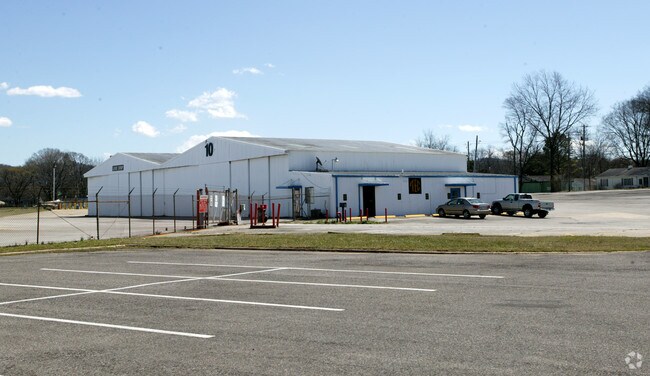

Property Detail
4530 68Th St N
23-00-10-3-006-002.000
BEG AT SW COR OF SW 1/4 SEC 10 TP 17 R 2W TH N 1330 FT TH E 835 FT TH SE 50 FT TH S 1285 FT TH W 860 FT TO POB
Airport
JEFFERSON
M1
Alabama
A Areas with a 1% annual chance of flooding and a 26% chance of flooding over the life of a 30-year mortgage.
26 AC
0
Center Point
2025
Birmingham
002100
Birmingham, AL
91,212 SF
NEARBY LISTINGS FOR SALE OR LEASE
DEMOGRAPHICS near 4530 68Th St N
1 mile
3 mile
5 mile
2025 Total Population
3,961
46,729
117,091
2030 Population
4,186
47,380
116,646
Pop Growth 2025-2030
+ 5.68%
+ 1.39%
(0.38%)
Average Age
39
39
39
2025 Total Households
1,535
18,863
49,625
HH Growth 2025-2030
+ 5.60%
+ 1.25%
(0.52%)
Median Household Inc
$27,300
$39,982
$54,652
Avg Household Size
2.30
2.30
2.20
2025 Avg HH Vehicles
2.00
2.00
2.00
Median Home Value
$78,106
$163,391
$239,943
Median Year Built
1955
1962
1966
Nearby Places
Map Layers
Map Styles
 Street
 Aerial
Layers
 Traffic
 Biking
Places
Listings with unknown addresses are not visible on the map
- Restaurants
- Banks
- Shops
- Fitness
- Groceries
PUBLIC TRANSPORTATION
COMMUTER RAIL
Birmingham (Crescent - Amtrak)
Drive
Walk
Distance
Birmingham (Crescent - Amtrak)
10 min
6.6 mi
AIRPORT
Birmingham-Shuttlesworth International
Drive
Walk
Distance
Birmingham-Shuttlesworth International
7 min
3.7 mi
Freight Ports
Port of Mobile
Drive
Walk
Distance
Port of Mobile
289 min
263.6 mi
Nearby Properties
Address
Land Use
TOTAL SIZE
Lot Size
Zoning
Address
Land Use
TOTAL SIZE
Lot Size
Zoning
145,865 SF
142 AC
M1-M
Address
Land Use
TOTAL SIZE
Lot Size
Zoning
298,966 SF
73 AC
M1
Address
Land Use
TOTAL SIZE
Lot Size
Zoning
166,863 SF
21 AC
CB2
Address
Land Use
TOTAL SIZE
Lot Size
Zoning
80,288 SF
3 AC
CB2
Address
Land Use
TOTAL SIZE
Lot Size
Zoning
144,135 SF
32 AC
CR5
Address
Land Use
TOTAL SIZE
Lot Size
Zoning
297,391 SF
27 AC
CR5
Address
Land Use
TOTAL SIZE
Lot Size
Zoning
345,035 SF
39 AC
M1
Address
Land Use
TOTAL SIZE
Lot Size
Zoning
225,000 SF
20.23 AC
B-2
Address
Land Use
TOTAL SIZE
Lot Size
Zoning
456,619 SF
27.30 AC
M2
Address
Land Use
TOTAL SIZE
Lot Size
Zoning
22 AC
CB2
Address
Land Use
TOTAL SIZE
Lot Size
Zoning
151,235 SF
12.60 AC
CB2
Address
Land Use
TOTAL SIZE
Lot Size
Zoning
131,319 SF
13 AC
CB2
Address
Land Use
TOTAL SIZE
Lot Size
Zoning
210,920 SF
22 AC
CB2
Address
Land Use
TOTAL SIZE
Lot Size
Zoning
166,144 SF
12.95 AC
CB2
Address
Land Use
TOTAL SIZE
Lot Size
Zoning
222,082 SF
46 AC
R3
Address
Land Use
TOTAL SIZE
Lot Size
Zoning
205,872 SF
13 AC
CB2
Address
Land Use
TOTAL SIZE
Lot Size
Zoning
113,147 SF
115 AC
M1
Address
Land Use
TOTAL SIZE
Lot Size
Zoning
223,365 SF
15 AC
I1
Address
Land Use
TOTAL SIZE
Lot Size
Zoning
108,813 SF
156 AC
M-1
Address
Land Use
TOTAL SIZE
Lot Size
Zoning
29,095 SF
3 AC
B2
Address
Land Use
TOTAL SIZE
Lot Size
Zoning
150,750 SF
13 AC
CR5
Address
Land Use
TOTAL SIZE
Lot Size
Zoning
301,531 SF
41 AC
B5
Address
Land Use
TOTAL SIZE
Lot Size
Zoning
366,807 SF
25 AC
M2
Address
Land Use
TOTAL SIZE
Lot Size
Zoning
188,160 SF
14 AC
CB2
Address
Land Use
TOTAL SIZE
Lot Size
Zoning
53,000 SF
16.28 AC
M2
Address
Land Use
TOTAL SIZE
Lot Size
Zoning
60,832 SF
162 AC
M1
Address
Land Use
TOTAL SIZE
Lot Size
Zoning
148,165 SF
16 AC
M1
Address
Land Use
TOTAL SIZE
Lot Size
Zoning
68,046 SF
6 AC
B6
Address
Land Use
TOTAL SIZE
Lot Size
Zoning
126,976 SF
25 AC
M1
Address
Land Use
TOTAL SIZE
Lot Size
Zoning
74,984 SF
1 AC
R5
The World's #1 Commercial Real Estate Marketplace
Connect with us
© 2026 CoStar Group
The information above has been obtained from sources believed reliable. While we do not doubt its accuracy we have not verified it and make no guarantee, warranty or representation about it. It is your responsibility to independently confirm its accuracy and completeness. Any projections, opinions, assumptions, or estimates used are for example only and do not represent the current or future performance of the property. The value of this transaction to you depends on tax and other factors which should be evaluated by your tax, financial, and legal advisors. You and your advisors should conduct a careful, independent investigation of the property to determine to your satisfaction the suitability of the property for your needs.