No Photo
Property Record
4530 Mobile Hwy, Montgomery, AL 36108

NEARBY LISTINGS FOR SALE OR LEASE
Property Detail
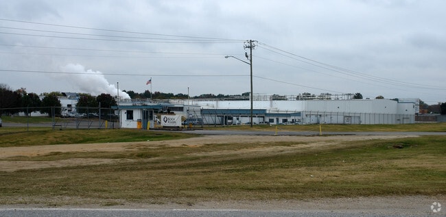
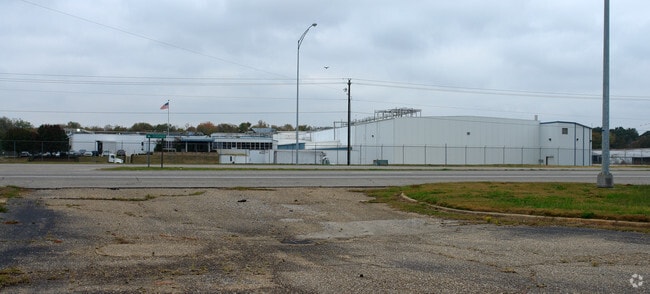
4530 Mobile Hwy
Montgomery, AL
Morrell 1
11-08-34-3-000-007.000
1108343000007000
Manufacturinglight
Montgomery
AE
Alabama
01101C0203J
a
2025
19.22 AC
2025
South Montgomery
006100
Montgomery
176,106 SF
DEMOGRAPHICS near 4530 Mobile Hwy
1 Mile
3 Mile
5 Mile
2024 Total Population
2,089
16,877
55,158
2029 Population
2,062
16,855
55,459
Pop Growth 2024-2029
(1.29%)
(0.13%)
+ 0.55%
Average Age
39
41
39
2024 Total Households
802
6,983
21,872
HH Growth 2024-2029
(1.37%)
(0.10%)
+ 0.84%
Median Household Inc
$25,992
$25,287
$33,682
Avg Household Size
2.60
2.30
2.20
2024 Avg HH Vehicles
2.00
1.00
2.00
Median Home Value
$83,817
$65,176
$84,256
Median Year Built
1973
1965
1964
Nearby Places
Map Layers
Map Styles
 Street
 Aerial
- Restaurants
- Banks
- Shops
- Fitness
- Groceries
PUBLIC TRANSPORTATION
AIRPORT
Montgomery Regional (Dannelly Field)
DRIVE
WALK
Distance
Montgomery Regional (Dannelly Field)
5 min
3.3 mi
Freight Ports
Port of Mobile
DRIVE
WALK
Distance
Port of Mobile
178 min
163.8 mi
SALE & LEASE HISTORY
LISTING DATE
SALE/LEASE

Sep 01, 2017
For Sale
Aug 21, 2017
For Sale
Aug 15, 2017
For Sale
Nearby Properties
Address
Land Use
TOTAL SIZE
Lot Size
Zoning
Address
Land Use
TOTAL SIZE
Lot Size
Zoning
909,718 SF
310.14 AC
M-3
Address
Land Use
TOTAL SIZE
Lot Size
Zoning
858,004 SF
61.22 AC
M-1
Address
Land Use
TOTAL SIZE
Lot Size
Zoning
657,684 SF
59 AC
M-1
Address
Land Use
TOTAL SIZE
Lot Size
Zoning
403,088 SF
114.39 AC
M-1
Address
Land Use
TOTAL SIZE
Lot Size
Zoning
9,060 SF
524.11 AC
Address
Land Use
TOTAL SIZE
Lot Size
Zoning
391,901 SF
13 AC
M-3
Address
Land Use
TOTAL SIZE
Lot Size
Zoning
93,745 SF
16 AC
B-4
Address
Land Use
TOTAL SIZE
Lot Size
Zoning
16,016 SF
30 AC
AGR-1
Address
Land Use
TOTAL SIZE
Lot Size
Zoning
129,122 SF
9.60 AC
M-3
Address
Land Use
TOTAL SIZE
Lot Size
Zoning
193,544 SF
20.33 AC
M-3
Address
Land Use
TOTAL SIZE
Lot Size
Zoning
8,483 SF
18.66 AC
M-1
Address
Land Use
TOTAL SIZE
Lot Size
Zoning
46,760 SF
4.38 AC
R-65-D
Address
Land Use
TOTAL SIZE
Lot Size
Zoning
88,994 SF
5.16 AC
INST
Address
Land Use
TOTAL SIZE
Lot Size
Zoning
146,238 SF
8.60 AC
M-1
Address
Land Use
TOTAL SIZE
Lot Size
Zoning
18,035 SF
14 AC
INST
Address
Land Use
TOTAL SIZE
Lot Size
Zoning
28,461 SF
5.20 AC
M-3
Address
Land Use
TOTAL SIZE
Lot Size
Zoning
37,048 SF
10.90 AC
M-3
Address
Land Use
TOTAL SIZE
Lot Size
Zoning
246.64 AC
AGR-1
Address
Land Use
TOTAL SIZE
Lot Size
Zoning
142,617 SF
17 AC
B-2
Address
Land Use
TOTAL SIZE
Lot Size
Zoning
26,633 SF
21.50 AC
Address
Land Use
TOTAL SIZE
Lot Size
Zoning
1,627 SF
14 AC
R-65-M
Address
Land Use
TOTAL SIZE
Lot Size
Zoning
75,544 SF
4 AC
INST
Address
Land Use
TOTAL SIZE
Lot Size
Zoning
12,024 SF
4.15 AC
M-1
Address
Land Use
TOTAL SIZE
Lot Size
Zoning
87,906 SF
63 AC
M-3
Address
Land Use
TOTAL SIZE
Lot Size
Zoning
4,801 SF
22.72 AC
M-3
Address
Land Use
TOTAL SIZE
Lot Size
Zoning
5,040 SF
162.48 AC
Address
Land Use
TOTAL SIZE
Lot Size
Zoning
25,763 SF
4.40 AC
M-1
Address
Land Use
TOTAL SIZE
Lot Size
Zoning
161,902 SF
7.20 AC
M-3
Address
Land Use
TOTAL SIZE
Lot Size
Zoning
7,792 SF
7.20 AC
R-65-M
The World's #1 Commercial Real Estate Marketplace
Connect with us
© 2026 CoStar Group
The information above has been obtained from sources believed reliable. While we do not doubt its accuracy we have not verified it and make no guarantee, warranty or representation about it. It is your responsibility to independently confirm its accuracy and completeness. Any projections, opinions, assumptions, or estimates used are for example only and do not represent the current or future performance of the property. The value of this transaction to you depends on tax and other factors which should be evaluated by your tax, financial, and legal advisors. You and your advisors should conduct a careful, independent investigation of the property to determine to your satisfaction the suitability of the property for your needs.