Property Record
4530 S Highway 181, Kenedy, TX 78119

Property Detail
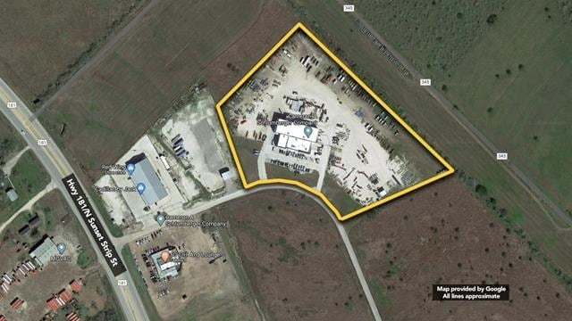
4530 S Highway 181
103-7809
CSL COM SUBD UNIT 4 (202000004223) LOT 32 IN AB 187 J W LOONEY TR 31
Commercialnec
KARNES
B and X Area of moderate flood hazard, usually the area between the limits of the 100-year and 500-year floods.
Texas
2025
32
2025
10.25 AC
970301
Texas South Area
18,395 SF
Other Market Areas
NEARBY LISTINGS FOR SALE OR LEASE
-
-
View all Kenedy listings for sale on LoopNet.com
DEMOGRAPHICS near 4530 S Highway 181
1 mile
3 mile
5 mile
2025 Total Population
270
5,068
9,842
2030 Population
289
5,270
10,192
Pop Growth 2025-2030
+ 7.04%
+ 3.99%
+ 3.56%
Average Age
39
41
40
2025 Total Households
100
1,782
3,262
HH Growth 2025-2030
+ 7.00%
+ 4.83%
+ 4.41%
Median Household Inc
$19,078
$40,122
$51,134
Avg Household Size
2.60
2.50
2.50
2025 Avg HH Vehicles
1.00
2.00
2.00
Median Home Value
$135,714
$134,800
$115,990
Median Year Built
1987
1983
1981
Nearby Places
Map Layers
Map Styles
 Street
 Aerial
Layers
 Traffic
 Biking
Places
Listings with unknown addresses are not visible on the map
- Restaurants
- Banks
- Shops
- Fitness
- Groceries
SALE & LEASE HISTORY
LISTING DATE
SALE/LEASE

Sep 10, 2020
For Sale
Nearby Properties
Address
Land Use
TOTAL SIZE
Lot Size
Zoning
Address
Land Use
TOTAL SIZE
Lot Size
Zoning
155,550 SF
20 AC
Address
Land Use
TOTAL SIZE
Lot Size
Zoning
140,004 SF
75.01 AC
Address
Land Use
TOTAL SIZE
Lot Size
Zoning
66,128 SF
14.64 AC
Address
Land Use
TOTAL SIZE
Lot Size
Zoning
14,337 SF
7.60 AC
Address
Land Use
TOTAL SIZE
Lot Size
Zoning
105,530 SF
14.40 AC
Address
Land Use
TOTAL SIZE
Lot Size
Zoning
17,973 SF
4.30 AC
Address
Land Use
TOTAL SIZE
Lot Size
Zoning
11,373 SF
1.62 AC
Address
Land Use
TOTAL SIZE
Lot Size
Zoning
41,484 SF
4.34 AC
Address
Land Use
TOTAL SIZE
Lot Size
Zoning
22,692 SF
6.21 AC
Address
Land Use
TOTAL SIZE
Lot Size
Zoning
54,276 SF
14.45 AC
Address
Land Use
TOTAL SIZE
Lot Size
Zoning
25,841 SF
2.93 AC
Address
Land Use
TOTAL SIZE
Lot Size
Zoning
22,550 SF
0.96 AC
Address
Land Use
TOTAL SIZE
Lot Size
Zoning
11,000 SF
2.03 AC
Address
Land Use
TOTAL SIZE
Lot Size
Zoning
27,008 SF
2.79 AC
Address
Land Use
TOTAL SIZE
Lot Size
Zoning
45,323 SF
7.80 AC
Address
Land Use
TOTAL SIZE
Lot Size
Zoning
29,752 SF
10 AC
Address
Land Use
TOTAL SIZE
Lot Size
Zoning
24,096 SF
2.70 AC
Address
Land Use
TOTAL SIZE
Lot Size
Zoning
8,064 SF
9.99 AC
Address
Land Use
TOTAL SIZE
Lot Size
Zoning
4,264 SF
1.38 AC
Address
Land Use
TOTAL SIZE
Lot Size
Zoning
14,895 SF
0.82 AC
Address
Land Use
TOTAL SIZE
Lot Size
Zoning
8,520 SF
1.66 AC
Address
Land Use
TOTAL SIZE
Lot Size
Zoning
12,780 SF
1.80 AC
Address
Land Use
TOTAL SIZE
Lot Size
Zoning
12,555 SF
2.53 AC
Address
Land Use
TOTAL SIZE
Lot Size
Zoning
24,360 SF
0.27 AC
Address
Land Use
TOTAL SIZE
Lot Size
Zoning
14,917 SF
11.32 AC
Address
Land Use
TOTAL SIZE
Lot Size
Zoning
11,648 SF
15.70 AC
Address
Land Use
TOTAL SIZE
Lot Size
Zoning
2,003 SF
1.42 AC
Address
Land Use
TOTAL SIZE
Lot Size
Zoning
10,765 SF
3.95 AC
Address
Land Use
TOTAL SIZE
Lot Size
Zoning
16,640 SF
1.56 AC
The World's #1 Commercial Real Estate Marketplace
Connect with us
© 2026 CoStar Group
The information above has been obtained from sources believed reliable. While we do not doubt its accuracy we have not verified it and make no guarantee, warranty or representation about it. It is your responsibility to independently confirm its accuracy and completeness. Any projections, opinions, assumptions, or estimates used are for example only and do not represent the current or future performance of the property. The value of this transaction to you depends on tax and other factors which should be evaluated by your tax, financial, and legal advisors. You and your advisors should conduct a careful, independent investigation of the property to determine to your satisfaction the suitability of the property for your needs.