Property Record
4530 Southmark Dr, Salisbury, NC 28147


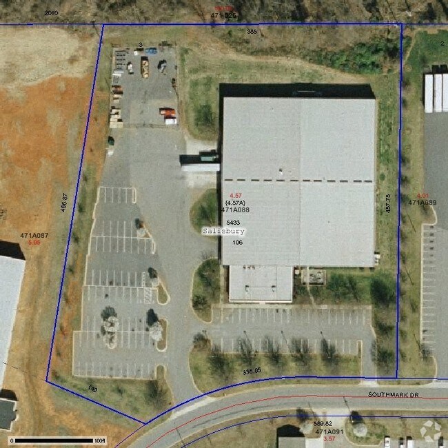
Property Detail
4530 Southmark Dr
471-A088
L3 4.57AC
Industrialgeneral
Rowan
B and X Area of moderate flood hazard, usually the area between the limits of the 100-year and 500-year floods.
North Carolina
2025
4.57 AC
2025
Rowan County
051201
Charlotte
54,282 SF
Charlotte-Concord-Gastonia, NC-SC
NEARBY LISTINGS FOR SALE OR LEASE
DEMOGRAPHICS near 4530 Southmark Dr
1 mile
3 mile
5 mile
2025 Total Population
2,692
15,284
52,477
2030 Population
2,810
15,889
54,643
Pop Growth 2025-2030
+ 4.38%
+ 3.96%
+ 4.13%
Average Age
38
40
40
2025 Total Households
697
5,531
20,133
HH Growth 2025-2030
+ 5.02%
+ 4.16%
+ 4.38%
Median Household Inc
$53,518
$64,218
$57,042
Avg Household Size
3.00
2.60
2.40
2025 Avg HH Vehicles
2.00
2.00
2.00
Median Home Value
$189,854
$255,359
$256,569
Median Year Built
1985
1989
1983
Nearby Places
Map Layers
Map Styles
 Street
 Aerial
Layers
 Traffic
 Biking
Places
Listings with unknown addresses are not visible on the map
- Restaurants
- Banks
- Shops
- Fitness
- Groceries
PUBLIC TRANSPORTATION
COMMUTER RAIL
Salisbury Station (Piedmont - North Carolina by Train (NC Train))
Drive
Walk
Distance
Salisbury Station (Piedmont - North Carolina by Train (NC Train))
12 min
5.1 mi
AIRPORT
Concord-Padgett Regional
Drive
Walk
Distance
Concord-Padgett Regional
35 min
24.2 mi
Charlotte/Douglas International
Drive
Walk
Distance
Charlotte/Douglas International
60 min
44.4 mi
Nearby Properties
Address
Land Use
TOTAL SIZE
Lot Size
Zoning
Address
Land Use
TOTAL SIZE
Lot Size
Zoning
739,291 SF
61.21 AC
Address
Land Use
TOTAL SIZE
Lot Size
Zoning
673,920 SF
44.85 AC
Address
Land Use
TOTAL SIZE
Lot Size
Zoning
41,142 SF
16.18 AC
Address
Land Use
TOTAL SIZE
Lot Size
Zoning
468,000 SF
43.12 AC
Address
Land Use
TOTAL SIZE
Lot Size
Zoning
27,321 SF
11.66 AC
Address
Land Use
TOTAL SIZE
Lot Size
Zoning
75,000 SF
82.04 AC
Address
Land Use
TOTAL SIZE
Lot Size
Zoning
99,416 SF
31.69 AC
Address
Land Use
TOTAL SIZE
Lot Size
Zoning
338,336 SF
32.55 AC
Address
Land Use
TOTAL SIZE
Lot Size
Zoning
144,720 SF
14.53 AC
Address
Land Use
TOTAL SIZE
Lot Size
Zoning
316,672 SF
64.08 AC
Address
Land Use
TOTAL SIZE
Lot Size
Zoning
12,960 SF
22.04 AC
Address
Land Use
TOTAL SIZE
Lot Size
Zoning
82,856 SF
40.24 AC
Address
Land Use
TOTAL SIZE
Lot Size
Zoning
88,852 SF
36.93 AC
Address
Land Use
TOTAL SIZE
Lot Size
Zoning
56,676 SF
2.73 AC
HB:HIGHWAY
Address
Land Use
TOTAL SIZE
Lot Size
Zoning
25,068 SF
7.18 AC
HB:HIGHWAY
Address
Land Use
TOTAL SIZE
Lot Size
Zoning
88,638 SF
55.39 AC
Address
Land Use
TOTAL SIZE
Lot Size
Zoning
69,072 SF
11.32 AC
HB:HIGHWAY
Address
Land Use
TOTAL SIZE
Lot Size
Zoning
56,212 SF
297.34 AC
Address
Land Use
TOTAL SIZE
Lot Size
Zoning
19,626 SF
2.29 AC
HB:HIGHWAY
Address
Land Use
TOTAL SIZE
Lot Size
Zoning
84,336 SF
34.98 AC
RR
Address
Land Use
TOTAL SIZE
Lot Size
Zoning
95,916 SF
24.60 AC
M1:LIGHT I
Address
Land Use
TOTAL SIZE
Lot Size
Zoning
20,608 SF
153.99 AC
Address
Land Use
TOTAL SIZE
Lot Size
Zoning
24,492 SF
223.90 AC
Address
Land Use
TOTAL SIZE
Lot Size
Zoning
292,500 SF
21.13 AC
Address
Land Use
TOTAL SIZE
Lot Size
Zoning
259,486 SF
13.05 AC
Address
Land Use
TOTAL SIZE
Lot Size
Zoning
89,088 SF
12.77 AC
Address
Land Use
TOTAL SIZE
Lot Size
Zoning
22,580 SF
3.19 AC
HB:HIGHWAY
Address
Land Use
TOTAL SIZE
Lot Size
Zoning
98,024 SF
8.40 AC
Address
Land Use
TOTAL SIZE
Lot Size
Zoning
24,998 SF
9.01 AC
HB:HIGHWAY
Address
Land Use
TOTAL SIZE
Lot Size
Zoning
39,440 SF
5.94 AC
The World's #1 Commercial Real Estate Marketplace
Connect with us
© 2026 CoStar Group
The information above has been obtained from sources believed reliable. While we do not doubt its accuracy we have not verified it and make no guarantee, warranty or representation about it. It is your responsibility to independently confirm its accuracy and completeness. Any projections, opinions, assumptions, or estimates used are for example only and do not represent the current or future performance of the property. The value of this transaction to you depends on tax and other factors which should be evaluated by your tax, financial, and legal advisors. You and your advisors should conduct a careful, independent investigation of the property to determine to your satisfaction the suitability of the property for your needs.