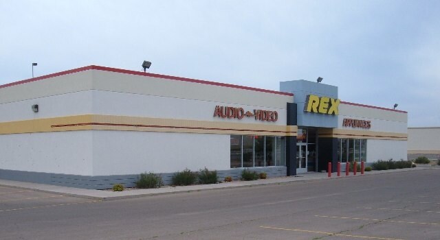
Property Record
4531 N Main St, Roswell, NM 88201

Property Detail
4531 N Main St
R006018
SUBD: SAMARCAN SUB LOT: 2 S: 16 T: 10S R: 24E BK 738 PG 1194 SWD
Realpropertynec
Chaves
COMMUNITY
New Mexico
B and X Area of moderate flood hazard, usually the area between the limits of the 100-year and 500-year floods.
2
2024
1.39 AC
2025
Other Market Areas
001001
Roswell, NM
12,000 SF
NEARBY LISTINGS FOR SALE OR LEASE
DEMOGRAPHICS near 4531 N Main St
1 mile
3 mile
5 mile
2025 Total Population
2,160
16,033
36,378
2030 Population
2,087
15,849
36,090
Pop Growth 2025-2030
(3.38%)
(1.15%)
(0.79%)
Average Age
40
40
39
2025 Total Households
807
6,239
13,844
HH Growth 2025-2030
(3.47%)
(1.17%)
(0.90%)
Median Household Inc
$82,746
$65,797
$52,429
Avg Household Size
2.60
2.50
2.50
2025 Avg HH Vehicles
2.00
2.00
2.00
Median Home Value
$216,612
$234,782
$187,186
Median Year Built
1978
1980
1972
Nearby Places
Map Layers
Map Styles
 Street
 Aerial
Layers
 Traffic
 Biking
Places
Listings with unknown addresses are not visible on the map
- Restaurants
- Banks
- Shops
- Fitness
- Groceries
PUBLIC TRANSPORTATION
AIRPORT
Roswell Air Center
Drive
Walk
Distance
Roswell Air Center
23 min
15.0 mi
SALE & LEASE HISTORY
LISTING DATE
SALE/LEASE

Oct 04, 2018
For Lease
Feb 25, 2020
For Lease
Nearby Properties
Address
Land Use
TOTAL SIZE
Lot Size
Zoning
Address
Land Use
TOTAL SIZE
Lot Size
Zoning
10,644 SF
5.81 AC
COMMUNITY
Address
Land Use
TOTAL SIZE
Lot Size
Zoning
23.93 AC
RESIDENTIA
Address
Land Use
TOTAL SIZE
Lot Size
Zoning
230,872 SF
9.40 AC
COMMUNITY
Address
Land Use
TOTAL SIZE
Lot Size
Zoning
22.08 AC
Address
Land Use
TOTAL SIZE
Lot Size
Zoning
6.47 AC
RESIDENTIA
Address
Land Use
TOTAL SIZE
Lot Size
Zoning
203,209 SF
22.13 AC
COMMUNITY
Address
Land Use
TOTAL SIZE
Lot Size
Zoning
9.05 AC
Address
Land Use
TOTAL SIZE
Lot Size
Zoning
134,448 SF
15.85 AC
COMMUNITY
Address
Land Use
TOTAL SIZE
Lot Size
Zoning
20.23 AC
RESIDENTIA
Address
Land Use
TOTAL SIZE
Lot Size
Zoning
39,382 SF
1.90 AC
COMMUNITY
Address
Land Use
TOTAL SIZE
Lot Size
Zoning
29.09 AC
RESIDENTIA
Address
Land Use
TOTAL SIZE
Lot Size
Zoning
6.48 AC
RESIDENTIA
Address
Land Use
TOTAL SIZE
Lot Size
Zoning
39,383 SF
2.11 AC
COMMUNITY
Address
Land Use
TOTAL SIZE
Lot Size
Zoning
59,672 SF
3.04 AC
COMMUNITY
Address
Land Use
TOTAL SIZE
Lot Size
Zoning
50,281 SF
1.47 AC
COMMUNITY
Address
Land Use
TOTAL SIZE
Lot Size
Zoning
238,267 SF
18.30 AC
COMMUNITY
Address
Land Use
TOTAL SIZE
Lot Size
Zoning
12,689 SF
4.86 AC
RESIDENTIA
Address
Land Use
TOTAL SIZE
Lot Size
Zoning
9.39 AC
RESIDENTIA
Address
Land Use
TOTAL SIZE
Lot Size
Zoning
21,970 SF
2.28 AC
LIGHT INDU
Address
Land Use
TOTAL SIZE
Lot Size
Zoning
5 AC
RESIDENTIA
Address
Land Use
TOTAL SIZE
Lot Size
Zoning
92,983 SF
6.39 AC
COMMUNITY
Address
Land Use
TOTAL SIZE
Lot Size
Zoning
33,201 SF
4.27 AC
COMMUNITY
Address
Land Use
TOTAL SIZE
Lot Size
Zoning
23,576 SF
3.57 AC
COMMUNITY
Address
Land Use
TOTAL SIZE
Lot Size
Zoning
37,965 SF
1.70 AC
COMMUNITY
Address
Land Use
TOTAL SIZE
Lot Size
Zoning
42,002 SF
1.75 AC
COMMUNITY
Address
Land Use
TOTAL SIZE
Lot Size
Zoning
42,742 SF
2.20 AC
COMMUNITY
Address
Land Use
TOTAL SIZE
Lot Size
Zoning
47,690 SF
2.42 AC
COMMUNITY
Address
Land Use
TOTAL SIZE
Lot Size
Zoning
1.45 AC
COMMUNITY
Address
Land Use
TOTAL SIZE
Lot Size
Zoning
125,285 SF
11.42 AC
COMMUNITY
Address
Land Use
TOTAL SIZE
Lot Size
Zoning
12,423 SF
1.94 AC
RESIDENTIA
The World's #1 Commercial Real Estate Marketplace
Connect with us
© 2026 CoStar Group
The information above has been obtained from sources believed reliable. While we do not doubt its accuracy we have not verified it and make no guarantee, warranty or representation about it. It is your responsibility to independently confirm its accuracy and completeness. Any projections, opinions, assumptions, or estimates used are for example only and do not represent the current or future performance of the property. The value of this transaction to you depends on tax and other factors which should be evaluated by your tax, financial, and legal advisors. You and your advisors should conduct a careful, independent investigation of the property to determine to your satisfaction the suitability of the property for your needs.