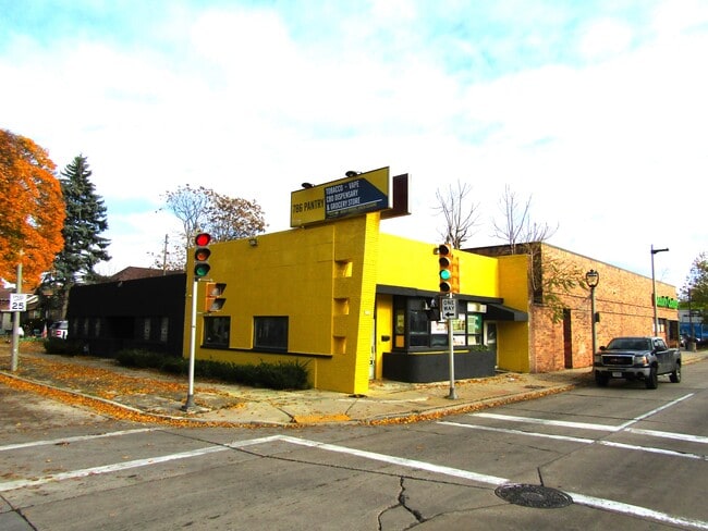
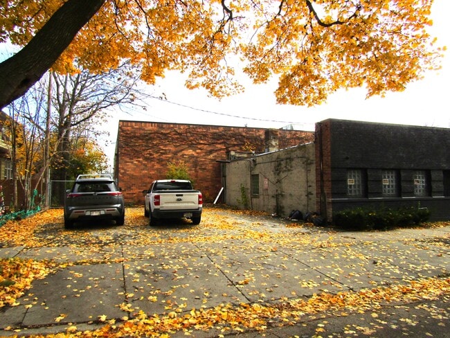
Property Record
4534 W North Ave, Milwaukee, WI 53208

Save to a Folder
{{folder.Name}}
{{folder.ListingIds.length}} Properties
{{folder.ListingIds.length}} Property
Create a New Folder
Property Detail
4534 W North Ave
328-1282-000-0
S1 FTLOT12
Storemultistory
MILWAUKEE
LB2
Wisconsin
B and X Area of moderate flood hazard, usually the area between the limits of the 100-year and 500-year floods.
12
2024
0.11 AC
2025
Milwaukee West
009100
Milwaukee/Madison
2,814 SF
Milwaukee-Waukesha, WI
NEARBY LISTINGS FOR SALE OR LEASE
-
-
-
-
-
-
-
-
-
-
-
-
1801-1805 N Dr Martin Luther King Jr Dr
Milwaukee, WI 53212
$280,000 - $760,000
1,721 - 6,714 SF
Retail
-
View all Milwaukee listings for sale on LoopNet.com
DEMOGRAPHICS near 4534 W North Ave
1 mile
3 mile
5 mile
2025 Total Population
32,749
206,423
519,271
2030 Population
32,862
206,835
517,837
Pop Growth 2025-2030
+ 0.35%
+ 0.20%
(0.28%)
Average Age
35
36
36
2025 Total Households
12,168
83,244
217,527
HH Growth 2025-2030
+ 0.04%
+ 0.04%
(0.23%)
Median Household Inc
$53,104
$47,258
$54,881
Avg Household Size
2.60
2.30
2.20
2025 Avg HH Vehicles
1.00
1.00
1.00
Median Home Value
$191,010
$182,636
$199,373
Median Year Built
1945
1948
1949
Nearby Places
Map Layers
Map Styles
 Street
 Aerial
Layers
 Traffic
 Biking
Places
Listings with unknown addresses are not visible on the map
- Restaurants
- Banks
- Shops
- Fitness
- Groceries
PUBLIC TRANSPORTATION
COMMUTER RAIL
Drive
Walk
Distance
10 min
5.2 mi
AIRPORT
General Mitchell International
Drive
Walk
Distance
General Mitchell International
21 min
11.8 mi
Freight Ports
Port Milwaukee
Drive
Walk
Distance
Port Milwaukee
14 min
7.7 mi
Nearby Properties
Address
Land Use
TOTAL SIZE
Lot Size
Zoning
Address
Land Use
TOTAL SIZE
Lot Size
Zoning
8.05 AC
TL
Address
Land Use
TOTAL SIZE
Lot Size
Zoning
730,000 SF
6.94 AC
PD
Address
Land Use
TOTAL SIZE
Lot Size
Zoning
5,104 SF
0.11 AC
LB1
Address
Land Use
TOTAL SIZE
Lot Size
Zoning
3.04 AC
TL
Address
Land Use
TOTAL SIZE
Lot Size
Zoning
607,577 SF
1.67 AC
PD
Address
Land Use
TOTAL SIZE
Lot Size
Zoning
1 SF
6.43 AC
C9D(A)
Address
Land Use
TOTAL SIZE
Lot Size
Zoning
180,407 SF
0.63 AC
PD
Address
Land Use
TOTAL SIZE
Lot Size
Zoning
122.53 AC
TL
Address
Land Use
TOTAL SIZE
Lot Size
Zoning
9.33 AC
PUD
Address
Land Use
TOTAL SIZE
Lot Size
Zoning
262,109 SF
2.24 AC
PD
Address
Land Use
TOTAL SIZE
Lot Size
Zoning
3.74 AC
PUD
Address
Land Use
TOTAL SIZE
Lot Size
Zoning
2.92 AC
C9D(A)
Address
Land Use
TOTAL SIZE
Lot Size
Zoning
0.07 AC
RS6
Address
Land Use
TOTAL SIZE
Lot Size
Zoning
5.85 AC
C9D(A)
Address
Land Use
TOTAL SIZE
Lot Size
Zoning
0.09 AC
LB2
Address
Land Use
TOTAL SIZE
Lot Size
Zoning
0.36 AC
Address
Land Use
TOTAL SIZE
Lot Size
Zoning
1,709,128 SF
9.32 AC
PD
Address
Land Use
TOTAL SIZE
Lot Size
Zoning
150,370 SF
2.46 AC
C9G
Address
Land Use
TOTAL SIZE
Lot Size
Zoning
12.74 AC
TL
Address
Land Use
TOTAL SIZE
Lot Size
Zoning
8.77 AC
Address
Land Use
TOTAL SIZE
Lot Size
Zoning
68.35 AC
TL
Address
Land Use
TOTAL SIZE
Lot Size
Zoning
356,019 SF
0.95 AC
CS
Address
Land Use
TOTAL SIZE
Lot Size
Zoning
78,975 SF
1.83 AC
C9D(A)
Address
Land Use
TOTAL SIZE
Lot Size
Zoning
0.71 AC
RM2
Address
Land Use
TOTAL SIZE
Lot Size
Zoning
2.29 AC
INSTITUTIO
Address
Land Use
TOTAL SIZE
Lot Size
Zoning
78,210 SF
2.36 AC
PD
Address
Land Use
TOTAL SIZE
Lot Size
Zoning
242,700 SF
2.40 AC
C9G
Address
Land Use
TOTAL SIZE
Lot Size
Zoning
35.55 AC
INSTITUTIO
Address
Land Use
TOTAL SIZE
Lot Size
Zoning
97,490 SF
0.76 AC
C9G
Address
Land Use
TOTAL SIZE
Lot Size
Zoning
47.96 AC
TL
The World's #1 Commercial Real Estate Marketplace
Connect with us
© 2026 CoStar Group
The information above has been obtained from sources believed reliable. While we do not doubt its accuracy we have not verified it and make no guarantee, warranty or representation about it. It is your responsibility to independently confirm its accuracy and completeness. Any projections, opinions, assumptions, or estimates used are for example only and do not represent the current or future performance of the property. The value of this transaction to you depends on tax and other factors which should be evaluated by your tax, financial, and legal advisors. You and your advisors should conduct a careful, independent investigation of the property to determine to your satisfaction the suitability of the property for your needs.