Property Record
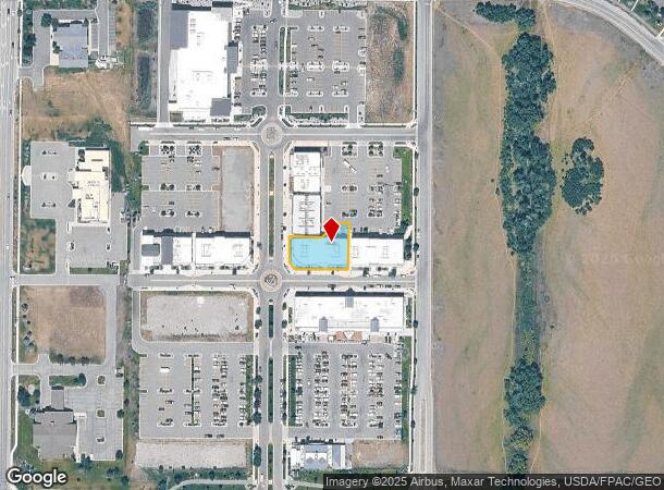
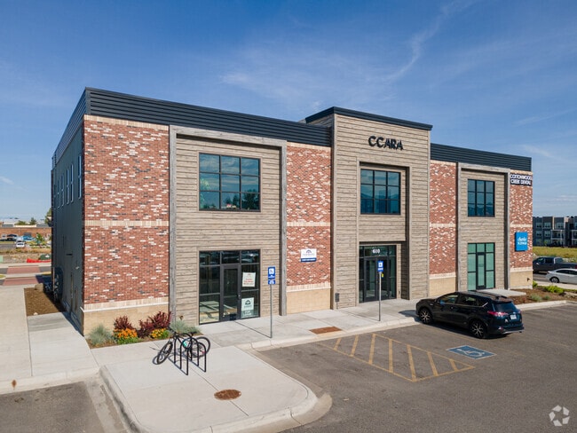
4535 Valley Commons Dr, Bozeman, MT 59718

NEARBY LISTINGS FOR SALE OR LEASE
Property Detail
4535 Valley Commons Dr
Bozeman, MT
Ferguson Farm Sub
06-0798-10-3-04-04-0000
FERGUSON FARM SUB, S10, T02 S, R05 E, BLOCK 4, LOT 2, ACRES 0.3331, PLAT J-563
Officebuilding
Gallatin
X
Montana
30031C0811D
2
2025
0.33 AC
2025
Bozeman/Yellowstone Country
000505
Other Market Areas
17,400 SF
DEMOGRAPHICS near 4535 Valley Commons Dr
1 Mile
3 Mile
5 Mile
2024 Total Population
8,837
53,147
79,679
2029 Population
10,210
60,739
90,860
Pop Growth 2024-2029
+ 15.54%
+ 14.28%
+ 14.03%
Average Age
36
33
36
2024 Total Households
3,679
21,051
32,301
HH Growth 2024-2029
+ 16.04%
+ 15.27%
+ 14.89%
Median Household Inc
$83,562
$71,968
$81,583
Avg Household Size
2.30
2.30
2.30
2024 Avg HH Vehicles
2.00
2.00
2.00
Median Home Value
$454,358
$489,294
$602,877
Median Year Built
2010
2005
2002
Nearby Places
Map Layers
Map Styles
 Street
 Aerial
- Restaurants
- Banks
- Shops
- Fitness
- Groceries
PUBLIC TRANSPORTATION
AIRPORT
Bozeman Yellowstone International
DRIVE
WALK
Distance
Bozeman Yellowstone International
20 min
10.8 mi
Freight Ports
Port of Everett
DRIVE
WALK
Distance
Port of Everett
748 min
701.5 mi
SALE & LEASE HISTORY
LISTING DATE
SALE/LEASE

Feb 12, 2019
For Lease
Nearby Properties
Address
Land Use
TOTAL SIZE
Lot Size
Zoning
Address
Land Use
TOTAL SIZE
Lot Size
Zoning
15,099 SF
16.05 AC
Address
Land Use
TOTAL SIZE
Lot Size
Zoning
33,109 SF
9.89 AC
Address
Land Use
TOTAL SIZE
Lot Size
Zoning
214,283 SF
5.20 AC
Address
Land Use
TOTAL SIZE
Lot Size
Zoning
6,317 SF
9.14 AC
Address
Land Use
TOTAL SIZE
Lot Size
Zoning
23,325 SF
9.82 AC
Address
Land Use
TOTAL SIZE
Lot Size
Zoning
69,093 SF
8.96 AC
BP
Address
Land Use
TOTAL SIZE
Lot Size
Zoning
10,368 SF
6.75 AC
Address
Land Use
TOTAL SIZE
Lot Size
Zoning
33,771 SF
7.10 AC
Address
Land Use
TOTAL SIZE
Lot Size
Zoning
81,620 SF
10.65 AC
1
Address
Land Use
TOTAL SIZE
Lot Size
Zoning
259,349 SF
B2
Address
Land Use
TOTAL SIZE
Lot Size
Zoning
20,106 SF
8.23 AC
Address
Land Use
TOTAL SIZE
Lot Size
Zoning
119,732 SF
7.32 AC
Address
Land Use
TOTAL SIZE
Lot Size
Zoning
7,552 SF
8.60 AC
Address
Land Use
TOTAL SIZE
Lot Size
Zoning
90,003 SF
17.01 AC
Address
Land Use
TOTAL SIZE
Lot Size
Zoning
11,639 SF
6.69 AC
Address
Land Use
TOTAL SIZE
Lot Size
Zoning
162,081 SF
4.95 AC
Address
Land Use
TOTAL SIZE
Lot Size
Zoning
19,938 SF
Address
Land Use
TOTAL SIZE
Lot Size
Zoning
27,219 SF
10.11 AC
R3
Address
Land Use
TOTAL SIZE
Lot Size
Zoning
34,198 SF
5.30 AC
Address
Land Use
TOTAL SIZE
Lot Size
Zoning
128,745 SF
4.24 AC
Address
Land Use
TOTAL SIZE
Lot Size
Zoning
41,864 SF
16.37 AC
1
Address
Land Use
TOTAL SIZE
Lot Size
Zoning
162.22 AC
Address
Land Use
TOTAL SIZE
Lot Size
Zoning
59,860 SF
42.94 AC
Address
Land Use
TOTAL SIZE
Lot Size
Zoning
94,146 SF
7.18 AC
R3
Address
Land Use
TOTAL SIZE
Lot Size
Zoning
122,580 SF
10.85 AC
Address
Land Use
TOTAL SIZE
Lot Size
Zoning
173,255 SF
3.26 AC
Address
Land Use
TOTAL SIZE
Lot Size
Zoning
54,260 SF
78.15 AC
Address
Land Use
TOTAL SIZE
Lot Size
Zoning
84,649 SF
Address
Land Use
TOTAL SIZE
Lot Size
Zoning
47,466 SF
25.72 AC
Address
Land Use
TOTAL SIZE
Lot Size
Zoning
21,858 SF
5.48 AC
RO
The World's #1 Commercial Real Estate Marketplace
Connect with us
© 2026 CoStar Group
The information above has been obtained from sources believed reliable. While we do not doubt its accuracy we have not verified it and make no guarantee, warranty or representation about it. It is your responsibility to independently confirm its accuracy and completeness. Any projections, opinions, assumptions, or estimates used are for example only and do not represent the current or future performance of the property. The value of this transaction to you depends on tax and other factors which should be evaluated by your tax, financial, and legal advisors. You and your advisors should conduct a careful, independent investigation of the property to determine to your satisfaction the suitability of the property for your needs.