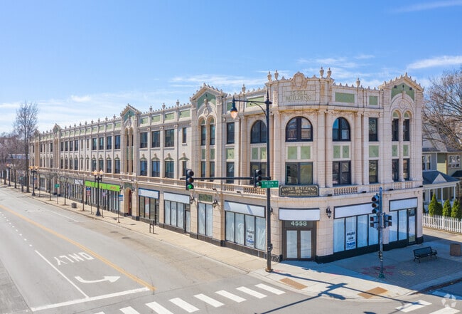
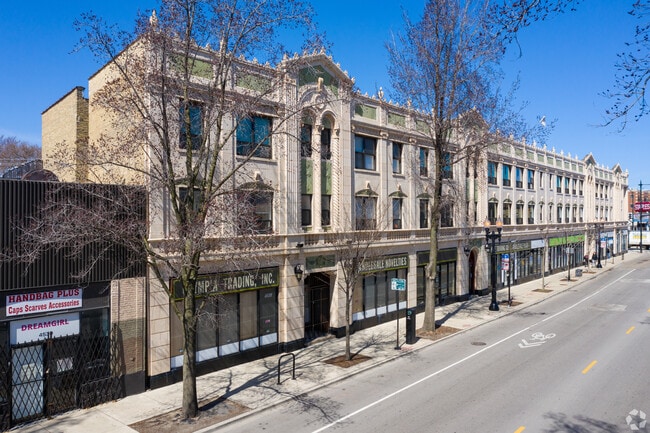
Property Record
4550 N Clark St, Chicago, IL 60640

Current Lease Availabilities
NEARBY LISTINGS FOR SALE OR LEASE
Property Detail
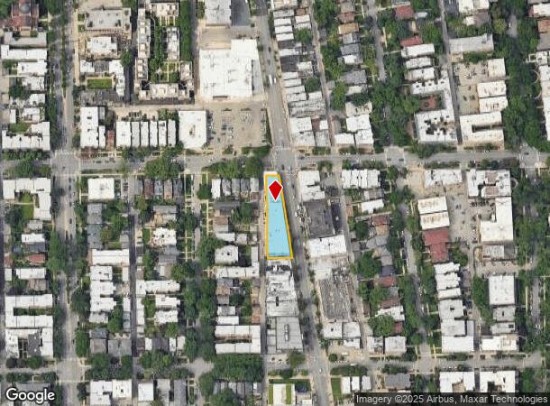
4550 N Clark St
Chicago-Naperville-Elgin, IL-IN-WI
Touhy & Rogers Add To Ravenswood
14-17-113-019-0000
(TOUHY) & (ROGERS) ADD TO (RAVENSWOOD) SEC 17-40-14
Commercialnec
Cook
X
Illinois
17031C0408K
1,2
2023
0.38 AC
2024
Ravenswood
031900
Chicago
15,500 SF
DEMOGRAPHICS near 4550 N Clark St
1 Mile
3 Mile
5 Mile
2024 Total Population
80,614
476,189
945,386
2029 Population
78,201
459,798
909,581
Pop Growth 2024-2029
(2.99%)
(3.44%)
(3.79%)
Average Age
38
37
38
2024 Total Households
42,449
227,744
435,248
HH Growth 2024-2029
(3.27%)
(3.59%)
(3.83%)
Median Household Inc
$72,863
$79,932
$84,926
Avg Household Size
1.80
2.00
2.10
2024 Avg HH Vehicles
1.00
1.00
1.00
Median Home Value
$402,586
$429,860
$432,727
Median Year Built
1948
1949
1949
Nearby Places
Map Layers
Map Styles
 Street
 Aerial
- Restaurants
- Banks
- Shops
- Fitness
- Groceries
PUBLIC TRANSPORTATION
TRANSIT/SUBWAY
Wilson Station (Red Line - Chicago Transit Authority "L" Trains (The "L"))
DRIVE
WALK
Distance
Wilson Station (Red Line - Chicago Transit Authority "L" Trains (The "L"))
3 min
11 min
0.5 mi
Montrose Station (Brown Line) (Brown Line - Chicago Transit Authority "L" Trains (The "L"))
DRIVE
WALK
Distance
Montrose Station (Brown Line) (Brown Line - Chicago Transit Authority "L" Trains (The "L"))
3 min
14 min
0.7 mi
Lawrence Station (Red Line - Chicago Transit Authority "L" Trains (The "L"))
DRIVE
WALK
Distance
Lawrence Station (Red Line - Chicago Transit Authority "L" Trains (The "L"))
3 min
14 min
0.7 mi
Damen Station (Brown Line) (Brown Line - Chicago Transit Authority "L" Trains (The "L"))
DRIVE
WALK
Distance
Damen Station (Brown Line) (Brown Line - Chicago Transit Authority "L" Trains (The "L"))
4 min
15 min
0.8 mi
Argyle Station (Red Line - Chicago Transit Authority "L" Trains (The "L"))
DRIVE
WALK
Distance
Argyle Station (Red Line - Chicago Transit Authority "L" Trains (The "L"))
4 min
20 min
1.0 mi
COMMUTER RAIL
Ravenswood Station (Union Pacific North Line - Northeast Illinois Regional Commuter Railroad (Metra))
DRIVE
WALK
Distance
Ravenswood Station (Union Pacific North Line - Northeast Illinois Regional Commuter Railroad (Metra))
3 min
12 min
0.6 mi
Rogers Park Station (Union Pacific North Line - Northeast Illinois Regional Commuter Railroad (Metra))
DRIVE
WALK
Distance
Rogers Park Station (Union Pacific North Line - Northeast Illinois Regional Commuter Railroad (Metra))
13 min
3.3 mi
AIRPORT
Chicago O'Hare International
DRIVE
WALK
Distance
Chicago O'Hare International
28 min
14.2 mi
Chicago Midway International
DRIVE
WALK
Distance
Chicago Midway International
34 min
16.8 mi
Nearby Properties
Address
Land Use
TOTAL SIZE
Lot Size
Zoning
Address
Land Use
TOTAL SIZE
Lot Size
Zoning
0.63 AC
PD 1372
Address
Land Use
TOTAL SIZE
Lot Size
Zoning
228,018 SF
8.72 AC
PD 958
Address
Land Use
TOTAL SIZE
Lot Size
Zoning
0.96 AC
PD 958
Address
Land Use
TOTAL SIZE
Lot Size
Zoning
16.93 AC
POS-1,PD 1
Address
Land Use
TOTAL SIZE
Lot Size
Zoning
19,500 SF
12.06 AC
PD 367
Address
Land Use
TOTAL SIZE
Lot Size
Zoning
376,302 SF
PD 1019
Address
Land Use
TOTAL SIZE
Lot Size
Zoning
301,100 SF
2.20 AC
PD 37
Address
Land Use
TOTAL SIZE
Lot Size
Zoning
1 AC
RS-3
Address
Land Use
TOTAL SIZE
Lot Size
Zoning
0.64 AC
PD 158
Address
Land Use
TOTAL SIZE
Lot Size
Zoning
0.81 AC
PD 158
Address
Land Use
TOTAL SIZE
Lot Size
Zoning
82,000 SF
9.68 AC
PD 437
Address
Land Use
TOTAL SIZE
Lot Size
Zoning
277,195 SF
1.78 AC
PD 1094
Address
Land Use
TOTAL SIZE
Lot Size
Zoning
190,011 SF
5.90 AC
PD 353
Address
Land Use
TOTAL SIZE
Lot Size
Zoning
147,835 SF
1.03 AC
PD 37
Address
Land Use
TOTAL SIZE
Lot Size
Zoning
170,538 SF
0.76 AC
PD 112
Address
Land Use
TOTAL SIZE
Lot Size
Zoning
331,294 SF
13.03 AC
PD 439
Address
Land Use
TOTAL SIZE
Lot Size
Zoning
201,600 SF
1.93 AC
PD 92
Address
Land Use
TOTAL SIZE
Lot Size
Zoning
2.25 AC
PD 612
Address
Land Use
TOTAL SIZE
Lot Size
Zoning
162,700 SF
0.64 AC
PD 50
Address
Land Use
TOTAL SIZE
Lot Size
Zoning
55,476 SF
6.16 AC
PD 619
Address
Land Use
TOTAL SIZE
Lot Size
Zoning
140,451 SF
9.48 AC
PD 213
Address
Land Use
TOTAL SIZE
Lot Size
Zoning
1.35 AC
PD 1194
Address
Land Use
TOTAL SIZE
Lot Size
Zoning
15,600 SF
0.77 AC
M1-1
Address
Land Use
TOTAL SIZE
Lot Size
Zoning
226,345 SF
3.71 AC
PD 1203
Address
Land Use
TOTAL SIZE
Lot Size
Zoning
144,865 SF
0.21 AC
Address
Land Use
TOTAL SIZE
Lot Size
Zoning
0.88 AC
RM-6.5
Address
Land Use
TOTAL SIZE
Lot Size
Zoning
85,214 SF
1.25 AC
PD 940
Address
Land Use
TOTAL SIZE
Lot Size
Zoning
340,838 SF
31 AC
PD 1411
Address
Land Use
TOTAL SIZE
Lot Size
Zoning
197,785 SF
4.03 AC
PD 943
Address
Land Use
TOTAL SIZE
Lot Size
Zoning
32,200 SF
5.67 AC
B3-5,RM-6.
The World's #1 Commercial Real Estate Marketplace
Connect with us
© 2025 CoStar Group
The information above has been obtained from sources believed reliable. While we do not doubt its accuracy we have not verified it and make no guarantee, warranty or representation about it. It is your responsibility to independently confirm its accuracy and completeness. Any projections, opinions, assumptions, or estimates used are for example only and do not represent the current or future performance of the property. The value of this transaction to you depends on tax and other factors which should be evaluated by your tax, financial, and legal advisors. You and your advisors should conduct a careful, independent investigation of the property to determine to your satisfaction the suitability of the property for your needs.