Property Record
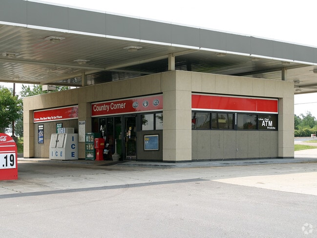
4538 Highway 81 N, Anderson, SC 29621

Property Detail
4538 Highway 81 N
Greenville-Anderson-Greer, SC
CP S 1226/7 F000 D000 PP 100/127 LOT A1 HWY 81 .53 AC
169-00-13-017
Anderson
Commercialnec
South Carolina
B and X Area of moderate flood hazard, usually the area between the limits of the 100-year and 500-year floods.
a1
2025
0.53 AC
2025
Highway 81
010501
Greenville/Spartanburg
1,138 SF
NEARBY LISTINGS FOR SALE OR LEASE
-
-
View all Anderson listings for sale on LoopNet.com
DEMOGRAPHICS near 4538 Highway 81 N
1 mile
3 mile
5 mile
2025 Total Population
240
6,398
21,031
2030 Population
254
6,776
22,168
Pop Growth 2025-2030
+ 5.83%
+ 5.91%
+ 5.41%
Average Age
41
41
41
2025 Total Households
85
2,308
7,748
HH Growth 2025-2030
+ 7.06%
+ 6.15%
+ 5.69%
Median Household Inc
$82,812
$98,854
$89,727
Avg Household Size
2.80
2.70
2.70
2025 Avg HH Vehicles
2.00
2.00
2.00
Median Home Value
$399,999
$407,035
$344,923
Median Year Built
2004
2004
1998
Nearby Places
Map Layers
Map Styles
 Street
 Aerial
Layers
 Traffic
 Biking
Places
Listings with unknown addresses are not visible on the map
- Restaurants
- Banks
- Shops
- Fitness
- Groceries
PUBLIC TRANSPORTATION
AIRPORT
Greenville Spartanburg International
Drive
Walk
Distance
Greenville Spartanburg International
41 min
31.3 mi
SALE & LEASE HISTORY
LISTING DATE
SALE/LEASE

Jul 31, 2019
For Sale
Jul 27, 2022
For Sale
Jan 28, 2019
For Sale
Dec 05, 2019
For Sale
Nearby Properties
Address
Land Use
TOTAL SIZE
Lot Size
Zoning
Address
Land Use
TOTAL SIZE
Lot Size
Zoning
109.52 AC
Address
Land Use
TOTAL SIZE
Lot Size
Zoning
41.61 AC
Address
Land Use
TOTAL SIZE
Lot Size
Zoning
86.84 AC
Address
Land Use
TOTAL SIZE
Lot Size
Zoning
59.13 AC
Address
Land Use
TOTAL SIZE
Lot Size
Zoning
2,420 SF
48.50 AC
Address
Land Use
TOTAL SIZE
Lot Size
Zoning
29.70 AC
Address
Land Use
TOTAL SIZE
Lot Size
Zoning
6.12 AC
Address
Land Use
TOTAL SIZE
Lot Size
Zoning
4.63 AC
Address
Land Use
TOTAL SIZE
Lot Size
Zoning
46,659 SF
2 AC
Address
Land Use
TOTAL SIZE
Lot Size
Zoning
45,085 SF
6.96 AC
Address
Land Use
TOTAL SIZE
Lot Size
Zoning
1,768 SF
7.33 AC
Address
Land Use
TOTAL SIZE
Lot Size
Zoning
16.80 AC
Address
Land Use
TOTAL SIZE
Lot Size
Zoning
30,736 SF
3.05 AC
Address
Land Use
TOTAL SIZE
Lot Size
Zoning
5,248 SF
9.44 AC
Address
Land Use
TOTAL SIZE
Lot Size
Zoning
34,568 SF
1.85 AC
Address
Land Use
TOTAL SIZE
Lot Size
Zoning
3,835 SF
2.98 AC
Address
Land Use
TOTAL SIZE
Lot Size
Zoning
1,328 SF
11.31 AC
Address
Land Use
TOTAL SIZE
Lot Size
Zoning
41.95 AC
Address
Land Use
TOTAL SIZE
Lot Size
Zoning
15,435 SF
2.94 AC
Address
Land Use
TOTAL SIZE
Lot Size
Zoning
7,507 SF
7.73 AC
Address
Land Use
TOTAL SIZE
Lot Size
Zoning
33,876 SF
19.82 AC
Address
Land Use
TOTAL SIZE
Lot Size
Zoning
12.86 AC
Address
Land Use
TOTAL SIZE
Lot Size
Zoning
32,679 SF
15.75 AC
Address
Land Use
TOTAL SIZE
Lot Size
Zoning
1,884 SF
3.87 AC
Address
Land Use
TOTAL SIZE
Lot Size
Zoning
12,149 SF
8.91 AC
Address
Land Use
TOTAL SIZE
Lot Size
Zoning
7,200 SF
3.70 AC
Address
Land Use
TOTAL SIZE
Lot Size
Zoning
943 SF
0.92 AC
Address
Land Use
TOTAL SIZE
Lot Size
Zoning
4,632 SF
2.43 AC
Address
Land Use
TOTAL SIZE
Lot Size
Zoning
4,710 SF
1.98 AC
The World's #1 Commercial Real Estate Marketplace
Connect with us
© 2026 CoStar Group
The information above has been obtained from sources believed reliable. While we do not doubt its accuracy we have not verified it and make no guarantee, warranty or representation about it. It is your responsibility to independently confirm its accuracy and completeness. Any projections, opinions, assumptions, or estimates used are for example only and do not represent the current or future performance of the property. The value of this transaction to you depends on tax and other factors which should be evaluated by your tax, financial, and legal advisors. You and your advisors should conduct a careful, independent investigation of the property to determine to your satisfaction the suitability of the property for your needs.