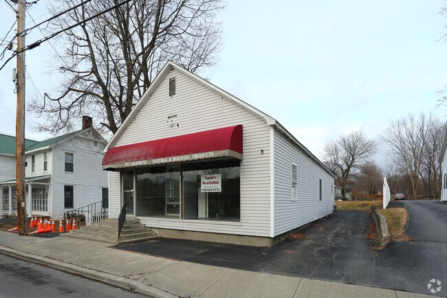
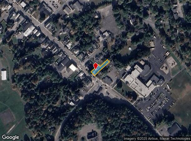
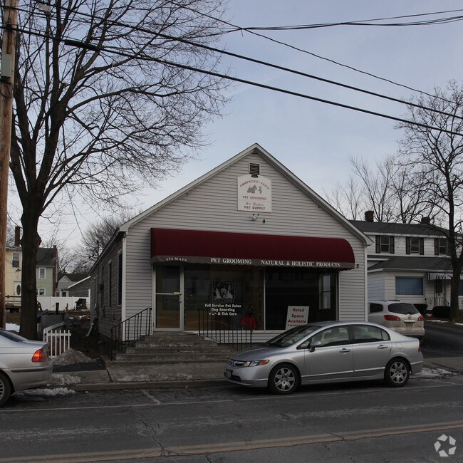
Property Record
454 Main St, Cairo, NY 12413
NEARBY LISTINGS FOR SALE OR LEASE
-
-
View all Cairo listings for sale on LoopNet.com
Property Detail
454 Main St
192400-101-009-0002-014-000-0000
DI STEFANO CANNA ROAD TELGA
Storesoffices
Greene
X
New York
36039C0261F
14.000
2025
0.22 AC
2024
Greene County
080502
Albany/Schenectady/Troy
1,769 SF
DEMOGRAPHICS near 454 Main St
1 mile
3 mile
5 mile
2024 Total Population
861
4,433
9,052
2029 Population
849
4,451
9,156
Pop Growth 2024-2029
(1.39%)
+ 0.41%
+ 1.15%
Average Age
43
44
44
2024 Total Households
378
1,914
3,894
HH Growth 2024-2029
(1.59%)
+ 0.21%
+ 0.95%
Median Household Inc
$53,965
$67,500
$69,008
Avg Household Size
2.20
2.30
2.30
2024 Avg HH Vehicles
2.00
2.00
2.00
Median Home Value
$169,599
$188,571
$199,405
Median Year Built
1970
1978
1978
Nearby Places
Map Layers
Map Styles
 Street
 Aerial
Transit
 Traffic
 Biking
Places
Listings with unknown addresses are not visible on the map
- Restaurants
- Banks
- Shops
- Fitness
- Groceries
PUBLIC TRANSPORTATION
AIRPORT
Albany International
Drive
Walk
Distance
Albany International
68 min
49.7 mi
Freight Ports
Albany, NY Port
Drive
Walk
Distance
Albany, NY Port
49 min
36.6 mi
Nearby Properties
Address
Land Use
TOTAL SIZE
Lot Size
Zoning
Address
Land Use
TOTAL SIZE
Lot Size
Zoning
72,654 SF
24.10 AC
01 - NOT Z
Address
Land Use
TOTAL SIZE
Lot Size
Zoning
1,800 SF
17.75 AC
01
Address
Land Use
TOTAL SIZE
Lot Size
Zoning
42,360 SF
6.73 AC
01 - NOT Z
Address
Land Use
TOTAL SIZE
Lot Size
Zoning
24,884 SF
131.20 AC
01 - NOT Z
Address
Land Use
TOTAL SIZE
Lot Size
Zoning
Address
Land Use
TOTAL SIZE
Lot Size
Zoning
2.50 AC
01 - NOT Z
Address
Land Use
TOTAL SIZE
Lot Size
Zoning
7,299 SF
1.82 AC
01 - NOT Z
Address
Land Use
TOTAL SIZE
Lot Size
Zoning
3,666 SF
7 AC
01 - NOT Z
Address
Land Use
TOTAL SIZE
Lot Size
Zoning
4,163 SF
14.10 AC
01 - NOT Z
Address
Land Use
TOTAL SIZE
Lot Size
Zoning
27,074 SF
15.84 AC
01 - NOT Z
Address
Land Use
TOTAL SIZE
Lot Size
Zoning
Address
Land Use
TOTAL SIZE
Lot Size
Zoning
1,652 SF
7.61 AC
01 - NOT Z
Address
Land Use
TOTAL SIZE
Lot Size
Zoning
12,592 SF
209.10 AC
01 - NOT Z
Address
Land Use
TOTAL SIZE
Lot Size
Zoning
490 SF
71.27 AC
01 - NOT Z
Address
Land Use
TOTAL SIZE
Lot Size
Zoning
1,160 SF
92.53 AC
01 - NOT Z
Address
Land Use
TOTAL SIZE
Lot Size
Zoning
15,545 SF
10 AC
01 - NOT Z
Address
Land Use
TOTAL SIZE
Lot Size
Zoning
9,848 SF
1.36 AC
01 - NOT Z
Address
Land Use
TOTAL SIZE
Lot Size
Zoning
2,978 SF
175.50 AC
RR
Address
Land Use
TOTAL SIZE
Lot Size
Zoning
3,532 SF
3.60 AC
01 - NOT Z
Address
Land Use
TOTAL SIZE
Lot Size
Zoning
18,436 SF
16.50 AC
01 - NOT Z
Address
Land Use
TOTAL SIZE
Lot Size
Zoning
3,252 SF
122.51 AC
01 - NOT Z
Address
Land Use
TOTAL SIZE
Lot Size
Zoning
7,200 SF
2.10 AC
01 - NOT Z
Address
Land Use
TOTAL SIZE
Lot Size
Zoning
3,774 SF
1.47 AC
01 - NOT Z
Address
Land Use
TOTAL SIZE
Lot Size
Zoning
3,816 SF
0.55 AC
01 - NOT Z
Address
Land Use
TOTAL SIZE
Lot Size
Zoning
3,115 SF
2.60 AC
01 - NOT Z
Address
Land Use
TOTAL SIZE
Lot Size
Zoning
3,292 SF
82.67 AC
01 - NOT Z
Address
Land Use
TOTAL SIZE
Lot Size
Zoning
16,833 SF
100.04 AC
01 - NOT Z
Address
Land Use
TOTAL SIZE
Lot Size
Zoning
18,420 SF
3.29 AC
01 - NOT Z
Address
Land Use
TOTAL SIZE
Lot Size
Zoning
7,050 SF
2.16 AC
01 - NOT Z
Address
Land Use
TOTAL SIZE
Lot Size
Zoning
3,968 SF
1.05 AC
01 - NOT Z
The World's #1 Commercial Real Estate Marketplace
Connect with us
© 2026 CoStar Group
The information above has been obtained from sources believed reliable. While we do not doubt its accuracy we have not verified it and make no guarantee, warranty or representation about it. It is your responsibility to independently confirm its accuracy and completeness. Any projections, opinions, assumptions, or estimates used are for example only and do not represent the current or future performance of the property. The value of this transaction to you depends on tax and other factors which should be evaluated by your tax, financial, and legal advisors. You and your advisors should conduct a careful, independent investigation of the property to determine to your satisfaction the suitability of the property for your needs.