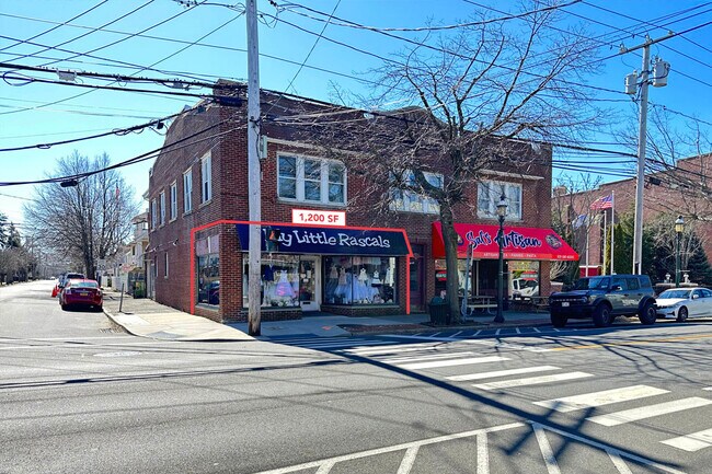
Property Record
454 Main St, Islip, NY 11751


NEARBY LISTINGS FOR SALE OR LEASE
Property Detail
454 Main St
Nassau County-Suffolk County, NY
X2217457Y184238 N059N00000000
0500-370-00-03-00-044-000
Suffolk
Townhouserowhouse
New York
X
300
36103C0877H
0.12 AC
0
Southwestern Suffolk
2024
Long Island (New York)
147702
DEMOGRAPHICS near 454 Main St
1 mile
3 mile
5 mile
2024 Total Population
11,436
85,601
198,017
2029 Population
11,303
83,488
192,507
Pop Growth 2024-2029
(1.16%)
(2.47%)
(2.78%)
Average Age
43
40
39
2024 Total Households
4,487
27,082
57,870
HH Growth 2024-2029
(1.25%)
(2.41%)
(2.75%)
Median Household Inc
$106,502
$113,847
$114,376
Avg Household Size
2.50
3.00
3.20
2024 Avg HH Vehicles
2.00
2.00
2.00
Median Home Value
$496,260
$451,954
$443,253
Median Year Built
1966
1964
1964
Nearby Places
Map Layers
Map Styles
 Street
 Aerial
Transit
 Traffic
 Biking
Places
Listings with unknown addresses are not visible on the map
- Restaurants
- Banks
- Shops
- Fitness
- Groceries
PUBLIC TRANSPORTATION
TRANSIT/SUBWAY
Islip Station (Montauk Branch - Long Island Rail Road)
Drive
Walk
Distance
Islip Station (Montauk Branch - Long Island Rail Road)
2 min
16 min
0.8 mi
COMMUTER RAIL
Islip Station (Montauk Branch - Long Island Rail Road)
Drive
Walk
Distance
Islip Station (Montauk Branch - Long Island Rail Road)
2 min
16 min
0.8 mi
Bay Shore Station (Montauk Branch - Long Island Rail Road)
Drive
Walk
Distance
Bay Shore Station (Montauk Branch - Long Island Rail Road)
5 min
2.4 mi
AIRPORT
Long Island MacArthur
Drive
Walk
Distance
Long Island MacArthur
18 min
9.9 mi
John F Kennedy International
Drive
Walk
Distance
John F Kennedy International
48 min
34.7 mi
LaGuardia
Drive
Walk
Distance
LaGuardia
58 min
41.6 mi
Freight Ports
NY - Red Hook Container Terminal
Drive
Walk
Distance
NY - Red Hook Container Terminal
69 min
46.1 mi
SALE & LEASE HISTORY
LISTING DATE
SALE/LEASE

Mar 13, 2023
For Lease
Nearby Properties
Address
Land Use
TOTAL SIZE
Lot Size
Zoning
Address
Land Use
TOTAL SIZE
Lot Size
Zoning
86.63 AC
Address
Land Use
TOTAL SIZE
Lot Size
Zoning
18.89 AC
Address
Land Use
TOTAL SIZE
Lot Size
Zoning
57.30 AC
IND1
Address
Land Use
TOTAL SIZE
Lot Size
Zoning
334.30 AC
AAA
Address
Land Use
TOTAL SIZE
Lot Size
Zoning
17.70 AC
A
Address
Land Use
TOTAL SIZE
Lot Size
Zoning
83.41 AC
Address
Land Use
TOTAL SIZE
Lot Size
Zoning
5,492 SF
1.30 AC
VILLA
Address
Land Use
TOTAL SIZE
Lot Size
Zoning
28.40 AC
A
Address
Land Use
TOTAL SIZE
Lot Size
Zoning
4,076 SF
3.20 AC
R1
Address
Land Use
TOTAL SIZE
Lot Size
Zoning
33.30 AC
A
Address
Land Use
TOTAL SIZE
Lot Size
Zoning
7,996 SF
1.36 AC
VILLA
Address
Land Use
TOTAL SIZE
Lot Size
Zoning
15 AC
B
Address
Land Use
TOTAL SIZE
Lot Size
Zoning
41 AC
PDDGROI
Address
Land Use
TOTAL SIZE
Lot Size
Zoning
15.46 AC
PDDEC
Address
Land Use
TOTAL SIZE
Lot Size
Zoning
6,724 SF
1.89 AC
R40
Address
Land Use
TOTAL SIZE
Lot Size
Zoning
2.54 AC
R1
Address
Land Use
TOTAL SIZE
Lot Size
Zoning
15.60 AC
BUS3
Address
Land Use
TOTAL SIZE
Lot Size
Zoning
3,526 SF
0.81 AC
CR60
Address
Land Use
TOTAL SIZE
Lot Size
Zoning
17.51 AC
Address
Land Use
TOTAL SIZE
Lot Size
Zoning
4,206 SF
1.85 AC
R1
Address
Land Use
TOTAL SIZE
Lot Size
Zoning
6,941 SF
1.02 AC
R1
Address
Land Use
TOTAL SIZE
Lot Size
Zoning
3,781 SF
0.89 AC
CR60
Address
Land Use
TOTAL SIZE
Lot Size
Zoning
3,387 SF
0.84 AC
CR60
Address
Land Use
TOTAL SIZE
Lot Size
Zoning
19.86 AC
C
Address
Land Use
TOTAL SIZE
Lot Size
Zoning
2,929 SF
0.93 AC
CR60
Address
Land Use
TOTAL SIZE
Lot Size
Zoning
5,962 SF
0.82 AC
R1
Address
Land Use
TOTAL SIZE
Lot Size
Zoning
19.60 AC
BUS3
Address
Land Use
TOTAL SIZE
Lot Size
Zoning
12.20 AC
CA
Address
Land Use
TOTAL SIZE
Lot Size
Zoning
10.90 AC
B
Address
Land Use
TOTAL SIZE
Lot Size
Zoning
14.10 AC
CA
The World's #1 Commercial Real Estate Marketplace
Connect with us
© 2026 CoStar Group
The information above has been obtained from sources believed reliable. While we do not doubt its accuracy we have not verified it and make no guarantee, warranty or representation about it. It is your responsibility to independently confirm its accuracy and completeness. Any projections, opinions, assumptions, or estimates used are for example only and do not represent the current or future performance of the property. The value of this transaction to you depends on tax and other factors which should be evaluated by your tax, financial, and legal advisors. You and your advisors should conduct a careful, independent investigation of the property to determine to your satisfaction the suitability of the property for your needs.